| Title | Albert Square |
| Date | 1890 |
| Location | Yeadon |
| Photo ID | SL017 |
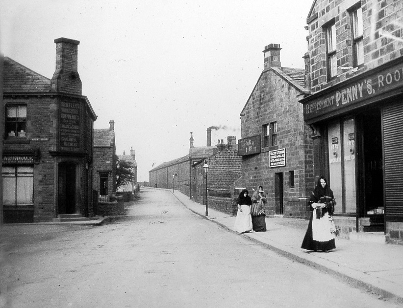
| Comment | The view looks from Albert Square up Cemetery Road. On the left is an off-licence shop, the name Arundale is above the window. This shop is reputed to have been built with stone taken from the demolished Pick and Hammer Inn at Carlton. It was closed in 1882 and pulled down the following year. On the right side of Cemetery Road is the Waterside Mill, the New Inn and Penny’s Refreshment Rooms, taken onto a glass slide by E. E. Slater and has been digitally transferred by John Hobson. |
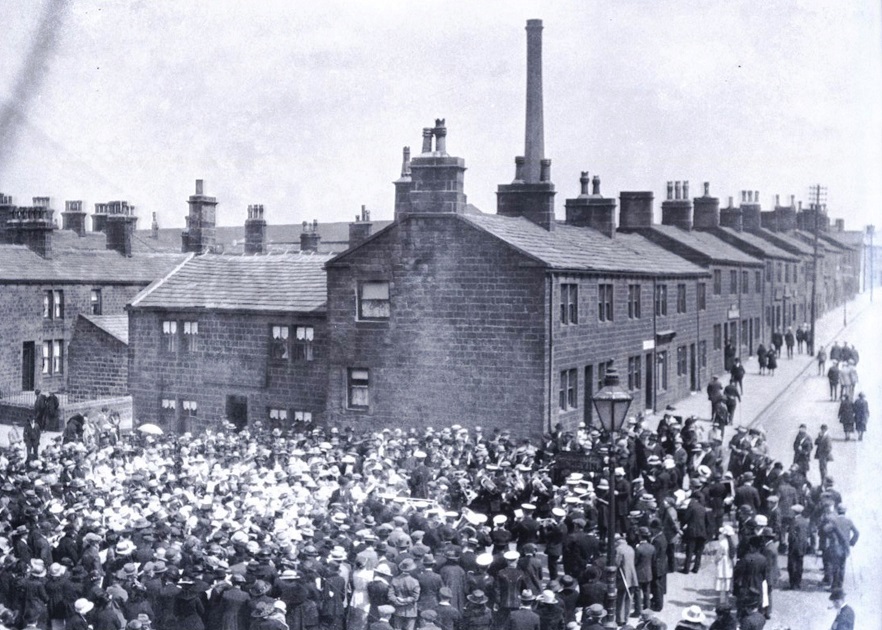
Albert Square was also the venue of the annual Feast week. To see the Feast/Fairground, please – Click Here
Albert Square (Penny Fool Hill) was further associated with the Ling Bob Witch c1785. To see the Ling Bob Witch, please – Click Here
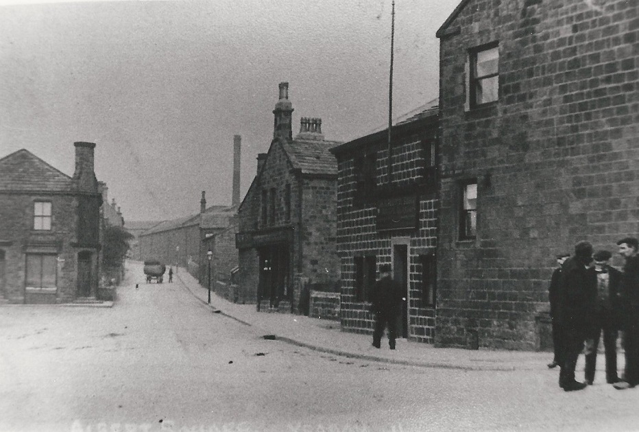
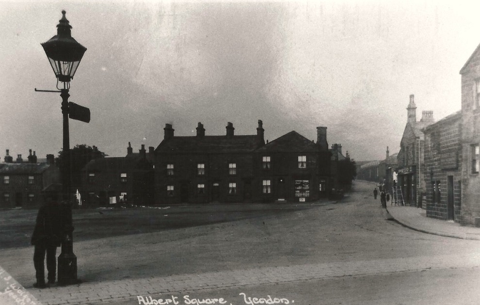
Albert Square – 1907
On the left is a shop (now an off-licence). The mill chimney and building are part of the Crompton Mill, built in 1869 by the Crompton Mill Company, this is on Cemetery Road.
On the right edge is the Albert Inn, the street just to the right of the Albert is Club Row. Around the time this photo was taken the landlord of the Albert was Joe Slater.
Albert Square – 1924
Albert Square, on the left is Cemetery Road with the New Inn public house. Moving right the houses on Club Row are in view with the Albert Inn on the right. Both of these pubs are still open for business, the New Inn is the smaller of the two and has traditional pub games. The Albert has wide-screen televisions for sporting events and serves food.
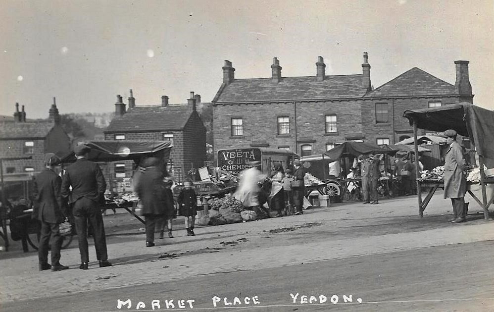
Albert Square – 1930s
An outstanding rare view of Albert Square when the weekly market was located there, stalls selling fruit, vegetables and other commodities. The Veeta Chemical Company, of which one of its vehicles can be seen in the image functioned between 1923 and 1932 so this image was taken during that period. JB. Ed: 07 Feb 23.
Donated by Andrew Emsley.
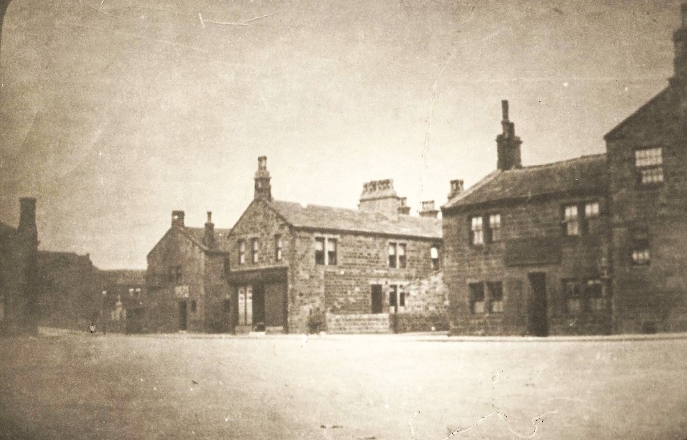
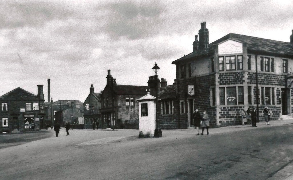
Albert Square – Undated
On the left, the house and shop are on Albert Square. Cemetery Road is next right, the large building with the chimney was the Crompton weaving mill.
The public house with the “Magnet” sign (John Smith’s Brewery) is the New Inn, the Albert Inn is on the right at the corner with the High Street.
A public telephone box is in the middle of the view, this type of kiosk was introduced in the early 1920s before the familiar red painted iron boxes.
Albert Square was once the venue for Yeadon Feast and the market.
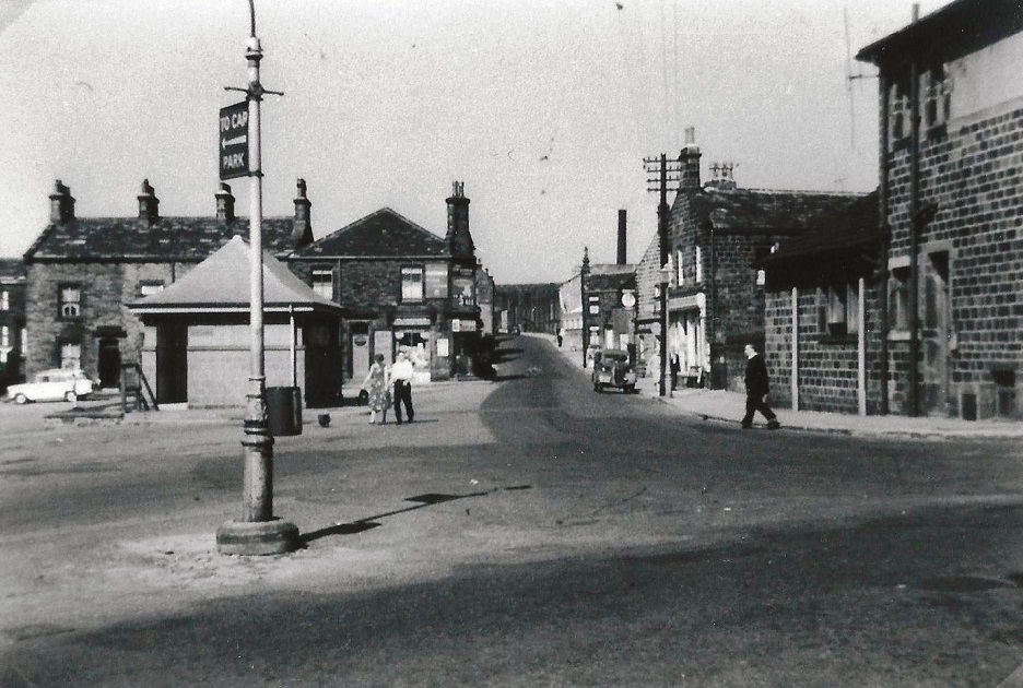
Albert Square – 1956
This and the following photograph shows Albert Square 21 years apart.
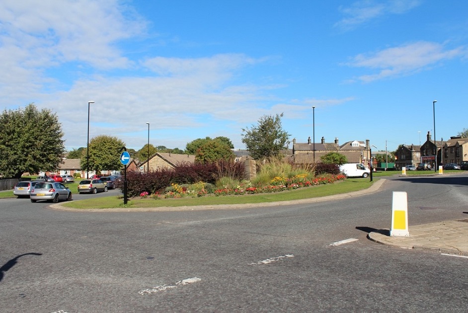
Albert Square before the roundabout was constructed, the building towards the left was a public lavatory. Cemetery Road is in the centre, Crompton Mill can be seen in the background to the right. The car is parked in front of the New Inn, the Albert Inn is on the right edge.
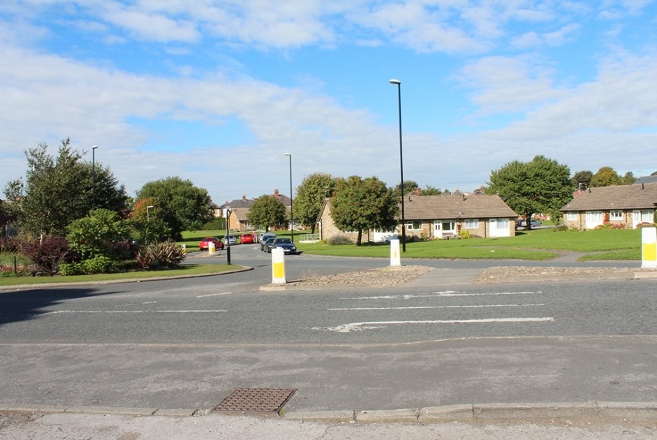
Albert Square – 1977
This and the previous photograph shows Albert Square 21 years apart.
On the left is the gable end of a bungalow, a number of these retired persons homes are on Albert Square. The dark stone building across the centre of the view is called Ingots Building, it was part of Waterside Mill and is now offices for Headrow Housing.
Moving right cars are parked on the forecourt of M & D Motors, this used to be Rhodes Garage.
Next the New Inn, then addressed as 1 Club Row is Gulshan Tandoori Restaurant and Takeaway. Club Row is between Gulshan and the Albert Inn which is on the right edge. The hanging sign has a portrait of Prince Albert, consort to Queen Victoria.
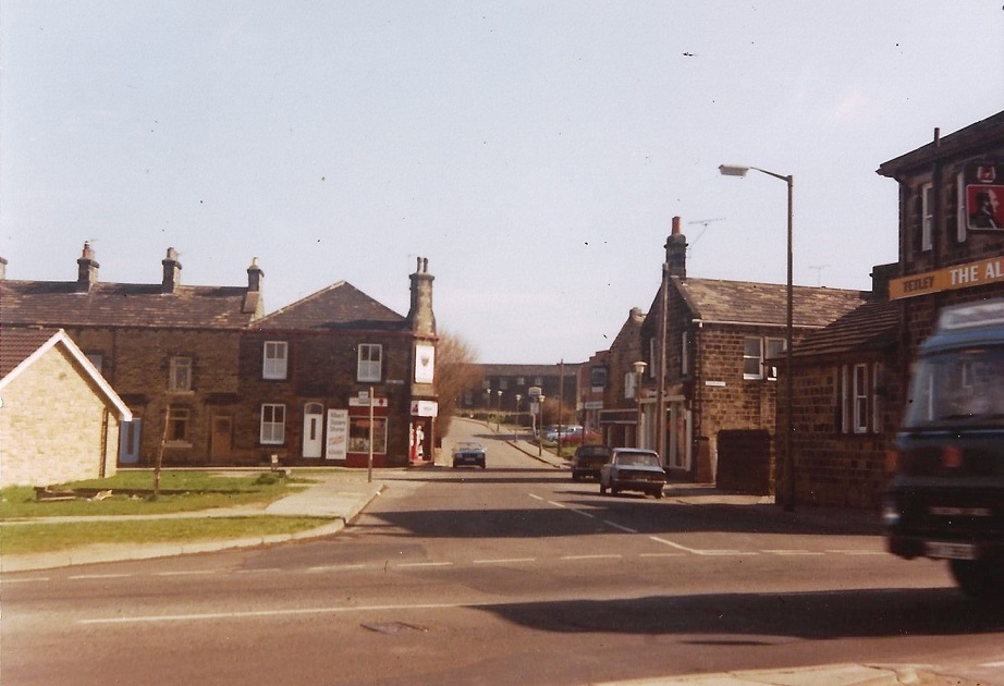
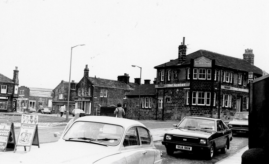
Albert Square – 1983
On the left is an off-license shop at the junction of Cemetery Road and Albert Square. Next, on Cemetery Road, is Rhodes Garage then the New Inn followed by what in recent times has been a take-away food outlet (May 2013).
The Albert Inn is at the corner with the High Street. Several cars are parked in a lay by outside a sweet shop called the “Wooden Hut”, boards on the pavement have been put out to advertise goods sold in the shop. This is now also a take-away food business (May 2013).
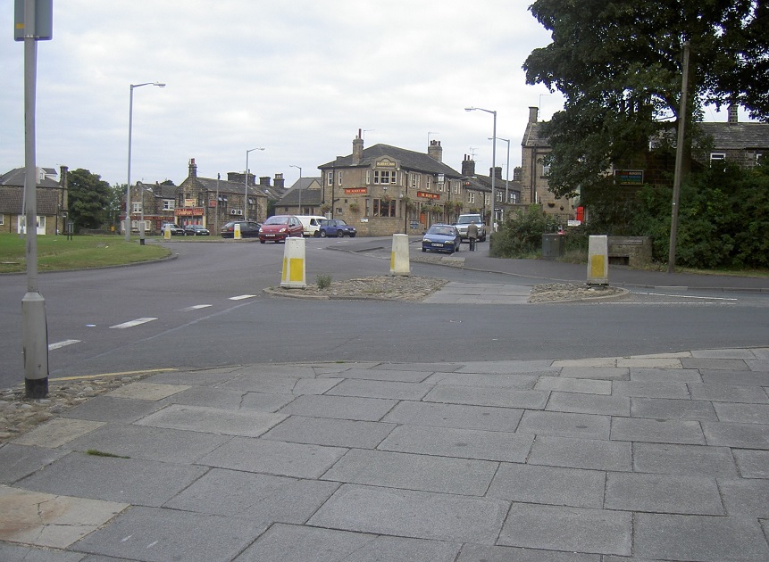
Albert Square – 2013
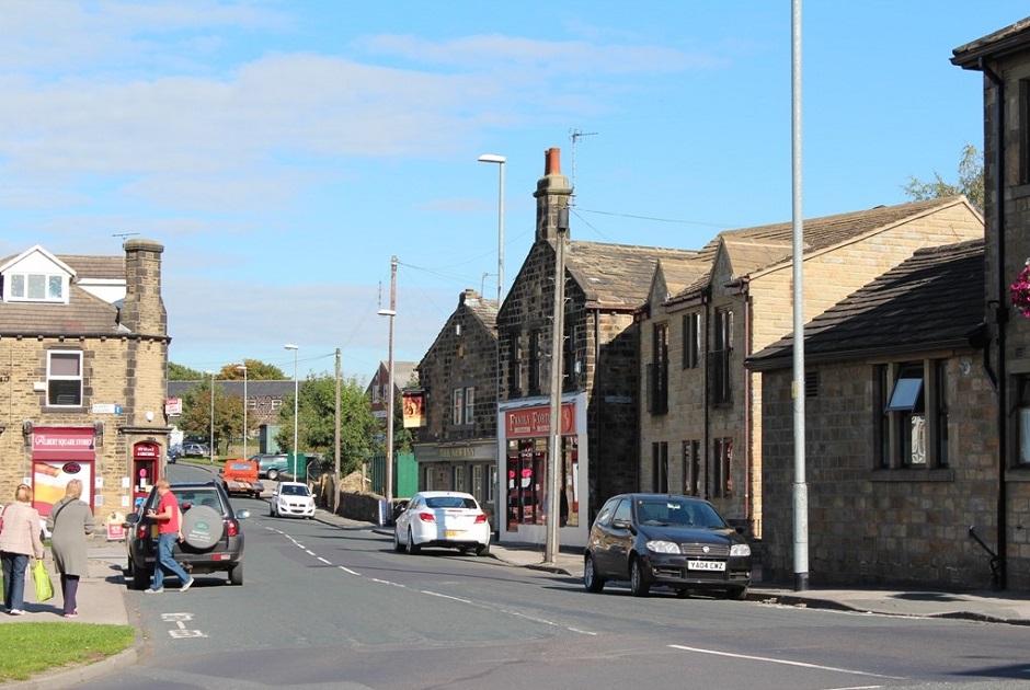
On the left of Cemetery Road is an off-licence shop.
To the right the apex roof of M & D Motors at Lakeside Garage can be seen, then the New Inn public house, next, Family Fortunes takeaway food outlet which is at the end of Club Row.
On the right edge is a partial view of the Albert Inn.
Donated by John Arundel.
Editor’s Note: Albert Square is the gateway to Cemetery Road and to see more photographs of this area – Click Here.
Consolidated by Elaine Ellwood. 20 May 2021.
Last updated: 12 December 2023 – Photo ID: E999. 25 July 2023 – Photo ID: A100. 28 November 2022 – All images updated.
