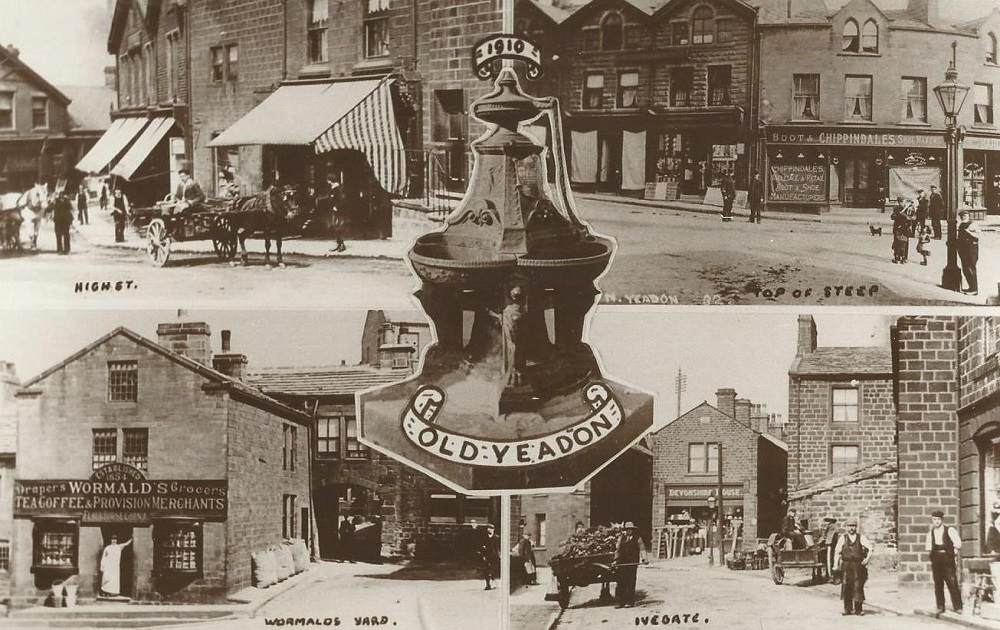
| Title | Multi-View Postcards |
| Date | 1910 |
| Location | Yeadon |
| Photo ID | K238 |
| Comment | In the centre is Yeadon Fountain, top left shows the bottom of the High Street at the corner with Silver Lane. Top right has the opposite side of the High Street at the junction with Ivegate, bottom left is Wormald’s grocers and Wormald’s Yard located on the Steep (Town Street). Bottom right is a view of Ivegate. Donated by Edith and Roger Pratt. |
Multi-View Postcard – 1910
Reverse carries a halfpenny stamp, written message, addressed to Basil Jordan from Mother and Father.
In the center is the Town Hall, opened in 1880.
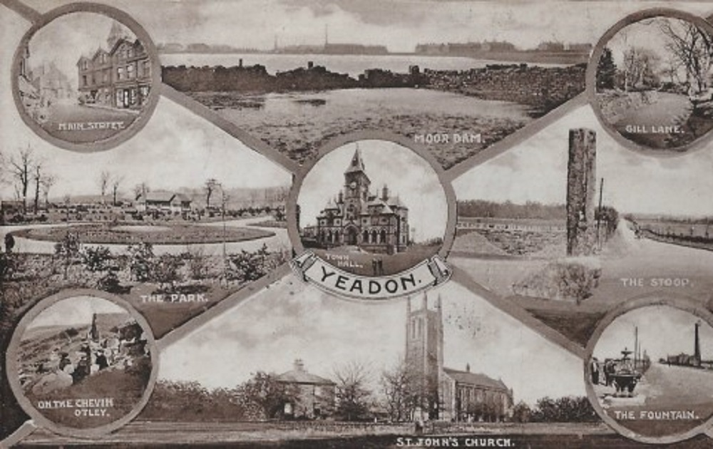
Top left, view of High Street from junction with Ivegate / Steep. Next, Yeadon Dam with Gill Lane to the right.
Center left is Nunroyd Park, the land was a gift from Jonathan Peate, opening to the public in 1907.
To the right is Yeadon Stoop stone at the junction of Harrogate Road and Warren House Lane.
The circular view on the right is of the Long Stoop, this is the highest point on the Dudley Hill to Killinghall turnpike road and is known as Crown Point. The pillar was erected in 1884, replacing an earlier stone which was struck by lightning. It was possibly a way marker across Yeadon Moor or a sighting post across the boggy ground around Yeadon Dam. It is not in this exact position now, having been moved when work was carried out for improvements to Leeds Bradford Airport.
Bottom left a group of people on Otley Chevin, next St. John’s church situated between Otley Road (A65) and Henshaw Lane.
Yeadon Fountain is on the right, erected to celebrate the Diamond Jubilee of Queen Victoria in 1897, it was placed at the junction of the High Street and the newly named Victoria Avenue.
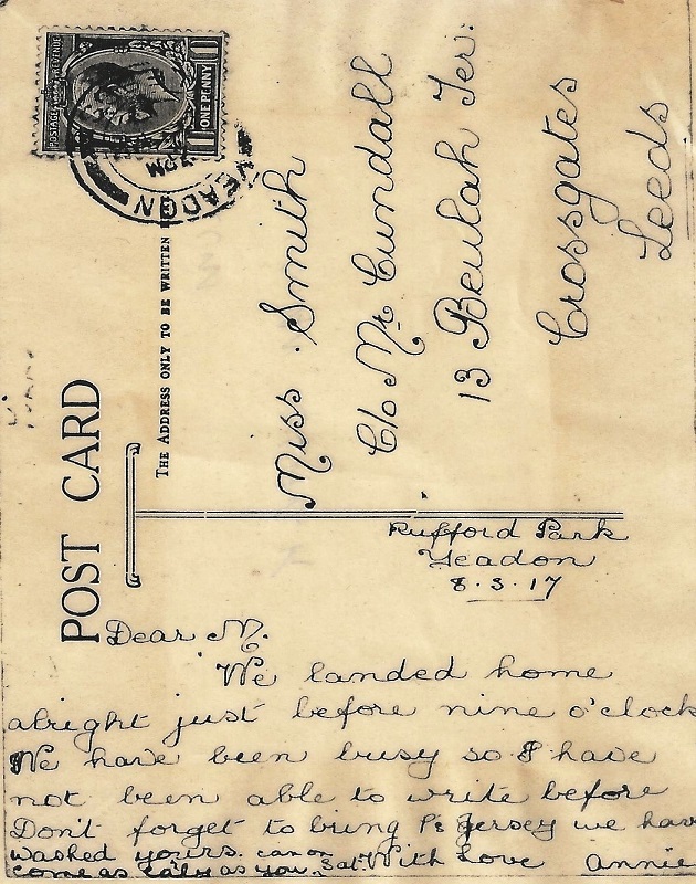
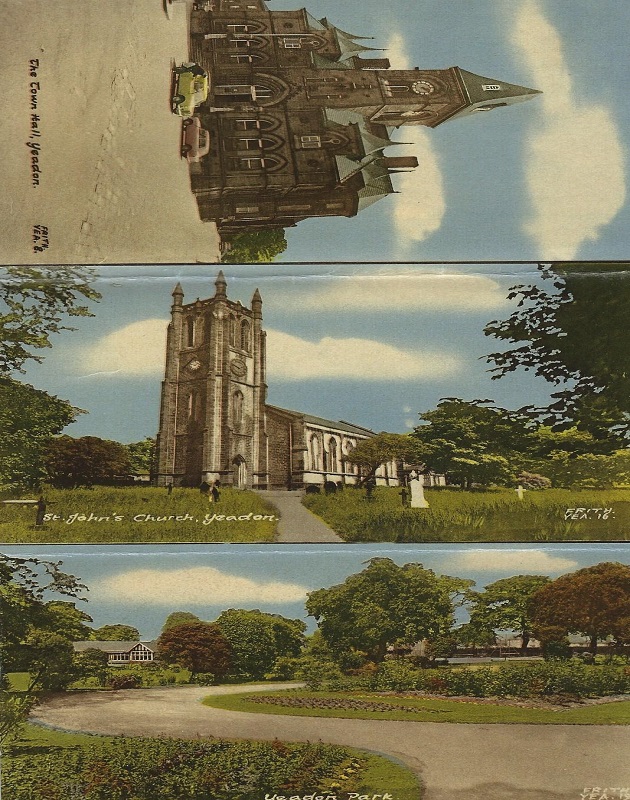
Multi-View Postcard – 1917
A message on the reverse reads :
“Rufford Park, Yeadon 8.3.17
Dear M, we landed home alright just before nine o clock. We have been very busy and not able to write before. Don’t forget to bring P’s jersey we have washed yours. Come as early as you can on Sat. with love Annie”. It was sent to Miss Smith, c/o Mrs Cundall, 15 Beulah Terrace, Crossgates, Leeds.
Multi-View Postcard – Undated
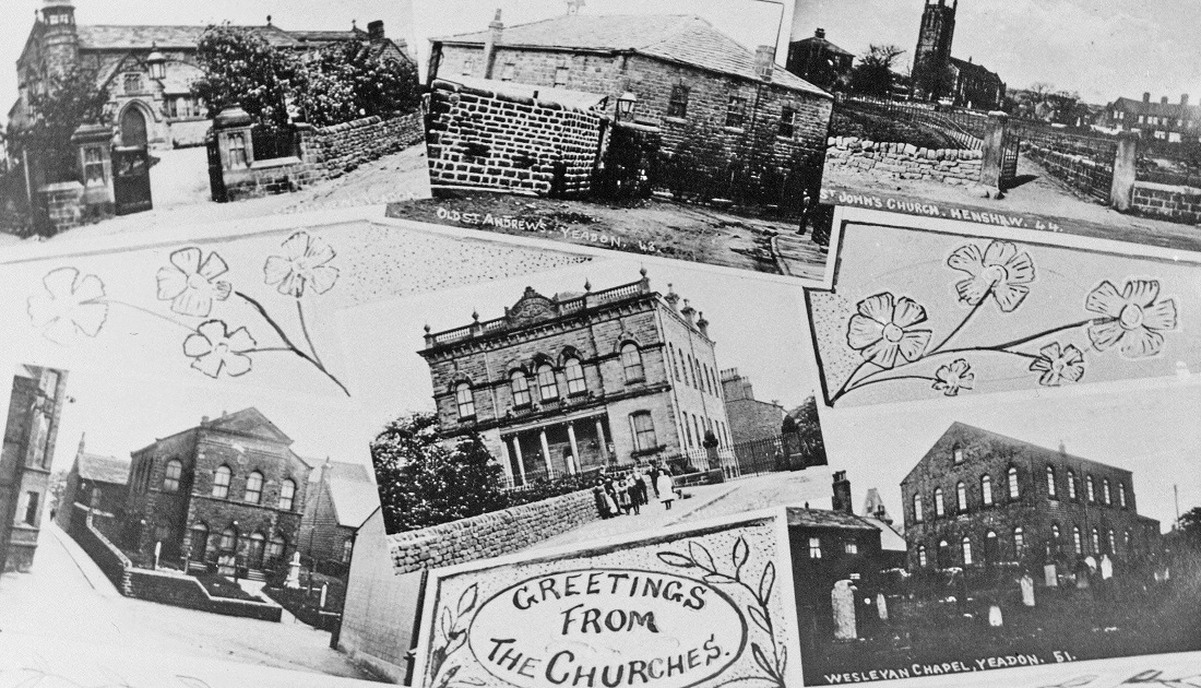
In the top left is St. Andrew’s Church, then what was the 1st Wesleyan Methodist Chapel in Yeadon, later it was a school and mission hall for the Church of England until St. Andrew’s was built. In the centre is Queen Street Chapel, the Primitive Methodist Chapel is bottom left. More details about these chapels and churches can be found on the AHS website.
Donated by Philip Archdale.
Multi-View Postcard – 1920
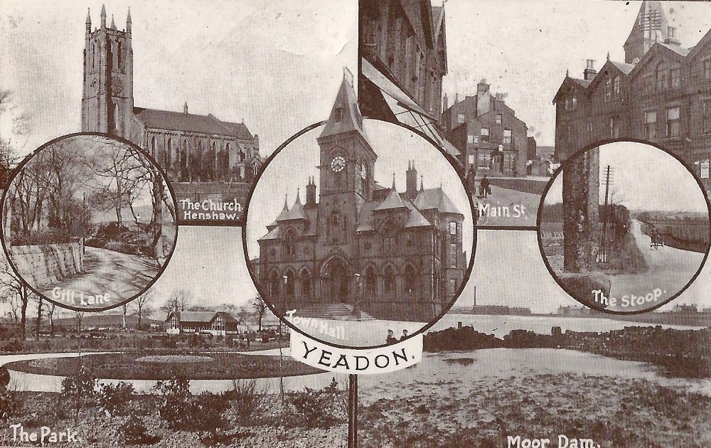
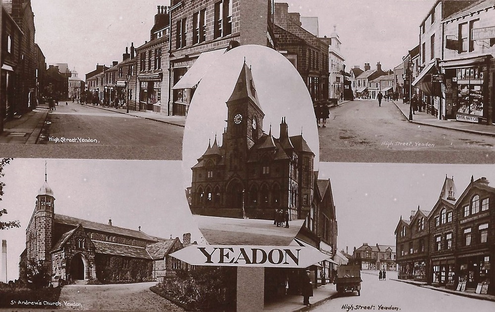
In the centre is Yeadon Town Hall, built by subscription, opened in 1880.
Top left view of Yeadon High Street, the white building in the centre is Yeadon Picture House, it opened on 3rd August 1925, it is now converted to the Aviator public house.
Top right, a similar view but closer to the cinema.
On the right edge Lucas’s stores selling sweets and tobacco.
Bottom left is St. Andrews church, Haw Lane, completed in 1889.
A 3 day bazaar was held in the Town Hall which raised £1,500 to help defray the cost of building the church.
It is no longer used by the Church of England but utilized by another religious concern.
Bottom left, view of the High Street from the junction with Silver Lane/Ivegate/Steep.
The Co-op building can be seen facing onto Town Hall Square.
A sign over the building on the right edge reads “Albion Printing Works”
The tower of the Town Hall can be seen above this row of shops.
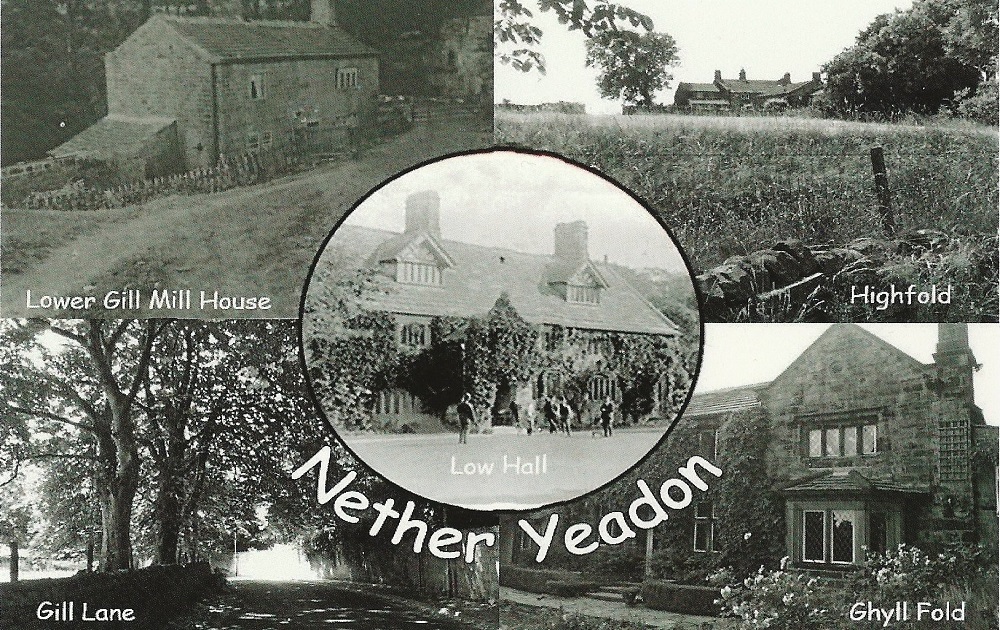
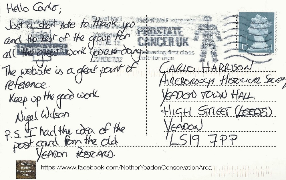
Multi-View Postcard – 2013
The card is titled “Nether (lower) Yeadon”, on the reverse is a message :
“Hello Carlo, just a short note to thank you and the rest of the group for all the great work you are doing. The web-site is a great point of reference. Keep up the good work. Nigel Wilson.
PS I had the idea of the postcard from the old Yeadon postcard”
Previous Comments:
Re A001
smbork
I found the comments on this page very informative and helpful. It has the best explanation of the Long Stoop.
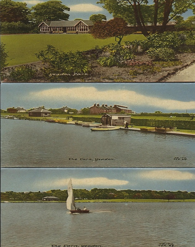
I could never quite believe it was as it had originally been as the two parts seemed not to have anything to do with each other. It does seem that it may have marked the highest point on the Turnpike road and that the upright was a later addition or a replacement after it was struck by lightning. The multi-view postcards are very interesting as the shops were exactly as I remember in the 40s yet it is clearly marked 1910. The text also calls the Tarn a fishpond. That would make sense as perhaps it WAS dammed to provide a more constant/ reliable t water supply to the factories in Yeadon. Thus it went from the Tarn to the Dam.
11 October 2021.
Consolidated by Elaine Ellwood. 03 September 2021.
Last updated: 29 December 2022 – All images reviewed. 01 March 2022 – Photo ID: C918. 27 September 2021 – Photo ID: K238, A001 & A004.
