| Title | Otley Road |
| Date | c1900s |
| Location | Guiseley |
| Photo ID | C196 |
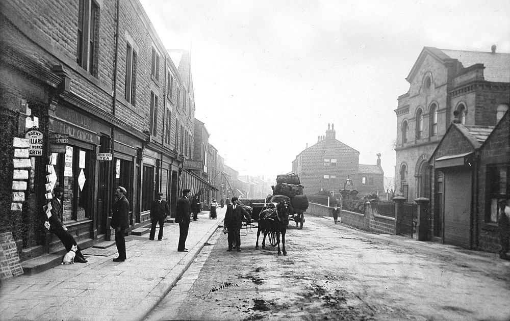
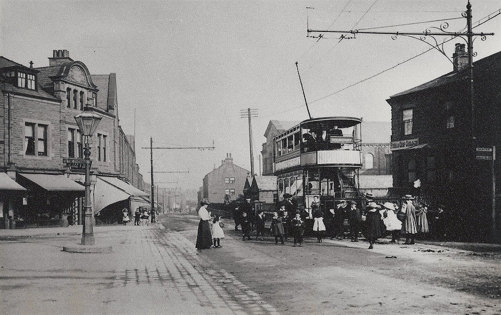
| Comment | On the left are the premises of John Dibb, grocer, his first shop was on Towngate. The family remained in business on Otley Road until shortly after Morrisons supermarket opened in 1989. Further along is a protruding sign for Chippindale’s shoe shop which was another local family concern. Coming towards the camera is a pony and trap, going in the opposite direction is a cart loaded with bales, perhaps for one of the local mills. The driver can just be seen peeping round on the left. On the right is the Primitive Methodist Chapel, also called the Providence Chapel which was demolished in 1970. The site is now an open space with seating adjacent to Morrisons store. |
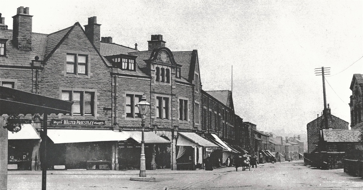
Otley Road – c1907
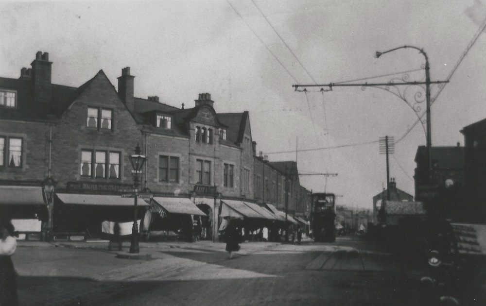
This is looking in the direction of Rawdon, Oxford Circus/Oxford Road is on the left.
It is presumably a hot day as all the shops have their blinds down to protect the goods in their windows.
Walter Priestley had a butcher’s shop on the left.
On the right is the Primitive Methodist Chapel also known as the Providence Chapel.
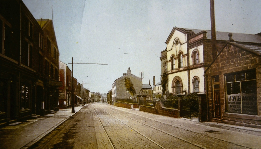
Otley Road – 1909
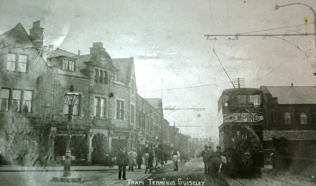
This view looks from Oxford Circus (Oxford Road) which is to the left and down Otley Road in the direction of Yeadon/Rawdon.
A number of children are gathered around a tram which has a destination board for Roundhay.
On the left behind the lamp post is a shop with rolls of linoleum outside. This is the business of Lee & Sons.
A finger post on the lamp standard points to Guiseley Railway Station.
The Providence Methodist Chapel is behind the tram. The building on the right has a sign “Fish and Chip Saloon”.
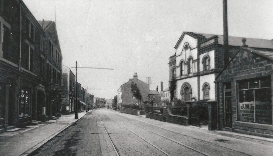
Otley Road – 1909
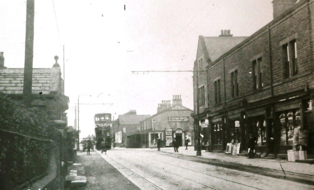
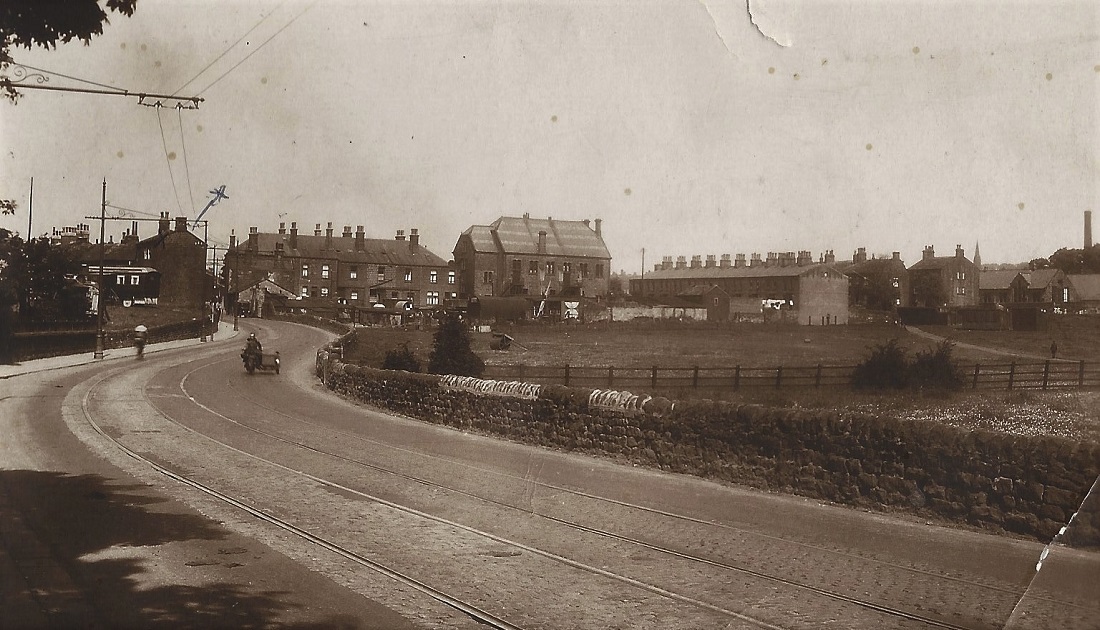
To the left is the junction with Oxford Road known as Oxford Circus. A tram is approaching the Oxford Circus terminus.
The first trams ran to Guiseley in 1909 when the area in this photo would have been the terminus. The line was extended to White Cross in 1915.
Otley Road – c1920s/2004
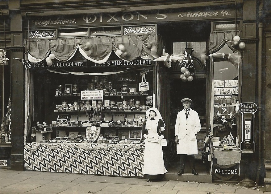
Dixon’s shop decorated to raise funds for Hospital Week, the model dressed as a nurse holds a collecting box. The shop window is filled with jars of sweets and boxes of chocolates, a notice informs “This window contains a prize — Consult Your Handbook”.
A Nestles chocolate machine supplies bars of chocolate for 1d, these machines selling chocolate, bubble gum, chewing gum or cigarettes used to be a common sight, now rarely seen.
This photo donated by Alan Pickles is a nostalgic reminder of past times.
Otley Road – 1920s/2004
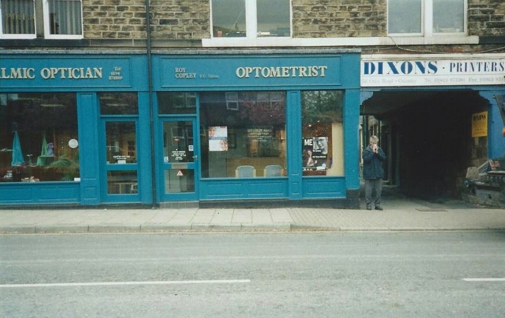
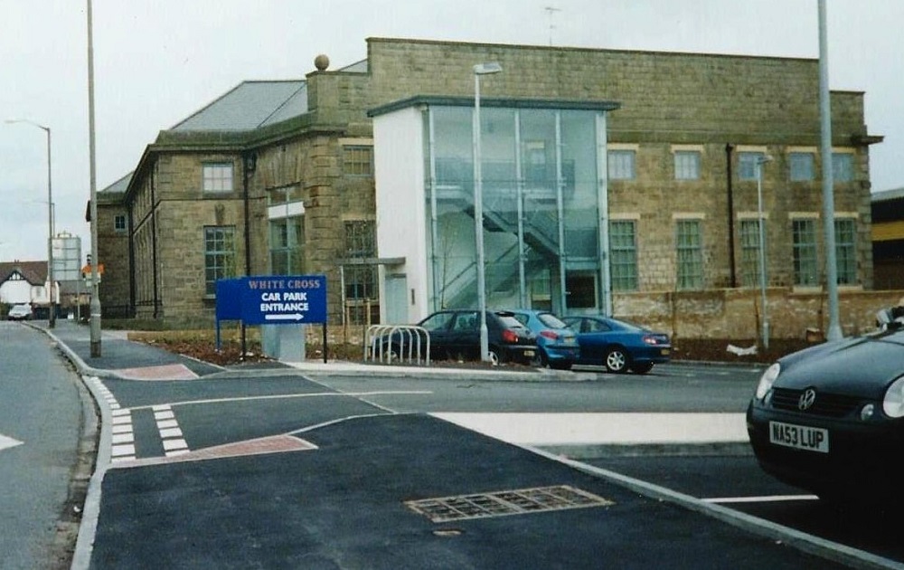
By 2004, this and the adjoining shop became an opticians.
It has now (2015) reverted back to single retail units. The one previously Dixons is now a nail beauty treatment centre and the other is Phillip Kirby Jeweller.
By coincidence the archway on the right led to a printing company also called Dixons.
Donated by Anne North.
Otley Road – 1930s
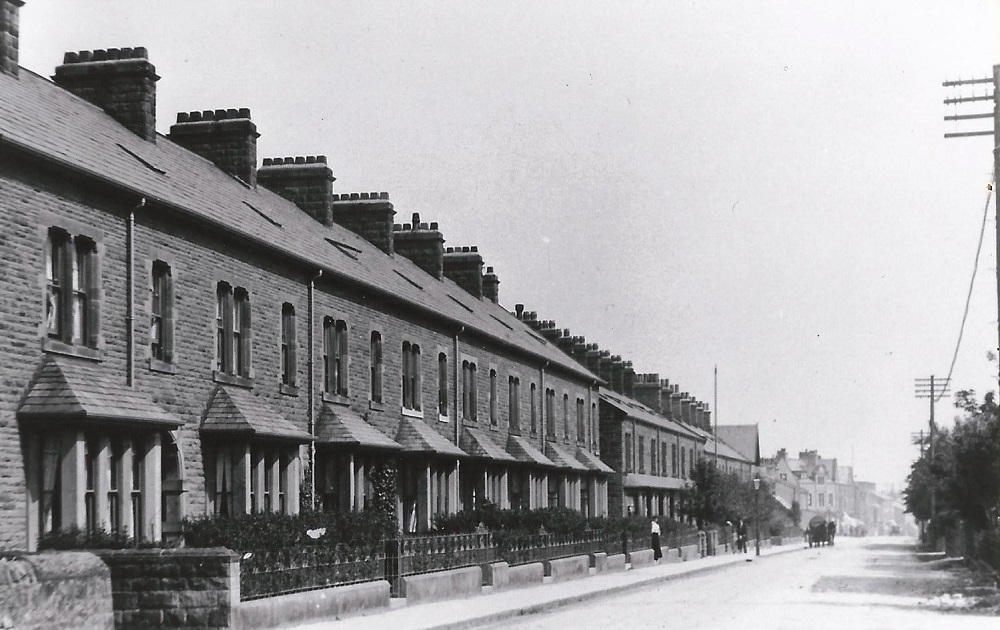
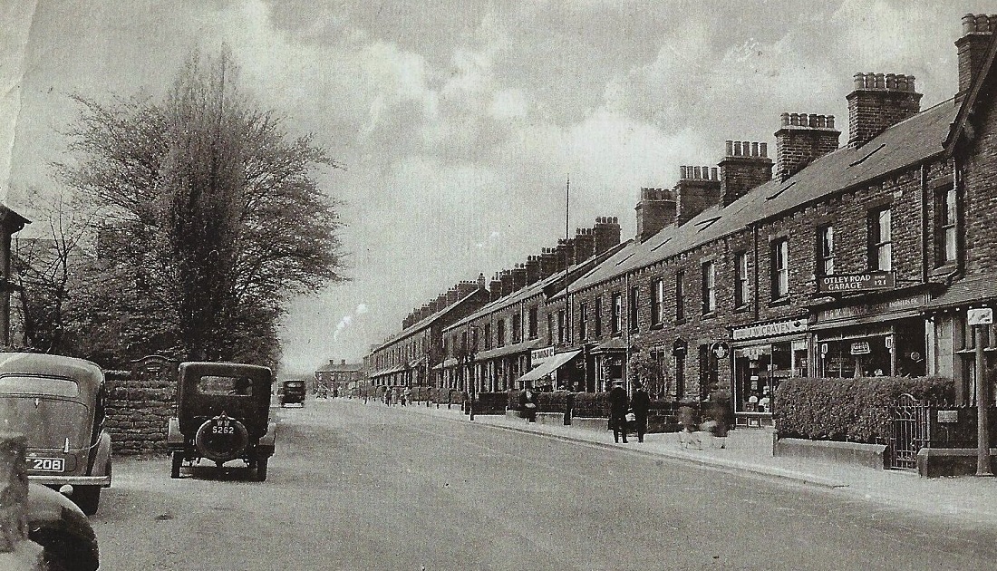
This is looking along Otley Road in the direction of Morton Terrace, seen here as the lower row of houses in the middle.
Morton Terrace was also called Padget Row, named after the family who lived at Tranfield Hall. They had the houses built as homes for railway workers.
On the right is an electricians shop owned by Jack Craven. At the right edge is H & W Warner, motor engineers with a sign for Otley Road Garage.
Otley Road – 1930s
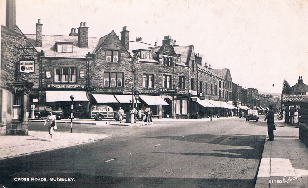
A view of Otley Road looking from the junctions of Oxford Road (left) and Victoria Road (right).
On the left is a furniture shop, business of R Lee.
On the right, the large building is the Primitive Methodist Chapel also known as the Providence Chapel.
A man is standing next to a Belisha Beacon which dates the photo to after 1934.
The beacons are orange globes set on a black and white striped pole and mark a pedestrian crossing, also striped black and white, so called Zebra crossings.
One is not visible in this image.
They were introduced and named after the Minister of Transport Leslie Hore-Belisha.
Previous Comments:
Re C012 & D073
From Martin Bairstow: This is the 1909 terminus at Guiseley, before the 1915 extension to White Cross. The tram is awaiting departure back to Leeds. It will have dropped its passengers on the opposite side of the road, then drawn forward into the terminal stub in the foreground. There the conductor will have turned the trolley and put it on the left hand wire. The tram has then moved to its boarding point.
Re C012
electricalphil2005
The shop was Joseph Lee & Sons. He was my Grand uncle and also had a furniture shop at the bottom of High Street, Yeadon.
29 May 2013.
Re V67
adminCH02
Dear Carlo,
Ref V67. The date may be earlier than 1939.
The tramway closed in October 1934 and an Abandonment Order was issued in March 1935. I may be wrong, but I don`t think they would have wasted much time in taking down the wires and resurfacing the road, possibly burying the tracks in the process.
It would depend if the price of scrap exceeded the cost of recovery. If they were still accessible after war broke out, they would most likely have salvaged them.
The wires for the two directions are very close together giving the appearance of trolleybus wires, which they are certainly not.
They were ok for trams taking power through a trolley pole but would have had to be re-sited directly above each track in order for bow collectors to be used.
Lines in Leeds which had a future at that time were converted for bow collectors around the time that Guiseley closed.
It is unclear from the photo whether the track is double or whether this is just a passing loop with the track singling beyond the motor cycle. Can the photo be enlarged?
I thought, but again may be wrong, that parts of the Kirkstall to Guiseley route were single track.
Had it survived beyond 1934, it would have had to be re-laid, double tracked and rewired.
The local authorities who, a generation earlier, had encouraged Leeds City Tramways to extend outside the City boundary were by 1934 more interested in seeing the road resurfaced and the tramlines obliterated.
Running on worn out track and, I think having to wait at passing loops, the trams would have been slower than motor buses, especially if the latter were given a better road surface.
After crossing the Leeds boundary, the line passed through four UDCs.
The stretch through Horsforth was built by the UDC and leased to Leeds City Tramways. Rawdon, Yeadon and Guiseley UDCs consented/ requested Leeds City Tramways to build it.
Otley, Burley and Ilkley UDCs wanted Leeds City Tramways to go even further but they wouldn`t.
Then in 1915, they erected wires for rather primitive trolley buses from White Cross to Otley and Burley, but not Ilkley and extended the tramway to White Cross and built the shed which still stands for both trams and trolleybuses.
Regards and seasons greetings.
Martin Bairstow.
27th December 2013.
Re V67
mikem
The section of A65 between Greenbottom and Nunroyd, is Leeds Road with old maps showing the group of houses at the side of the Yorkshire Rose (Public House) (‘x’ marked) as Greenbottom Terrace.
The ‘x’ marked house would be, 14 Leeds Road – the 1911 census shows my relations – James & Sarah Heap with their children Frank, Alice, John, Morris and Marion – living there.
These houses may have been demolished prior to WW2, but the feast was still held on this land prior to Stanley Grove being built (early 1950s). The feast was then held in the field opposite Guiseley Town Hall.
25 January 2014.
Page 1 of 8 More >>
Consolidated by Linda Plonka. 08 March 2022.
Last updated: 22 December 2023 – Photo ID: X639. 18 December 2023 – Photo ID: F846. 01 April 2022 – Photo ID: L238.
