| Title | Otley Road |
| Date | 1960s |
| Location | Guiseley |
| Photo ID | FB183 |
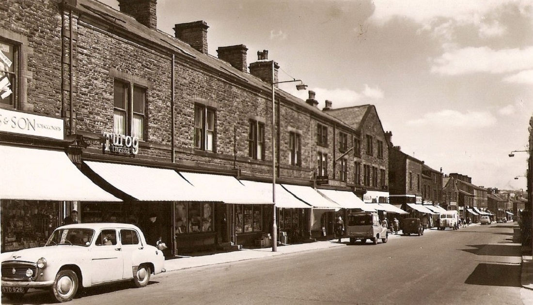
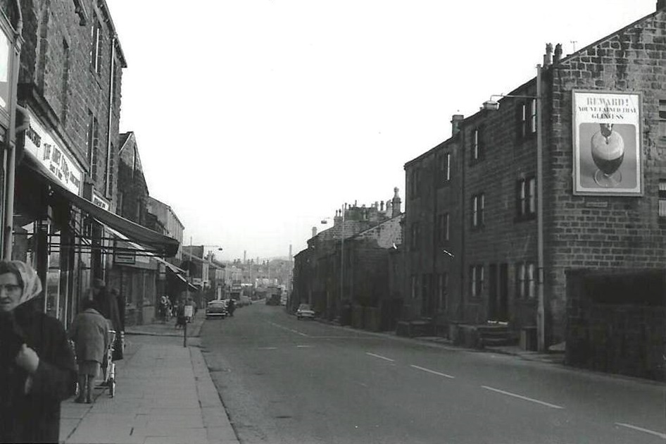
| Comment | View looking along Otley Road in the direction of Greenbottom. The shop with the boxes stacked outside is Dibb’s grocers. Donated by Andrew Clayton. |
N110 – Otley Road, 1960s.
Otley Road – 1960s
View of Otley Road looking towards the Station Inn and the junction with Oxford Road.
M232 – Otley Road, 1960s.
Otley Road – 1960s
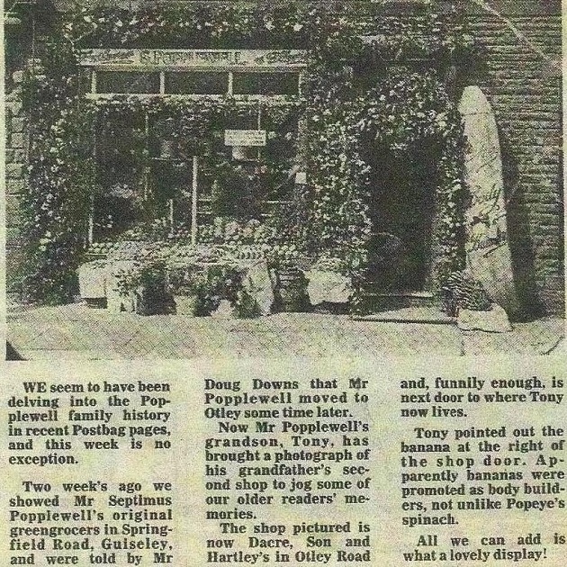
Then & now images of a shop on Otley Road. Once Popplewell’s greengrocers.
Donated by Anne North.

M232A – Otley Road, 1960s.
Otley Road – 1960s
It is now the premises of Dacre, Son & Hartley, estate agents.
Donated by Anne North.
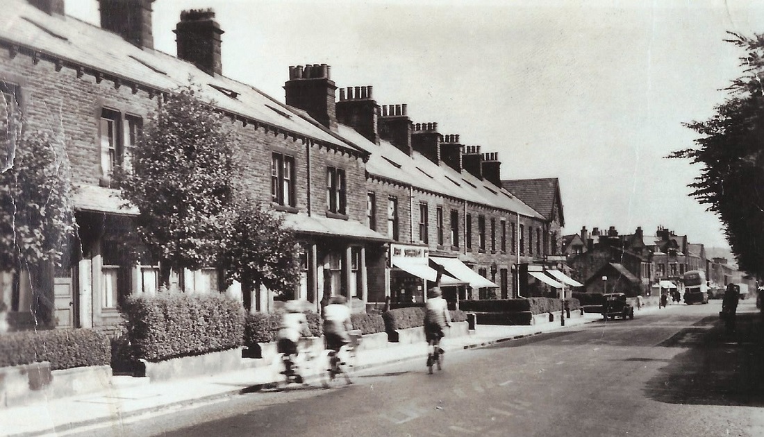
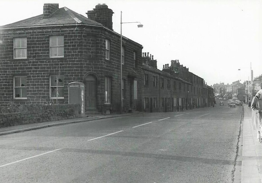
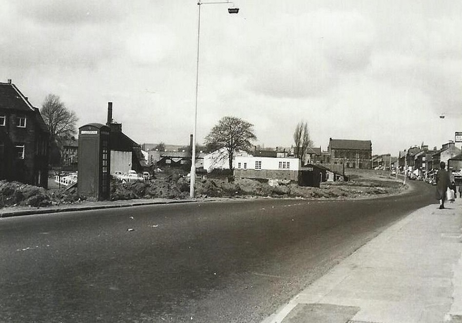
K418 – Otley Road, 1960s.
Otley Road – 1960s
Looking towards Greenbottom, to the right is an area of waste ground where properties have been demolished.
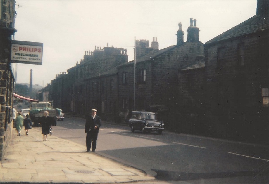
AA101 – Otley Road, 1960s.
Otley Road – 1960s
A different view of Otley Road, the shop with the “Philips Philishave Electric Shaver” sign is now a gas appliance showroom (May 2013).
Guiseley Library is set back out of view on the left, the site was previously a blacksmiths.
To the right are houses which were demolished and eventually Morrisons store would be built in this area.
The factory chimney is part of Nunroyd Mill. The view is looking in the direction of Rawdon.
The man in the foreground is Charles Darnbrough.
FF68 – Otley Road, 1960s.
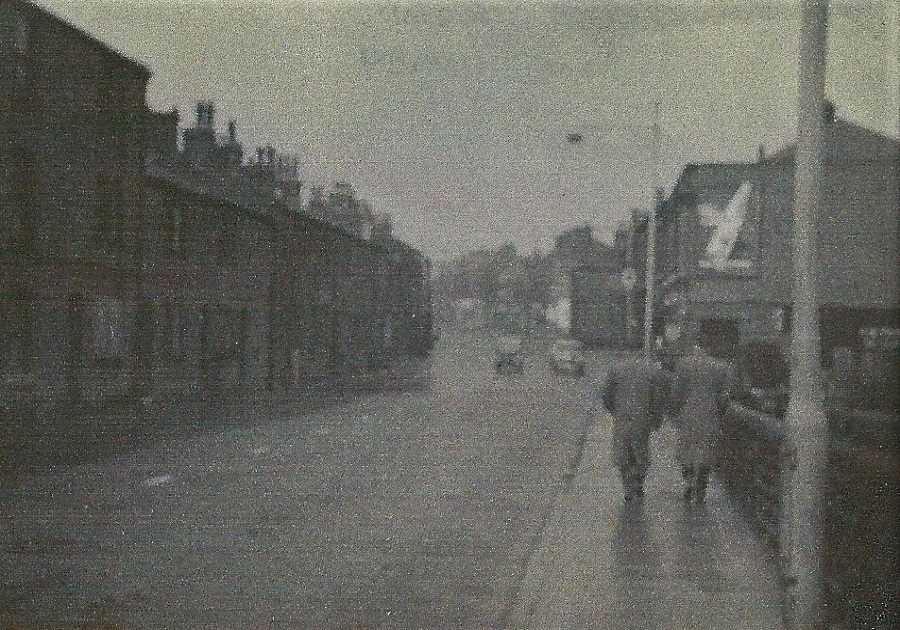
Otley Road – 1960s
View looking in the direction of White Cross. On the left are cottages which are now demolished (February 2013). This area is now part of the gyratory system at the end of Park Road.
To the right, the wall which juts out from the building line is the end of Bedford Place.
The large advertising sign is on the wall of what was the Co-op stores and is now Cooper’s Bar.
The lower building in front was once a Chapel of Rest and is now a fitness centre (February 2013).
The low wall the men are passing is still in situ and continues on to Greenbottom.
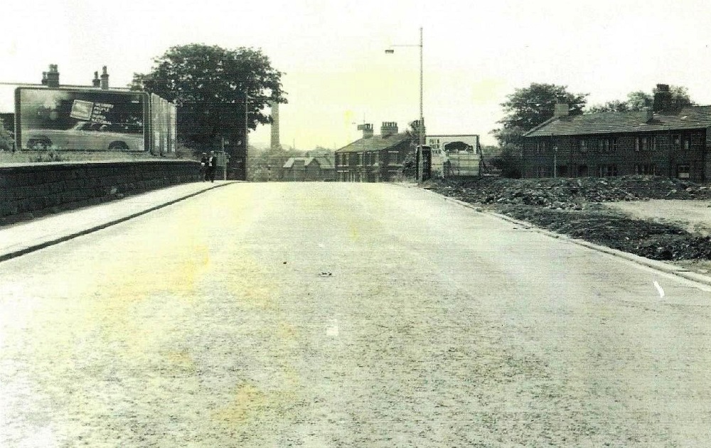
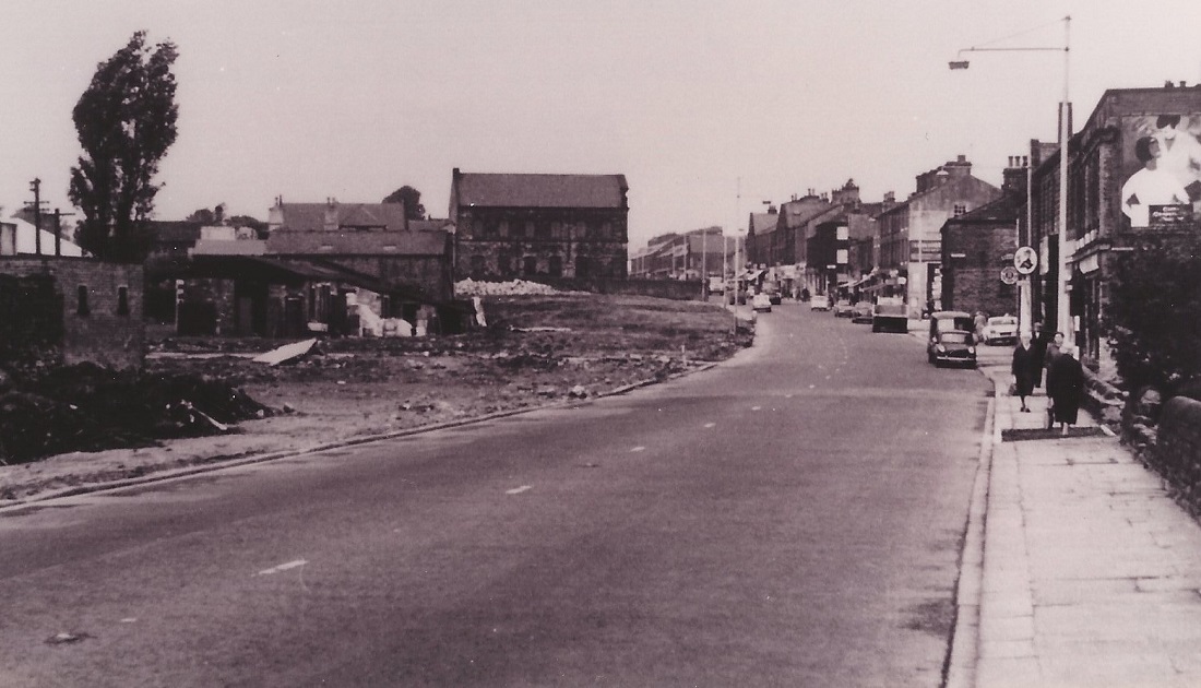
E365 – Otley Road, 1960s.
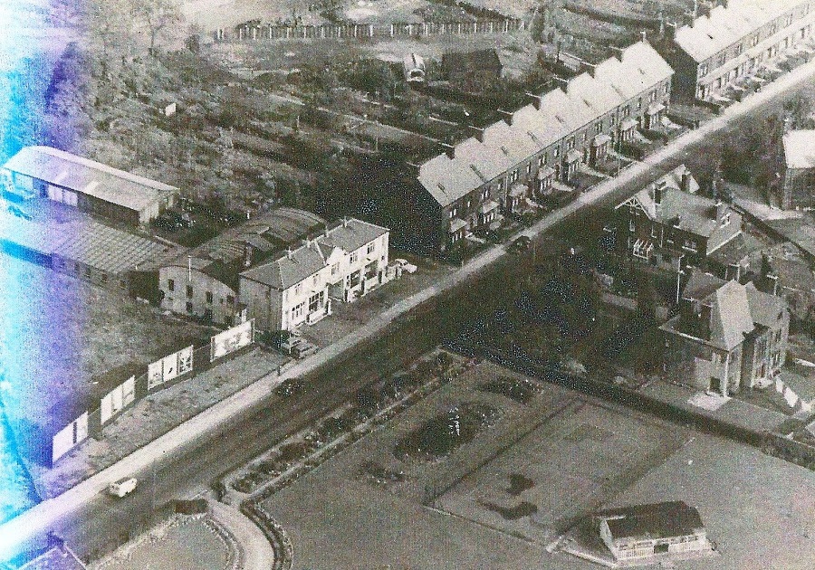
Otley Road – 1960s
Not a very good quality image which shows an aerial view of part of Otley Road in Guiseley.
On the left is what became a Benfield Ford garage and is currently under redevelopment (Feb 2022), moving right the two blocks of houses are Richmond Terrace and Queens Terrace.
Not in view to the right was the Silver Cross pram works.
E376 – Otley Road, 1960s.
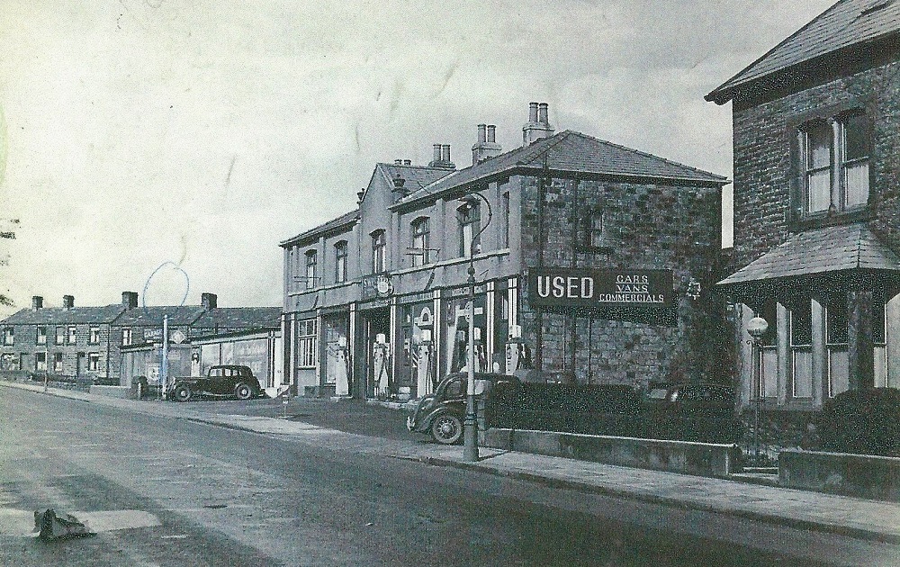
Otley Road – 1960s
On the left the row of houses is Morton Terrace, the garage is Swires, later to become Benfield Ford and now under re-development (Feb 2022). The house on the right is the end of Richmond Terrace.
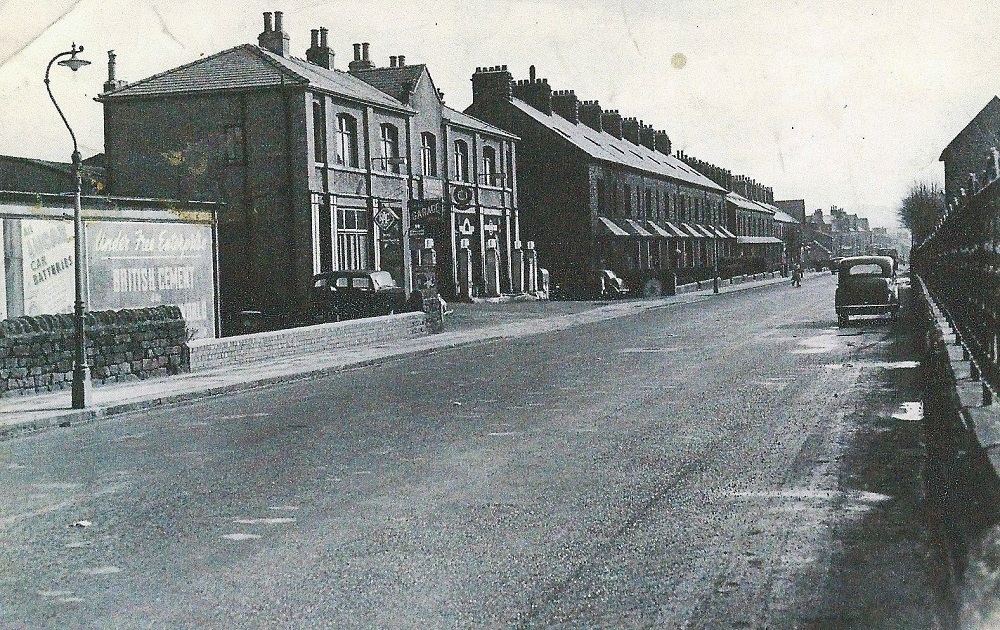
I236 – Otley Road, 1964.
Otley Road – 1964
Otley Road looking down towards Greenbottom, in the bottom right corner is the perimeter wall of the old Primitive Methodist Chapel or Providence Chapel.
Photographer James Farrar donated by his son David.
I235 – Otley Road, 1964.
Otley Road – 1964
Otley Road seen from a view in the opposite direction from the Greenbottom area. On the left is what was the telephone exchange.
Photographer James Farrar, donated by his son David.
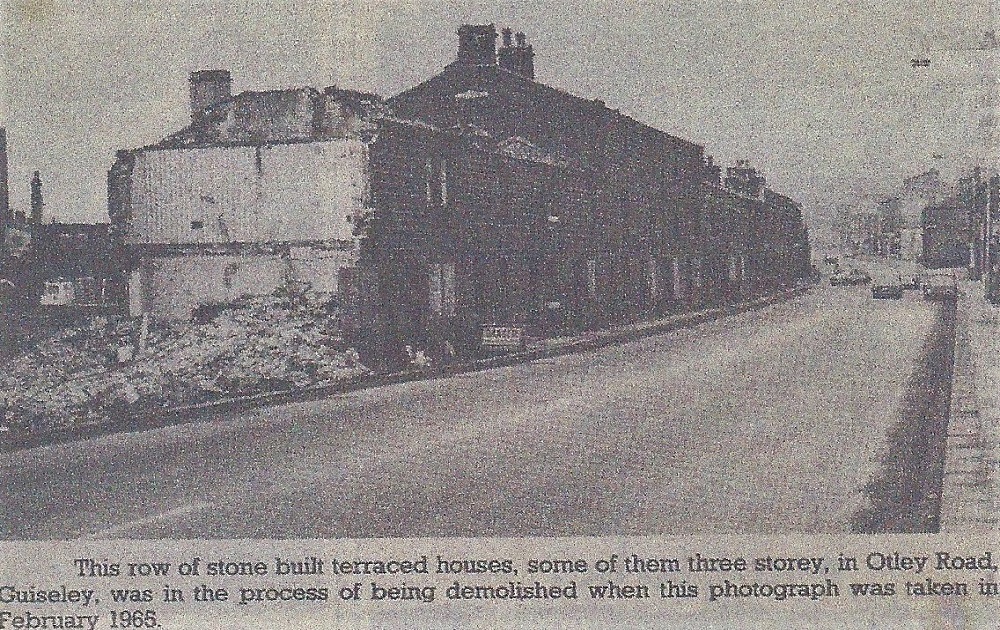
FF088 – Otley Road, 1965.
Otley Road – 1965
The caption reads “This row of stone built terraced houses, some of them three storey in Otley Road, Guiseley, was in the process of being demolished when this photograph was taken in February 1965”.
This site is now part of the gyratory system at the end of Park Road, opposite was the Co-op store which is now Cooper’s Bar (February 2013).
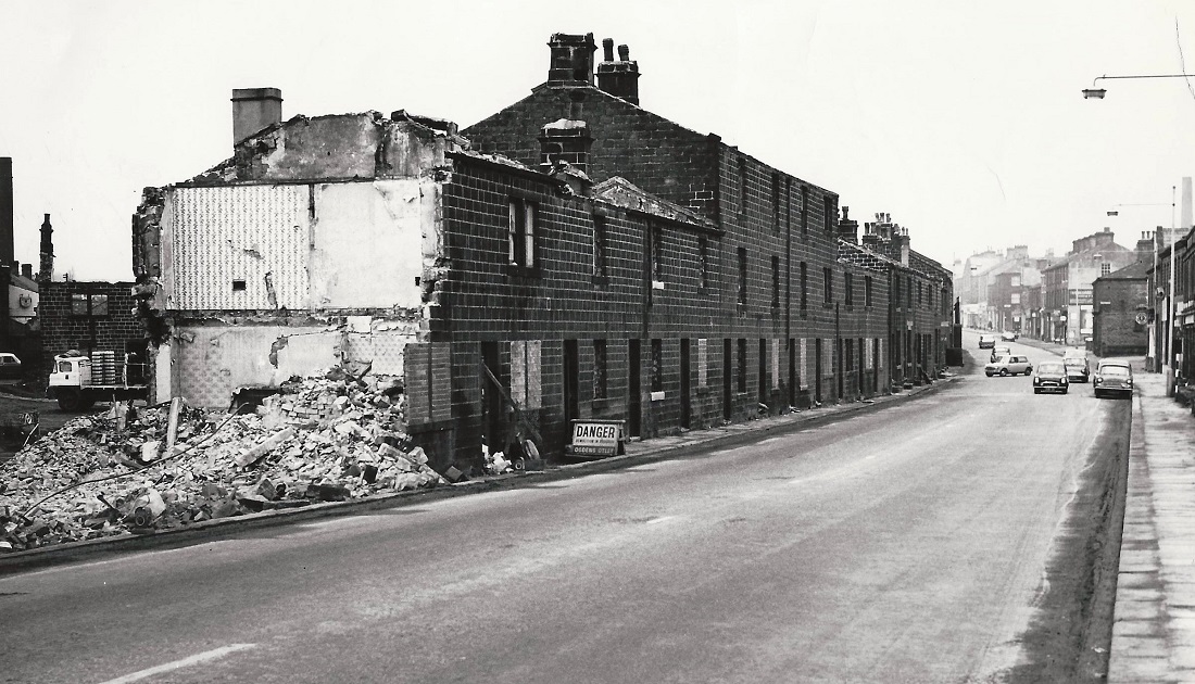
E386 – Otley Road, 1965.
Otley Road – 1965
As above and the demolition of houses on the left, behind these properties are Cassfield Mills.
J262 – Otley Road, 1966.
Otley Road – 1966
Photo taken after demolition of properties on the left side, the Primitive Methodist Chapel is still standing towards the junction with Oxford Road.
This view is now occupied by Morrison’s store and the gyratory traffic system.
Photographer James Farrar, donated by his son David.
X40 – Otley Road, Undated.
Otley Road – Undated
On the left is an area of cleared ground which had been the site of housing, Cassfield Mill lay behind these properties.
The large building is the Primitive (Providence) Methodist Chapel which was demolished in 1967.
To the right are shops on Otley Road, there are hanging signs outside the Regent Hotel, just behind them the stone wall is the end of Bedford Place.
E263 – Otley Road, Undated.
Otley Road – Undated
The view looks in the direction of the junction with Oxford Road / Victoria Road.
On the left is Benfield Ford Garage followed by terrace houses which are addressed as Richmond Terrace.
The photo is dated 1960s but it is thought that it could be the 1950s
Previous Comments:
Re K418
JHWellsMount
The pile of rubble in photo is the remains of the old Guiseley telephone exchange which was moved to land at White Cross.
15 October 2017.
facebook comments:
Re E376
John Wheatley: The Garage would have been Swires when the photo was taken. My dad always bought petrol there. 4 Gallons and 4 shots of Redex. He also bought 4 brand new cars from Swires.
Heather Pilkington: At bottom right is silvercross nursery.
Brian Triffitt: All the space at the bottom of the picture is Silver Cross land, in the bottom left of the picture is the roof of the Silver Cross house.
Joanne Gallant: Is the road running on the right hand side Renton?
Steve Howarth: The building at the bottom looks like a sports pavilion.
Michael Hull: What was Linwoods Coal yard is just visable to the rear of Richmond Terrace.
Jeannie Cutlan: My father used to work for Mr Linwood every Saturday morning in the late 50s early 60s. He and his wife were a lovely couple, lived on Ings Lane.
Christine Wilson: I worked at Swires, Yeadon, petrol one. Old pound for four gallons and a shot, if only that today. I was 17 and delivering new cars. I would not get insurance today, what a life!
Heather Pilkington: Two of my sons went there too.
Rachel O’Halloran-Morgan: I live on Richmond Terrace so this is a great bit of history on our house. Brilliant pic. Are there any more?
Kath Tarkenenso: Jenny Elstub, would that be nursery? The house on the right with the washing outside?
Jenny Elstub: Yes Kath it is! How lovely. X
Sharon Grace: Louise Priestley, I can see your house!
Christine Hathaway-Phillips: Agree with Heather Pilkington, that’s the nursey for Silver Cross bottom right…I used to go there, so vivid in my memory.