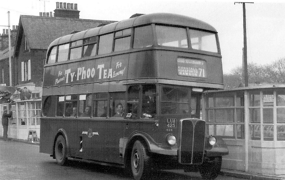
| Title | Otley Road |
| Date | Undated |
| Location | Guiseley |
| Photo ID | I076 |
| Comment | Leeds City Transport bus, Regent 021, serving route 71, which operated to Leeds via Rawdon, Horsforth and Kirkstall. Donated by Chris Youhill. |
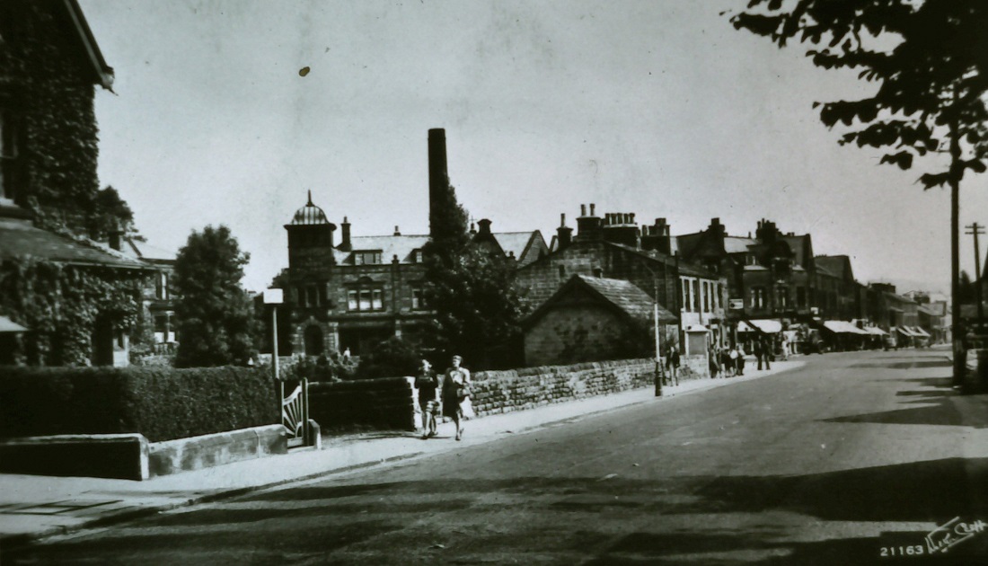
J263 – Otley Road, Undated.
Otley Road – Undated
Otley Road looking towards the junction with Oxford Road, the Station Hotel is on this corner. To the left is a house built by J B Busfield.
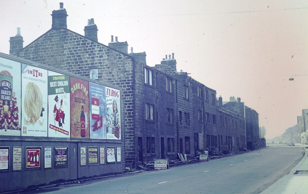
J264 – Otley Road, Undated.
Otley Road – Undated
Looking in the direction of Oxford Road, houses which are ready for demolition. Also a hoarding with advertisements for Heinz beans, Smith’s crisps, Craven’s mints, rum, cigarettes and Turog brand bread.
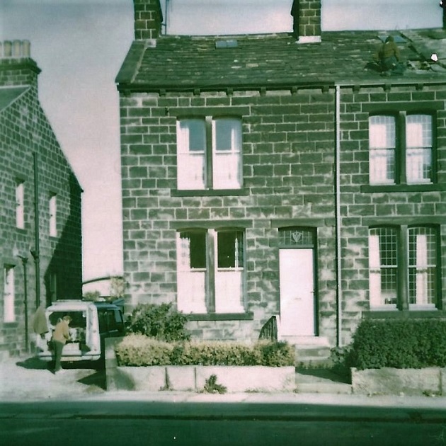
X55 – Otley Road, 1978.
Otley Road – 1978
138 Otley Road, Guiseley.
A stone terrace house. The estimated value in 1978 was £4,500.
The adjoining property on the right has a man on the roof carrying out repairs.
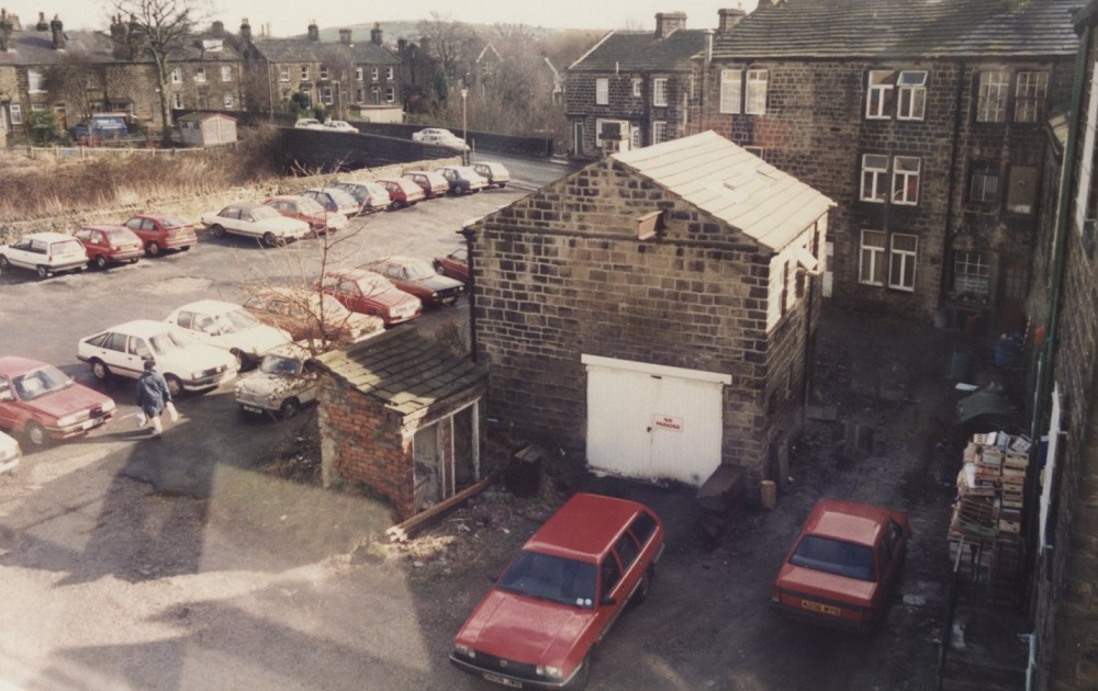
PU222 – Otley Road, 1980s.
Otley Road – 1980s
In the centre is the railway bridge on Springfield Road, moving right the properties facing the camera front onto Springfield Road.
On the right edge the properties face onto Otley Road.
The large free standing stone building belonged to Tony Woods butchers and was used as a cold store. The small unit in front was an outside privy used by the staff of Addy’s outfitters.
One modest assistant used to ask to use the facilities of Chippindale’s shoe shop, she was reluctant to use the privy which had a hole in the wall too high for her to cover up!
Donated by Jane Blake.
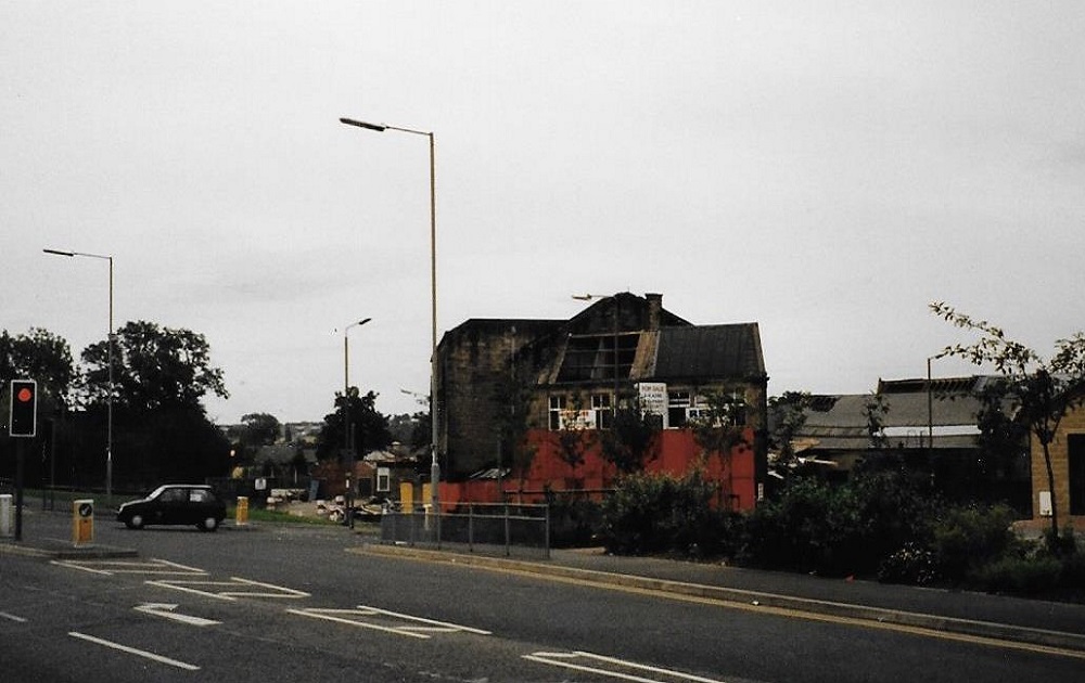
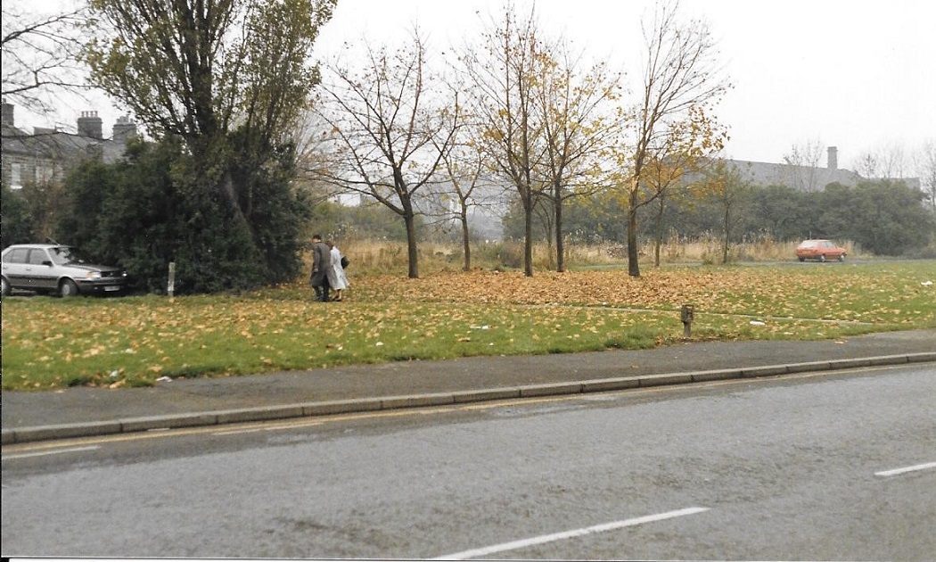
V479 – Otley Road, 1982.
Otley Road – 1982
Otley Road, a car is emerging from Park Road.
In the middle of the view are the derelict remains of the Chloride Shires factory. On the right is a new medical centre.
Donated by Andrew Emsley.
T386 – Otley Road, c1980s.
Otley Road – c1980s
Looking from the end of Thorpe Lane to Otley Road, the Damn Yankee restaurant is on the right.
Photographer Charles North.
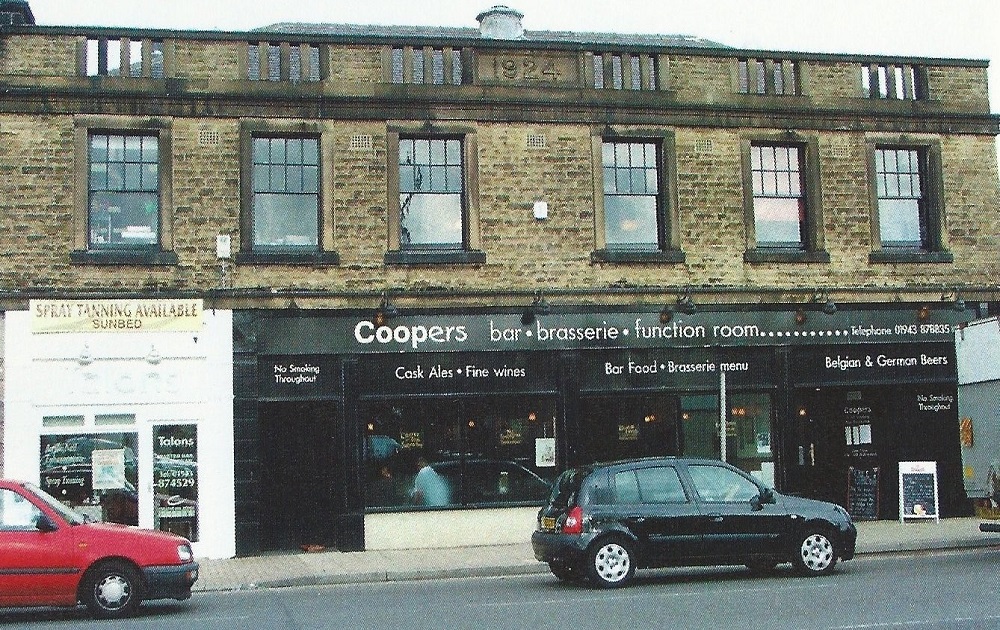
FF35 – Otley Road, Undated.
Otley Road – Undated
Coopers Bar occupies the former Co-op building which was built in 1924. The upper floor became a popular venue for funeral teas, the entrance to the bar on the right still retains the tiling which denotes it was the Co-op butchers department.
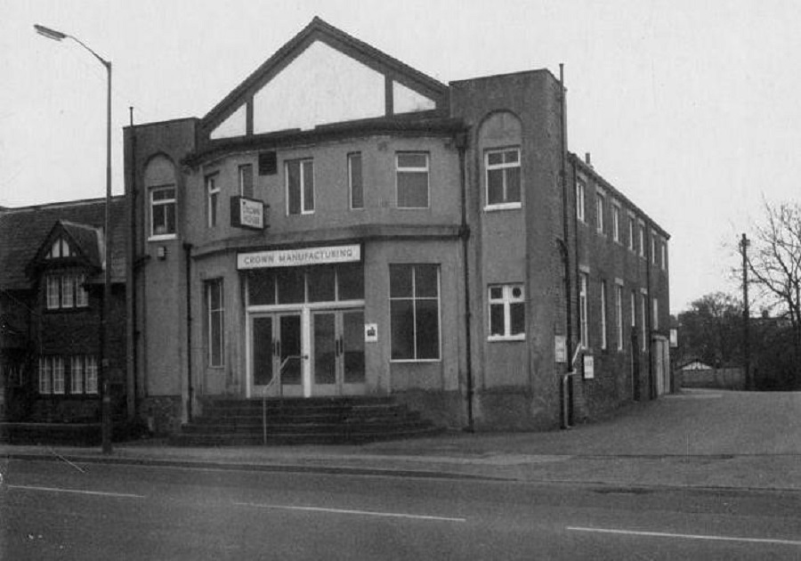
T447 – Otley Road, 1984.
Otley Road – 1984
Property on Otley Road, it was once Guiseley Picture Palace.
It was then named Crown House, this was changed to Chevin House, now a bathroom outlet (May 2016).
Donated by Les Owen.
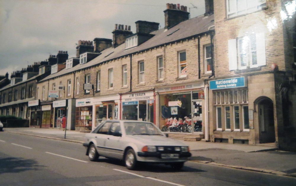
V315 – Otley Road, 1985.
Otley Road – 1985
Houses on the left are addressed as Queen’s Terrace, the shops in view include, J W Craven, television business, Warner’s cycles and Nationwide Building Society.
To the right and not seen is the car park for the Station Hotel.
Donated by Julie Malloy.
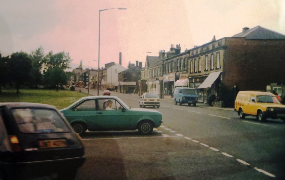
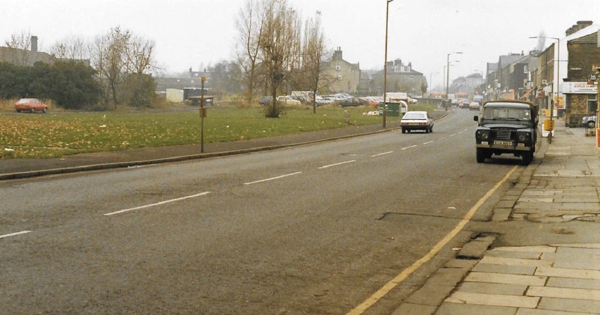
V321 – Otley Road, 1985.
Otley Road – 1985
Taken prior to Morrison’s supermarket being built. On the left are cars at the bottom of Park Road.
To the right the Regent Hotel is distinguished by the porch and apex roof.
Donated by Julie Malloy.
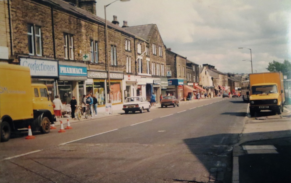
V331 – Otley Road, 1985.
Otley Road – 1985
View of Otley Road looking in the direction of Greenbottom.
On the left is John Dibb grocers, a long-established family business which traded until 1989 when Morrison’s store opened opposite.
Donated by Julie Malloy.
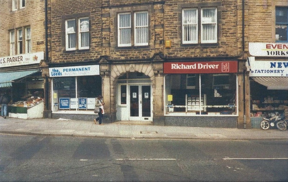
P321 – Otley Road, 1986.
Otley Road – 1986
This corner of Oxford Road (left) and Otley Road (right) is known as Oxford Circus.
To the left is Parker’s greengrocers, then Leeds Permanent building society, Richard Driver estate agents and Rhodes newsagent.
Courtesy of Rachel King.
W008 – Otley Road, 1988.
Otley Road – 1988
Two photographs of the site which is now Morrison’s Supermarket. To the left, the spare land once had houses lining the road, behind was Cassfield Mills.
W009 – Otley Road, 1988.
Otley Road – 1988
As above – This is now the site of Morrison’s supermarket which opened in the autumn of 1989.
Previous Comments:
facebook comments:
Re I076
Shirley Phillis: I used to catch this bus daily home from school to Westfield Ave.
John Birchall: This looks to be opposite the old picture house or nearly next door to the Station pub.
Michelle Pickard: Definitely next to the Station pub….. My old home. xx
Michael Hull: The white sign just visible through the shelter is for Busfields. (soft drink makers)
Andrew Game: Remember waiting in those shelters as a kid when we went to my grans in Horsforth with my mum!
Gordon Harris: I didn’t realise that Leeds City Transport operated out to Aireborough. I thought this was West Yorkshire Road Car territory?
Jan Loreal-Wilkinson: Good sturdy shelters too. Kept you dry in the rain unlike the useless ones they put up now.
Steve Howarth: Looks like the bus shelters are being installed men working on the one to the left, and the bus reg pre-dates the lettered years system. (although it could be an old bus)
Howard Riley: Proper bus.