| Title | Park Road |
| Date | 1896 |
| Location | Guiseley |
| Photo ID | D008 |
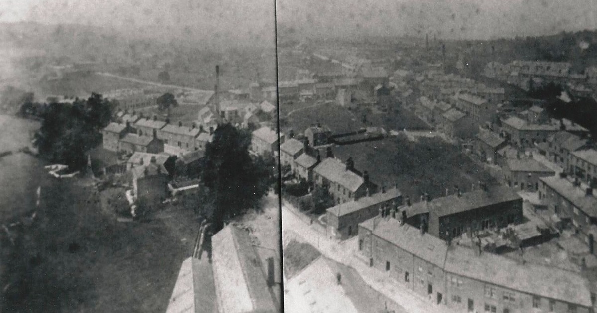
| Comment | Seen from the chimney of Greenbottom Mill, this view looks over Park Road and Otley Road. Park Road runs from the bottom right diagonally towards the middle left edge. The area on the left is Hawkhill. On the right of Park Road is the Cassfield works built by James Waddington. Morrison’s supermarket is now on this site (September 2012). Otley Road runs from the top middle (just right of the black line) to the middle right edge. The Primitive Methodist Chapel (also called Providence Chapel) is the large building on the left side of Otley Road just as the clear line of the road is lost between the buildings. |
A370 – Park Road, 1930s.
Park Road – 1930s
Park Road leading to Parkgate, once the home of Sir Matthew William Thompson.
He was an MP for Bradford and Lord Mayor of Bradford at a later date.
He was a great benefactor to Guiseley, he paid for the building of Guiseley Town Hall, gas street lighting and was generous to St. Oswald’s Church and the Church School.
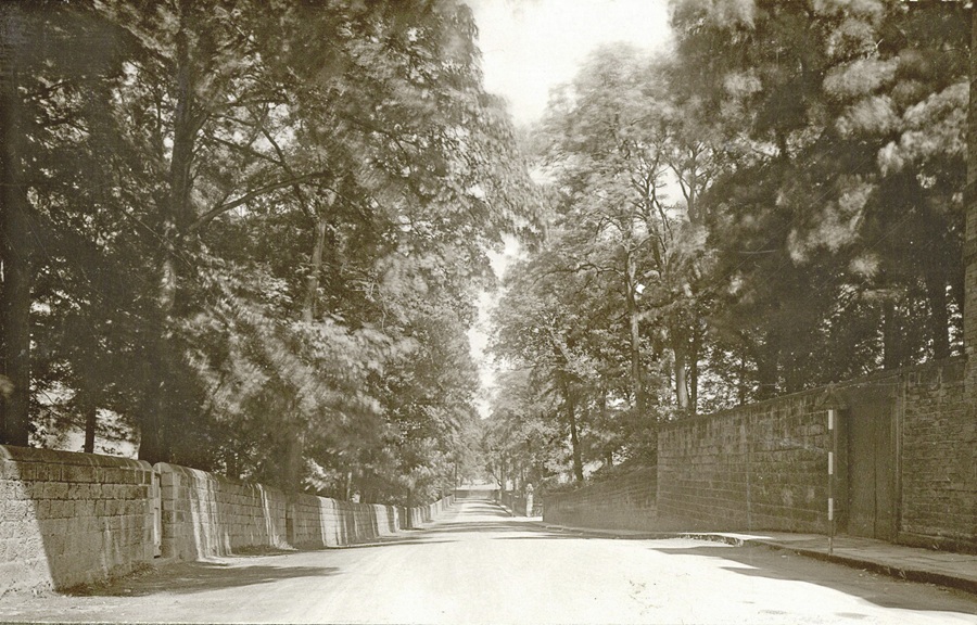
Y848 – Park Road.
Park Road – 1930s
Stretch of Park Road, to the right is part of the perimeter wall to Park Gate House and gardens.
X50 – Park Road, c1950s.
Park Road – c1950s
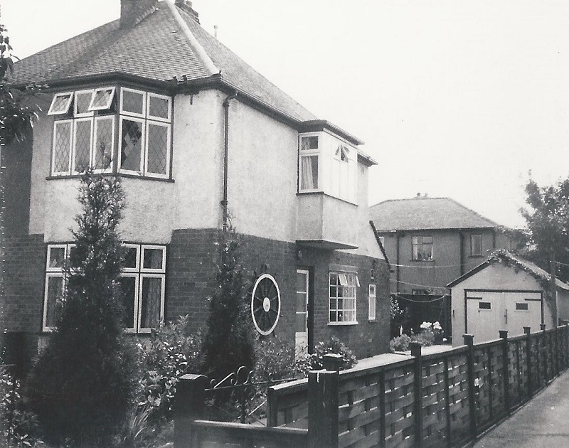
17 Park Lane, Guiseley.
Property on Park Lane which is a cul-de-sac running from Old Hollins Hill to fields overlooking Hollins Hill (Bradford Road).
The houses seen behind are on Hawkstone Avenue.
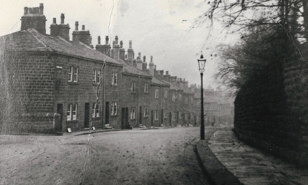
J283 – Park Road, 1955.
Park Road – 1955
View of Park Road before many of the old stone cottages were swept away under a slum clearance scheme.
Photographer James Farrar, donated by his son David.
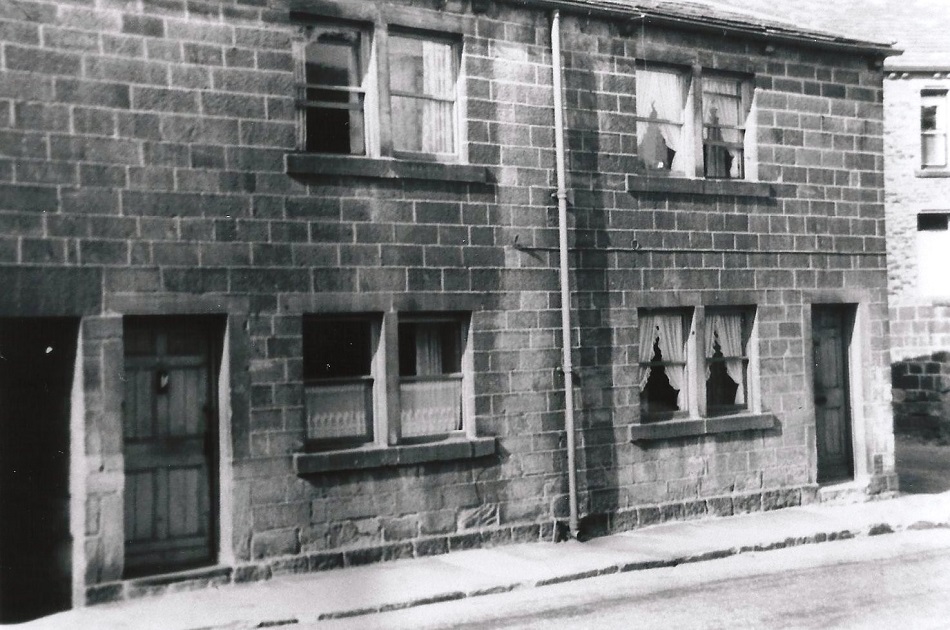
J284 – Park Road, c1955.
Park Road – 1955
Numbers 32 and 34 Park Road, seen prior to demolition.
Photographer James Farrar, donated by his son David.
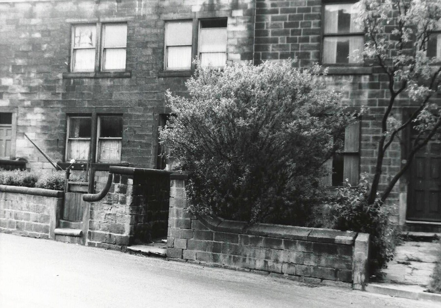
J290 – Park Road, 1955.
Park Road – 1955
Stone cottages on Park Road which were to be demolished.
Photographer James Farrar, donated by his son David.
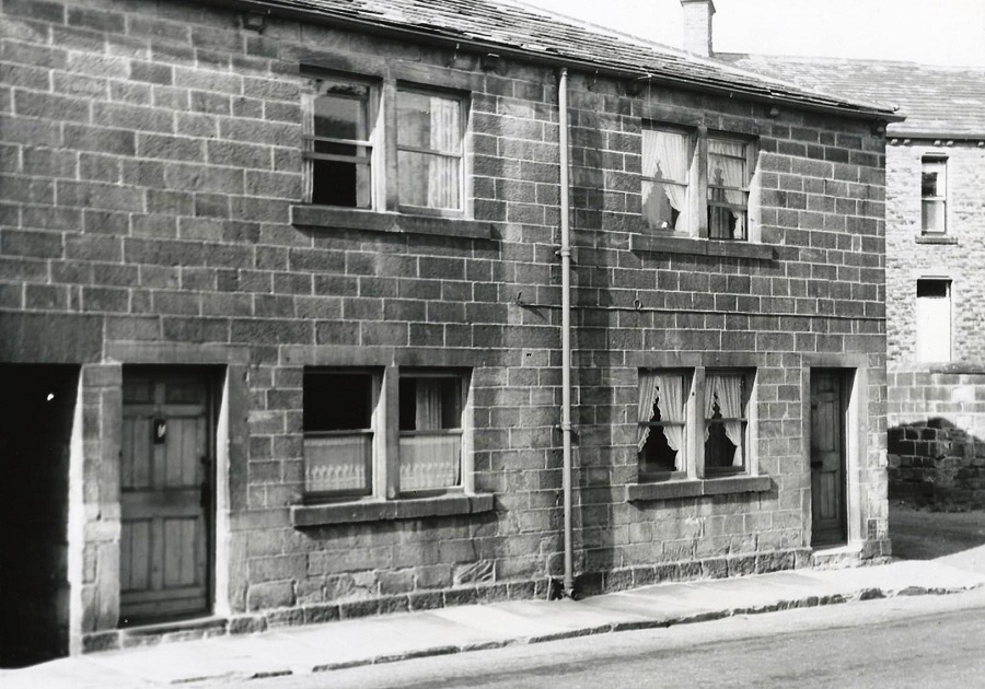
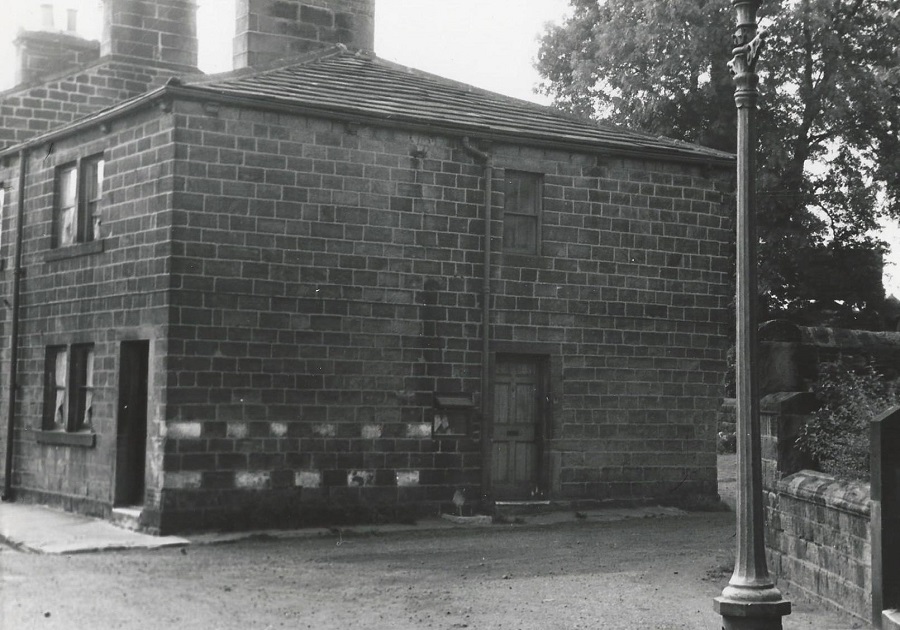
G123 – Park Road, 1955.
Park Road – 1955
Images of 32 Park Road which was the subject of a compulsory purchase order.
J291 – Park Road, 1955.
Park Road – 1955
Photographer James Farrar, donated by his son David.
J292 – Park Road, 1955.
Park Road – 1955
As above.
Photographer James Farrar, donated by his son David.
J293 – Park Road, 1955.
Park Road – 1955
As above.
Photographer James Farrar, donated by his son David.
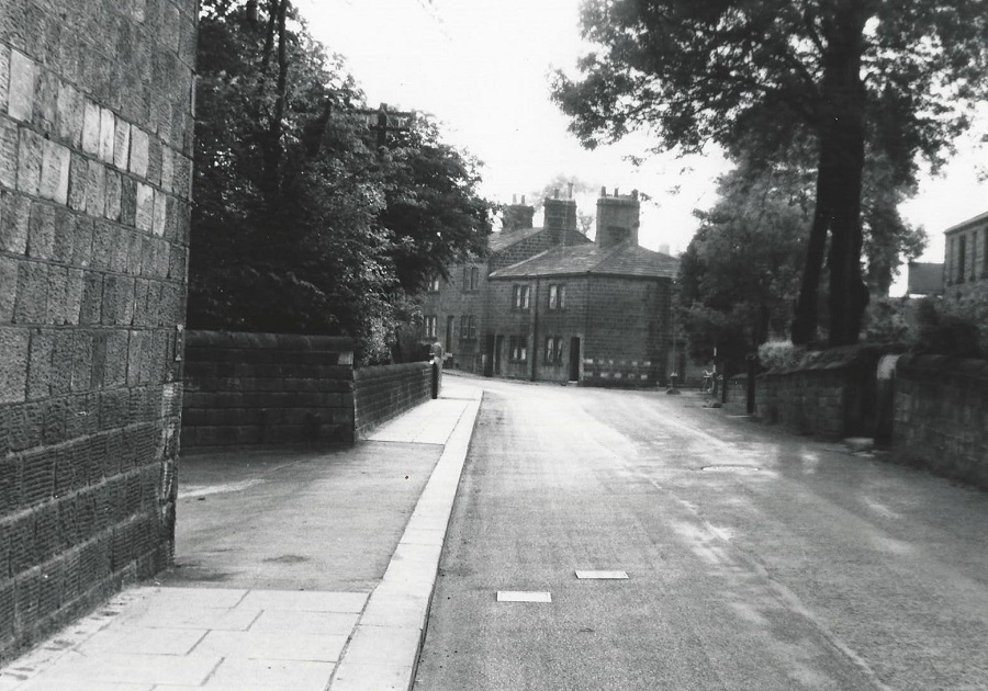
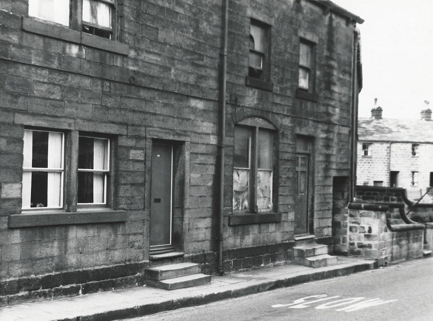
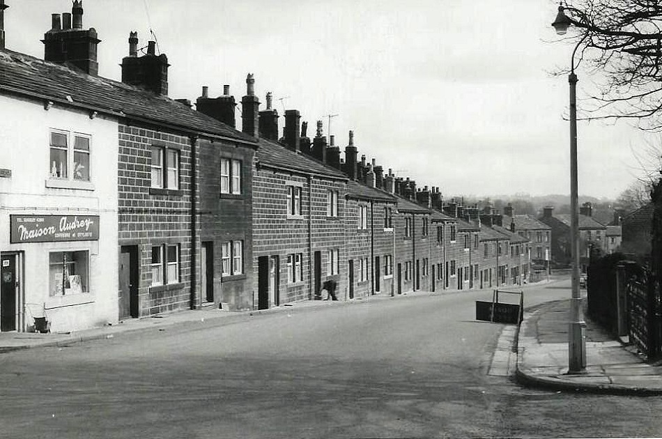
I143 – Park Road, 1964.
Park Road – 1964
This is the beginning of Park Road showing properties which front onto Otley Road.
Photographer James Farrar, donated by his son David.
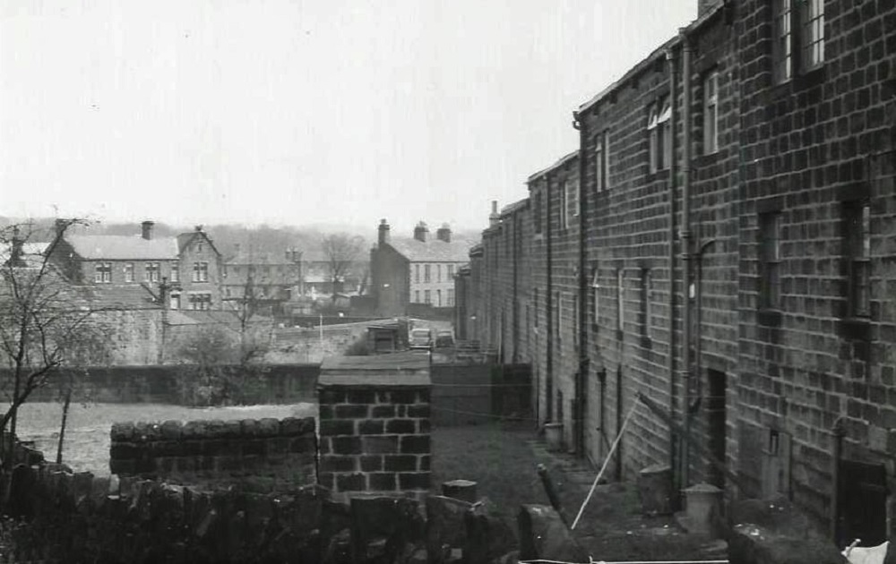
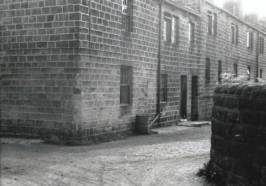
J280 – Park Road, 1966.
Park Road – 1966
View of the back of Park Road looking east.
Photographer James Farrar, donated by his son David.
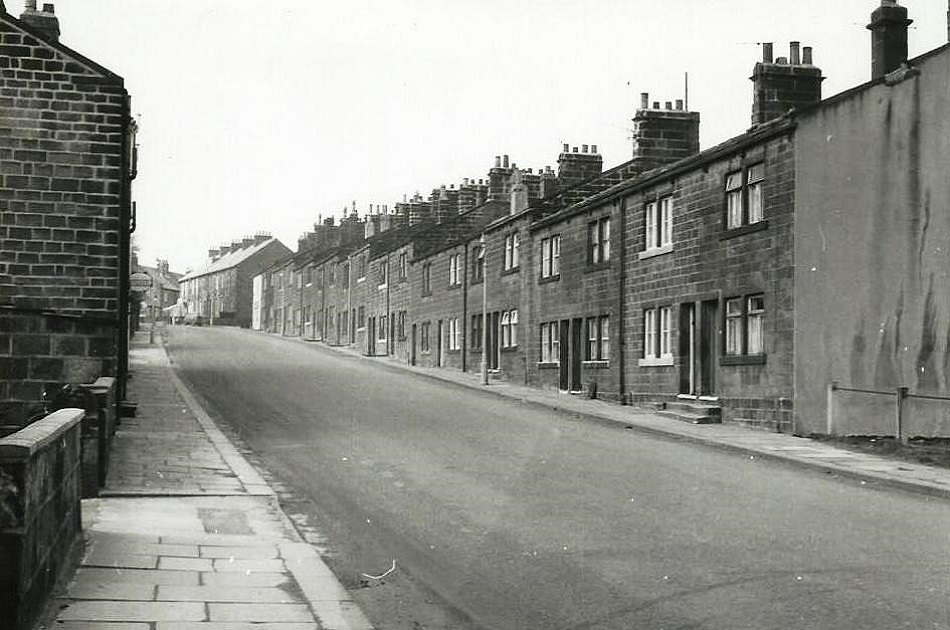
J285 – Park Road, 1966.
Park Road – 1966
The view is looking West.
Photographer James Farrar, donated by his son David.
J286 – Park Road, 1966.
Park Road – 1966
View of Park Road looking East.
Photographer James Farrar, donated by his son David.
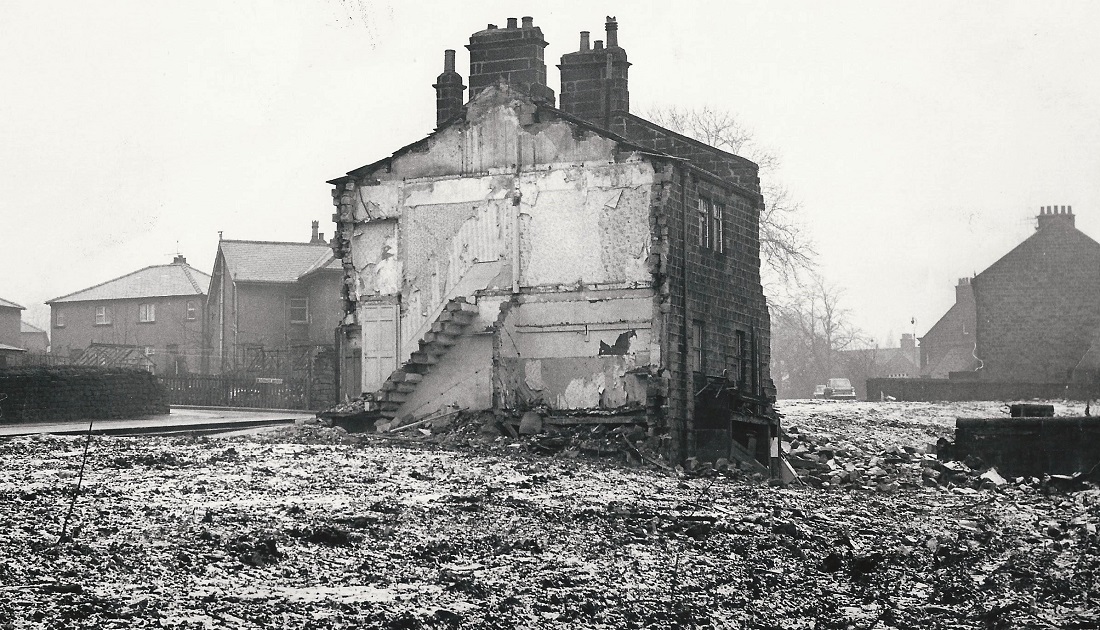
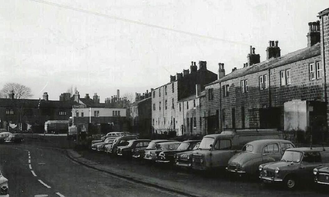
E364 – Park Road, 1970s.
Park Road – 1970s
The last of the houses to be demolished on Park Road. To the left is Silverdale Avenue and on the right is the junction with Victoria Road.
Previous Comments:
allserene
When I was less than 5, I lived at 9 Sconce Bank which was part of Park Road and opposite Greenbottom… driving toward Menston on the A65, turn left at Greenbottom as though you are entering Morrison’s. It was just there on the left, 70 yards from the commercial Pub. Yorkshire Rose? I think the first photo might be it. Total slum, outside toilet.
Tin bath in the kitchen filled by kettle. Next door was farmer Strickland who had all the land which is now Silverdale.
I had to go get warm fresh milk from him in a jug. Then we moved to 7 Edward Street which is under Morrison’s fish
counter now! Upon compulsory purchase when Morrison’s was built, we moved to Nethercliffe Crescent in a house
sold by Mr Maston, a Bank Manager! Moving on up but the house as big as my kitchen.
Now I live in a Mansion in Wisconsin with a 2 acre lawn which I cut with a tractor.
Comments from our facebook pages:
Re E364
Margaret Barrington: Houses to the left are definitely on Silverdale Avenue. I moved to Silverdale Avenue in July 1970 but don’t remember this house being demolished.
Chris Turner: Is this where Mr Ingham used to live, they had to move him further down Park Road so they could demolish this one, and the 1970’s time line is about right. Yes Silverdale Avenue is to the left.
Judith Archdale: Philip Archdale thinks the road you can see to the left is Silverdale Avenue not Hawkhill Avenue. The houses may be the back of the houses on Hawkhill Avenue.
Elizabeth Ludley-Grimshaw: Looks like a bomb site! I hope they built something nice in place of all of this devastation! I was living in Guiseley at this time and I have no recollection of this happening.
Mark Jackson: I lived on Victoria Road from about 1972 for maybe 18 months and don’t remember any houses being here on this spot. The old folks home behind if you turn round was being built.
Elizabeth Ludley-Grimshaw: If I returned to Guiseley, now, I am not sure I would recognise the place – so much has changed!
Janet Hall: I don’t remember this, I lived in Yeadon/guiseley from 1965 and my grandparents lived on Victoria road for a while. My dad might remember.
Joanna Archdale: Wow, I live on Hawkhill Avenue now and no it is a bustling street!!!! Incredible. However, my house has stood here since the 1930s x
Gill Morosini: Not good with cars but the ones in the background look earlier than that???
Ian Lewis: Wasn’t a German bomb landed here like the previous post had said looks like its before 1970s.
Page 1 of 2 More >>
Consolidated by Linda Plonka. 08 March 2022.
Last updated: 23 March 2022.
