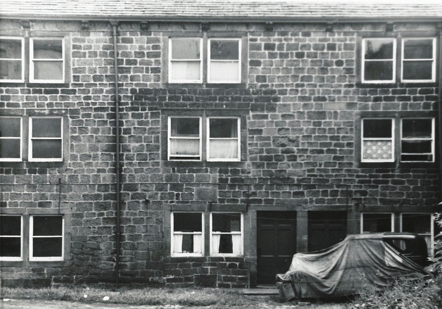
F472 – Well Lane, 1955.
Well Lane – 1955
Looking at Well Lane from the Green at the corner with the Red Lion hotel.
Photographer James Farrar, donated by his son Michael.
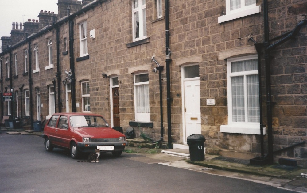
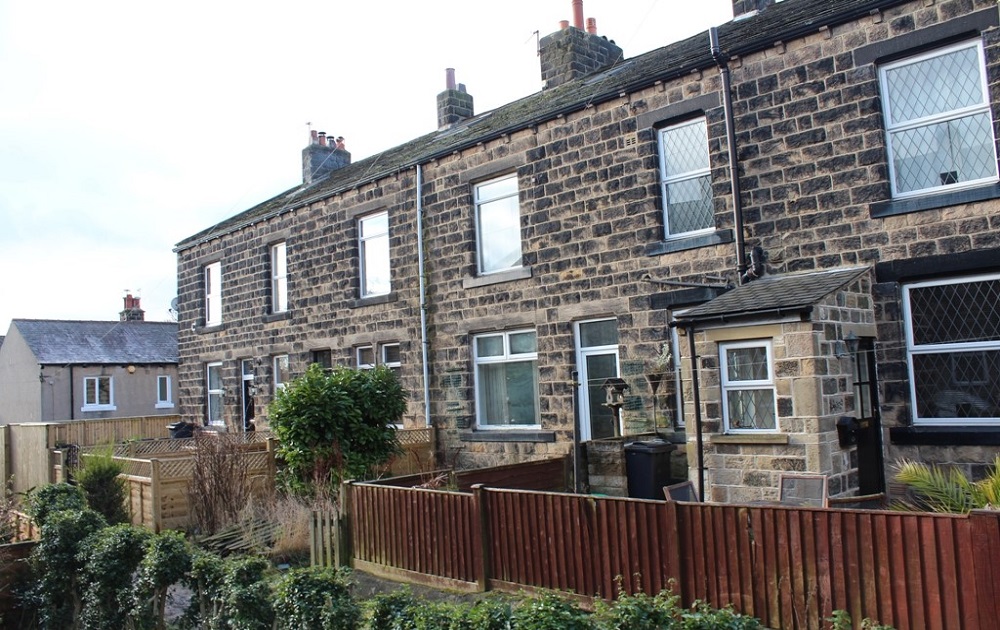
FBA083 – Wells Terrace, 1997.
Wells Terrace – 1997
A street of stone terrace houses.
Donated by Lynne Moxon.
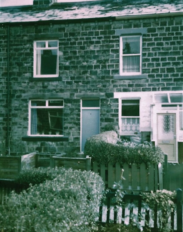
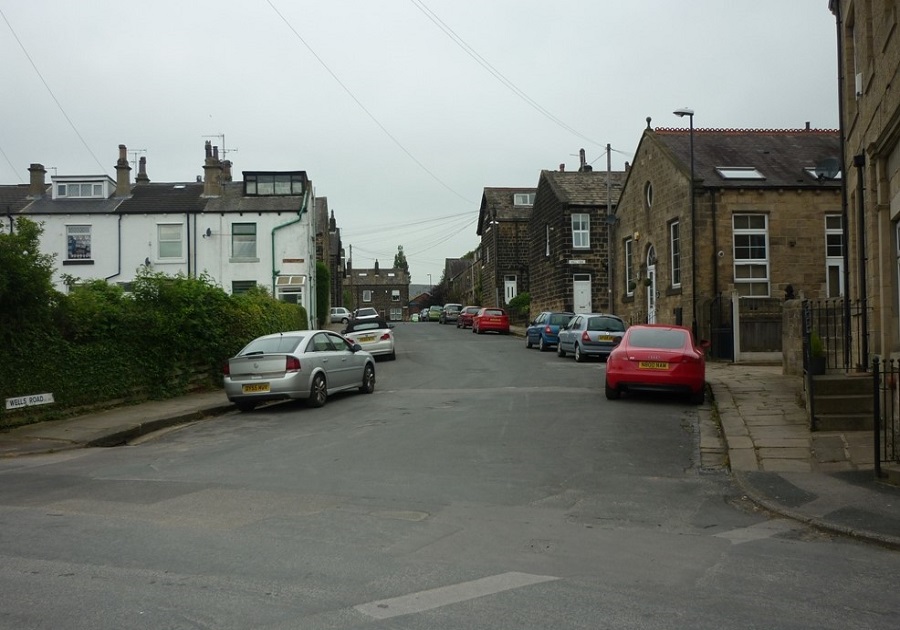
X57 – Wells Grove, 1998.
Wells Grove – 1998
4 Wells Grove, Guiseley.
Stone terrace property situated off Wells Road.

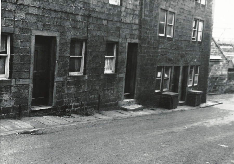
FF33 – Well Lane, 2006.
Well Lane – 2006
Well Lane with the wall of Springhead Mill in the background, the focus is on the blue camper van.
FF36 – Wells Road, 2006.
Wells Road – 2006
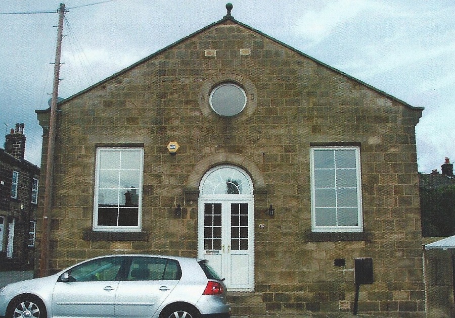
No: 16 Wells Road.
This building was erected in 1889 and is now a commercial property but was once a Salvation Army Citadel.
During the Second World War period it was used as a British Restaurant. These restaurants were staffed by volunteers, often WRVS and were initially set up to provide basic meals for bombed out families, as the food was off-ration and reasonably priced they became very popular. The Government encouraged the spread of the restaurants as they eased the burden of food shortages and rationing.
They were set up in halls, church halls and clubs, anywhere with basic cooking facilities, tables and chairs. A typical menu would be:
Liver Casserole 4d (pence)
Cottage Pie with Carrots 6d (pence)
Apple Crumble and Custard 2d (pence)
Cup of Tea 1d (pence)
After the war they were mostly closed.
FBA117 – Wells Road, 2013.
Wells Road – 2013
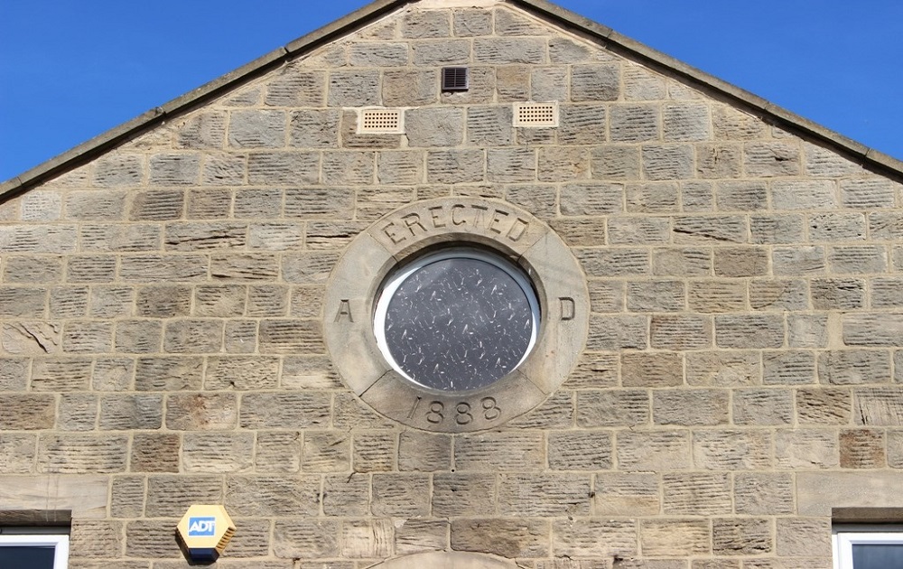
16 Wells Road.
By 2013 it was converted into private dwellings.
Close-up of a porthole window which has “Erected AD1888” engraved round it.
Donated by Ken Roberts.
N332 – Wells Grove, 2014.
Wells Grove – 2014
Wells Grove, a small street of stone houses in the vicinity of the ancient Guiseley Wells.
Donated by John Arundel.
N333 – Wells Mount, 2014.
Wells Mount – 2014
Wells Road, looking to Well Mount which faces the car park.
Photographer John Arundel.
G311 – Wells Mount, 2014.
Wells Mount – 2014
The rear view of Wells Mount.
Photographer John Arundel.
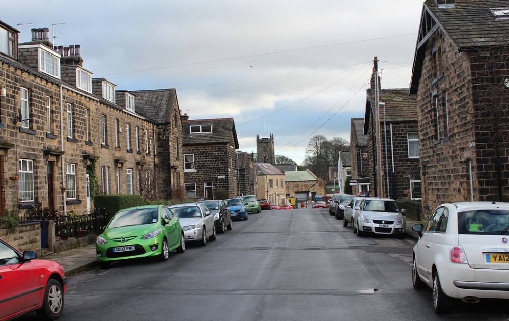
N334 – Wells Road, 2014.
Wells Road – 2014
View looking in the direction of Springfield Road, the tower of St. Oswald’s Church is behind the new housing built on the site of Springfield Mill.
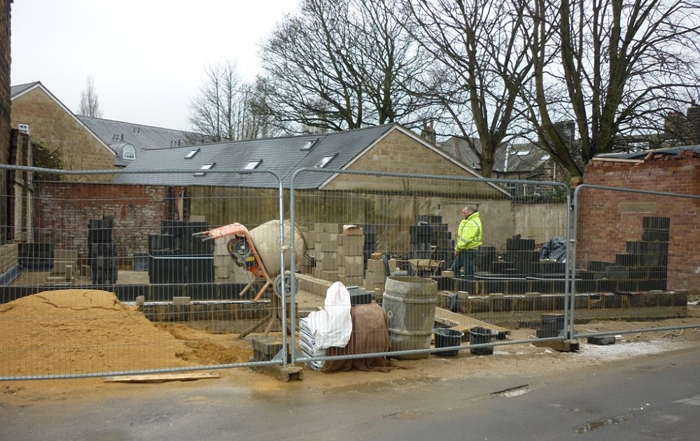
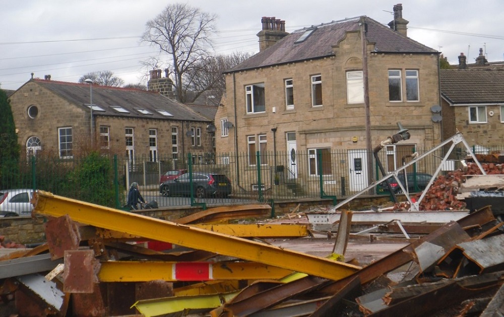
K212 – Wells Road, 2014.
Wells Road – 2014
Demolition of an old office building, a pair of houses are to be built on the site.
K231 – Wells Road, 2014.
Wells Road – 2014
Looking from Springfield Road to Wells Road.
F474 – Wells Road, 2014.
Wells Road – 2014
View from the site of the Springhead Mill demolition, on the left is a building on Wells Road dated 1888, it was used by the Salvation Army then during the 2nd World War it became a British Restaurant. Since then it has had various commercial uses and is now (September 2014) private housing.
Well House is in the centre of the view.
Photographer Joanne Coultas.
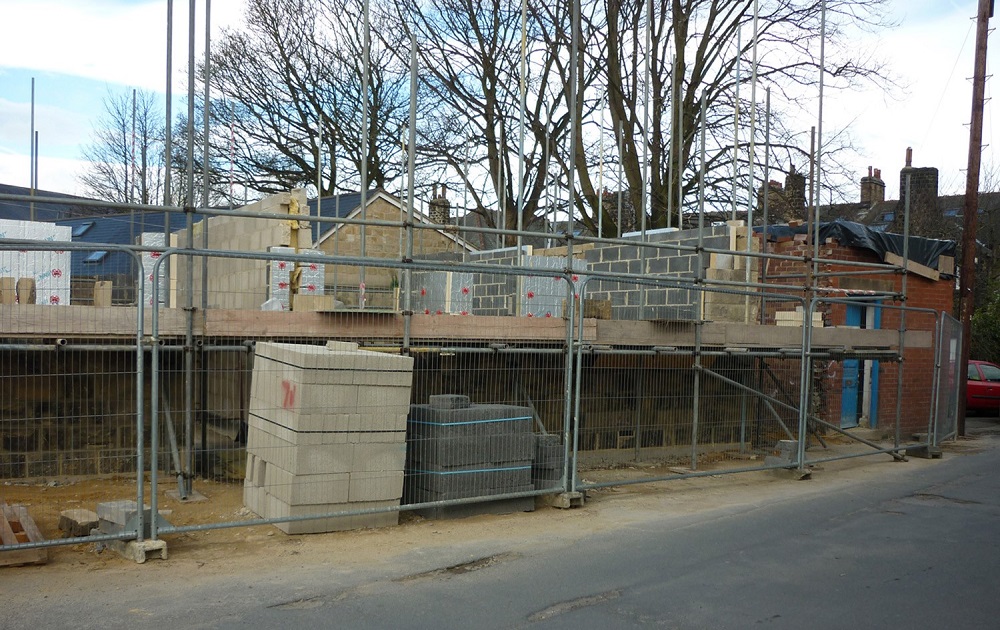
N330 – Wells Road, 2015.
Wells Road – 2015
New building on Wells Road.
Previous Comments:
Re F472
teleg
I think my grandparents lived in the house with the whole door showing during the thirties.
07 June 2013.
Re F472
budgiebri
A girl in my class at Guiseley secondary modern school lived in one of those houses, about 1947 her name was Margaret Hawkridge, who was also a friend of Sheila Poole.
04 January 2014.
Re F472
Joules1
My Grandma Janet Sykes lived at No:8, the end house around the time this photo was taken. She had two Daughters, Janet and Ivy. Sheila Poole lived next door to them at No: 7.
19 December 2016.
Re K212
JHWellsMount
The demolished building used to be the garage of Frank Cookson, corn merchants and the end of the terrace on the left is Eldon Mount. I wish I’d known about this as I lost a couple of tennis balls on that roof back in the 50’s!
21 January 2017.
Re N334 & K231
JHWellsMount
These photos are particularly poignant to me as I was brought up on the first street on the right where the white car is – Wells Mount! The bushes on the left of K231 are where we used to mess about pushing each other into. Behind them were growing rhubarb and mint which we used to pinch! Known to us as ‘Florrie’s mint’ as it was owned by Florrie Bail.
29 August 2017.
Consolidated by Elaine Ellwood. 24 February 2022.
Last updated: 25 February 2022.