| Title | Aerial Views |
| Date | 1962 – 1997 |
| Location | Rawdon |
| Photo ID | FBA061 |
| Comment | Apperley Lane runs from top to bottom of the image, just right of centre. The Little London area is to the left of the road. |
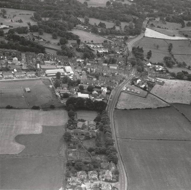
The view looks across from the area of the Billing. In the top left corner is Micklefield Park and Whitelands.
New Road Side (A65) runs at an angle across the top of the image. In the top right corner Benton Park School, is clearly visible with Harrogate Road, in front of the playing fields and just above at the right edge is Naylor Jenning’s Mill on Green Lane. In the lower section of the view is the old Larkfield Mill, it was to become Cartwrights pill factory. On the Larkfield Road side was the business of Storey Evans. Donated by David Teale.
FBA062 – Aerial View, 1962-1997.
Aerial View – 1962-1997
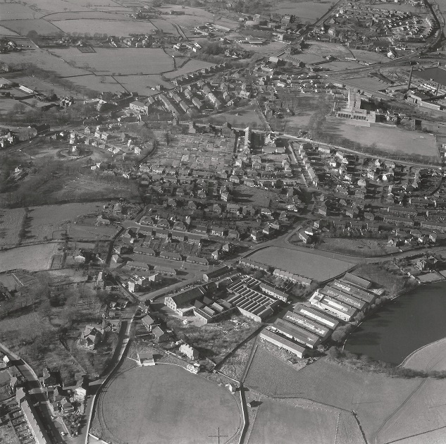
The view looks across from the area of the Billing.
In the top left corner is Micklefield Park and Whitelands.
New Road Side (A65) runs at an angle across the top of the image.
In the top right corner Benton Park School is clearly visible with Harrogate Road in front of the playing fields and just above at the right edge is Naylor Jenning’s Mill, on Green Lane.
In the lower section of the view is the old Larkfield Mill, it was to become Cartwrights.
Donated by David Teale.
FBA157 – Aerial View, 1962-1997.
Aerial View – 1962-1997
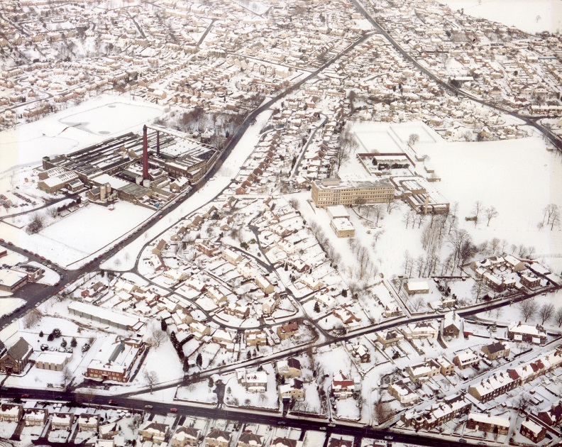
View of the Greenacre Park area of Rawdon after a snowfall.
Green Lane comes in from the left edge and runs diagonally to the top of the view, right of centre.
Here it joins Harrogate Road which begins in the top right corner.
New Road (A65) runs from left to right across the bottom of the image, here, Trinity Church is at the left edge with Greenacre Hall at the junction with Quaker Lane, which goes off to the right at an angle.
Naylor Jenning’s Green Lane, Dyeworks is clearly seen on the left of Green Lane, the large cream coloured building in the center is Benton Park School, the playing fields extend to Harrogate Road on the right.
Donated By Denis Court.
FBA166 – Aerial View, 1962-1997.
Aerial View – 1962-1997
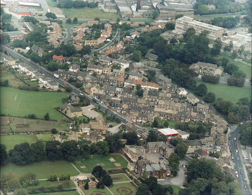
At the top of the image running left to right is Green Lane, Rawdon Fire Station, is on the left, Naylor Jennings, Green Lane, Dyeworks is to the right.
Benton Park School, is the large cream coloured building to the right, access to the front is from Harrogate Road.
New Road (A65) runs diagonally from the left to the right bottom corner where it meets Harrogate Road at the crossroads.
The building with the flat red and white roof was a petrol station, it was built on the site of the old Temperance Hall which in turn became a cinema, Rawdon Empire.
A small row of housing is there now named Weavers Fold (November 2013).
In the foreground is Micklefield Park, Micklefield House, Rawdon Library and “L” shaped stone buildings which were the stables for Micklefield House are seen just right of centre.
Donated By Matt Grimshaw.
Consolidated by Elaine Ellwood. 23 April 2021.
Last updated: 23 April 2021.