| Title | Harper Lane |
| Date | Undated |
| Location | Yeadon |
| Photo ID | FF200 |
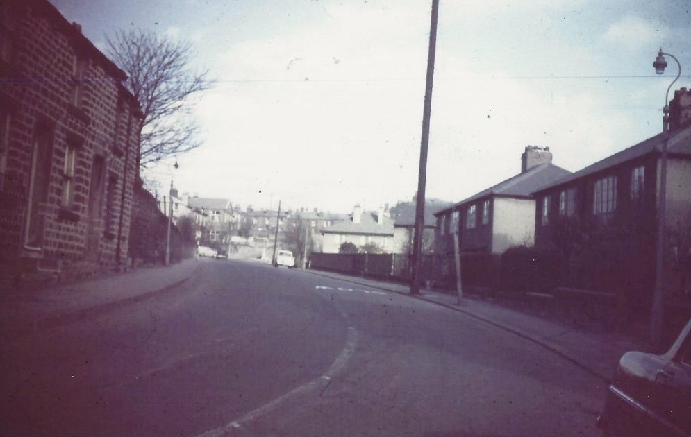
| Comment | Looking towards Harper Rock which is the terrace of stone cottages in the middle of the view. On the left are cottages which were demolished, Lane Fox Court is now on the site (September 2014). The van is turning out of South View Road, behind it is Croft House and the Trades Hall Club (now Morrisons petrol station). On the right the car is parked near the junction with Brooklands Crescent. |
M133 – Harper Lane, 1969.
Harper Lane – 1969
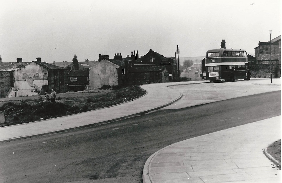
Harper Lane when the line of the road had just been altered, it had previously ended to the south near Harper Rock.
On the left is a cleared area part of the site Morrisons would be built on. A bus waits at the new bus stand, route number 781, to the rear of the bus the view looks down Marshall Street, the top of the Co-op building can be seen at the corner with the High Street.
On the right edge is the back of the Clothiers Arms.
FB051 – Harper Lane, 1983.
Harper Lane – 1983
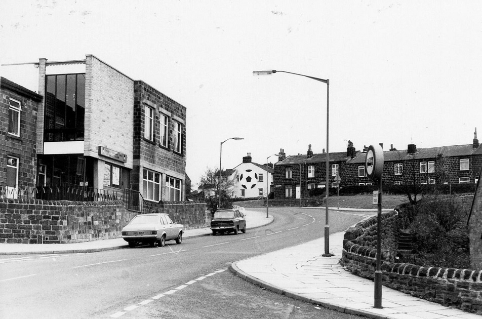
On the left is the Trades Hall Club (demolished 1999), it is now the site of Morrison’s petrol station. In the centre of the image is ‘Football’ with the iconic sign, the row of cottages is Harper Rock. In the bottom right corner is the junction with Rufford Avenue.
Donated By Dennis Court.
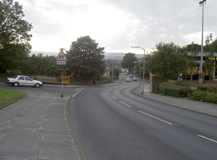
U042 – Harper Lane, 2012.
Harper Lane – 2012
Looking down Harper Lane, on the right is Morrison’s petrol station.
Photographer Carlo Harrison.
JA034 – Harper Lane, 2013.
Harper Lane – 2013
Harper Lane, just before the junction with the Albert Square roundabout. The building on the left is Hanover House apartments. the railings on the right side of the Lane are in front of a pull-in area for buses. The wall and gate on the right are part of the Clothiers Arms which has frontage on the High Street.
Donated by John Arundel.
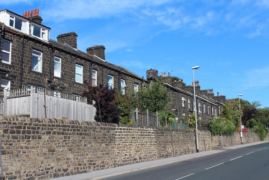
B483 – Harper Lane, 2013.
Harper Lane – 2013
Stone terrace houses to the rear they look across the old Wesleyan Methodist Burial Ground which is grassed over.
Beyond this is a car park and the present Yeadon Methodist Church.
Donated by John Arundel.
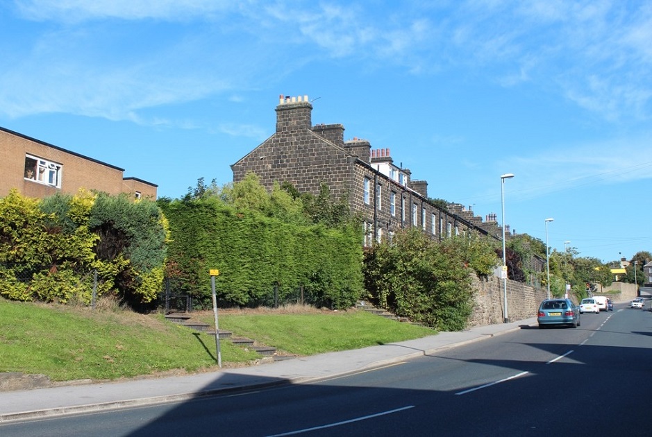
B480 – Harper Lane, 2013.
Harper Lane – 2013
Looking up Harper Lane in the direction of Harper Rock which can just be seen on the right. On the left is Lane Fox Court apartments.
The row of stone terrace houses have rear entrances and a view towards the Methodist Church. The high wall surrounds Morrison’s petrol station at the corner with South View Road, this was the site of the Trades Hall Social Club.
Donated by John Arundel.
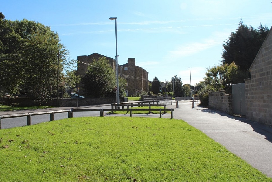
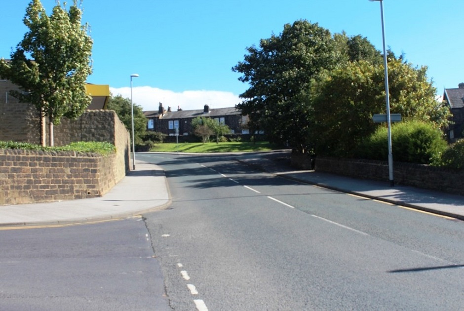
L326 – Harper Lane, 2014.
Harper Lane – 2014
Harper Lane with the junction of Brooklands Crescent. The white car on the left is parked in the car park of Brooklands Nursing Home.
Donated by John Arundel.
L380 – Harper Lane, 2014.
Harper Lane – 2014
To the left is the junction with South View Road, the glimpse of a yellow board is the canopy above Morrison’s petrol station, the row of stone cottages is Harper Rock.
Donated by John Arundel.
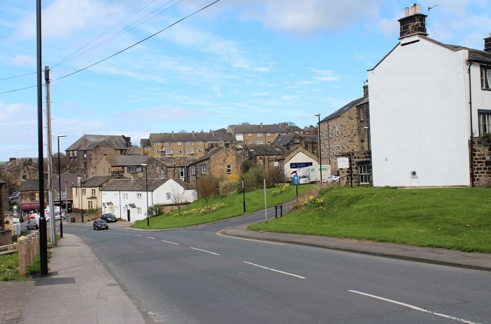
I196 – Harper Lane, 2014.
Harper Lane – 2014
Harper Lane with the junction of Sandy Way.
On the left side in the distance are the shops at the bottom of Town Street (the Steep). To the right of the shops the white building was a public house, originally the Oddfellows Arms, latterly called “The Rag & Louse”. This has now been converted into 2 dwellings (May 2021). Sandy Way is the road leading to the right, a Kettley’s furniture van is parked to the rear of the shop which fronts onto Ivegate. Willow Cottage is the building on the right with the white gable end wall.
Donated by John Arundel.
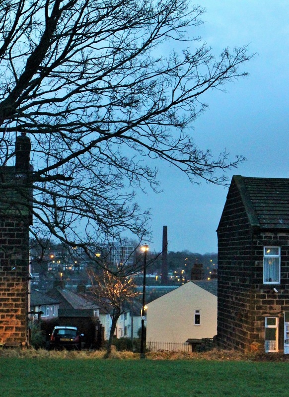
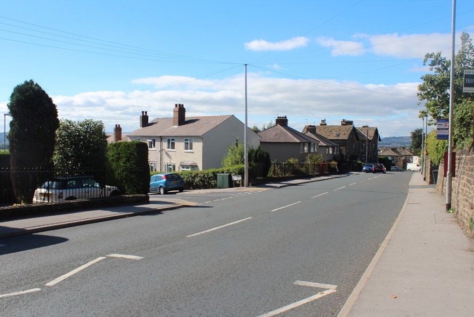
U096 – Harper Lane, 2015.
Harper Lane – 2015
Rear view of houses on Harper Lane, a gap in the building line gives a glimpse of Brooklands Crescent, Benton Park school can be seen in the distance.
Donated by Phil Walker.
Previous Comments:
Re M133
Jeanwalker60
My husband, Mick Walker, helped to construct the road.
24 April 2016.
Consolidated by Elaine Ellwood. 20 June 2021.
Last updated: 10 December 2022 – All images updated.