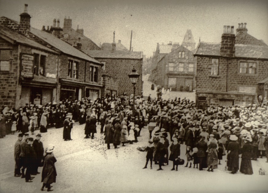
X865 – Steep & Green, c1900.
Steep & Green – c1900
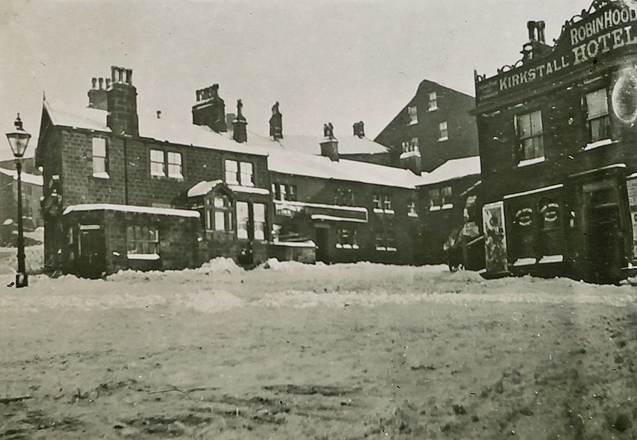
Yeadon Green was that area in front of The Robin Hood pub with Town Street (The Steep) coming in on the left & The Oddfellows or Lord Raglan in the middle. The photo has been taken after a fall of snow.
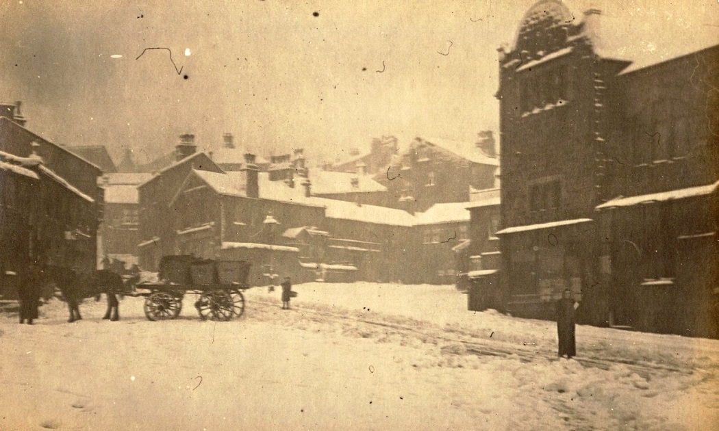
F937 – Steep & Green, c1900.
Steep & Green – c1900
An evocative glimpse of Yeadon in winter, a loaded cart is at the bottom of the Steep, the Temperance Hall is on the right.
Donated by Keith Spink.
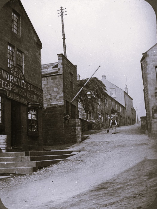
K998 – Steep, c1900s
Steep – c1900s
Looking up Town Street or the Steep as it is called locally for an obvious reason, Wormald’s grocers shop is on the left.
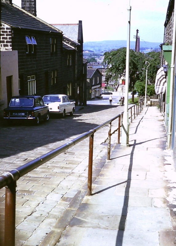
L152 – Steep, 1960s.
Steep – 1960s
Looking down the Steep to the Green, on the right is a pavement and handrail to assist pedestrians to reach the bottom safely, or those coming in the opposite direction to haul themselves up!
Photographer Charles Lideard, donated by his daughter Christine Hogg.
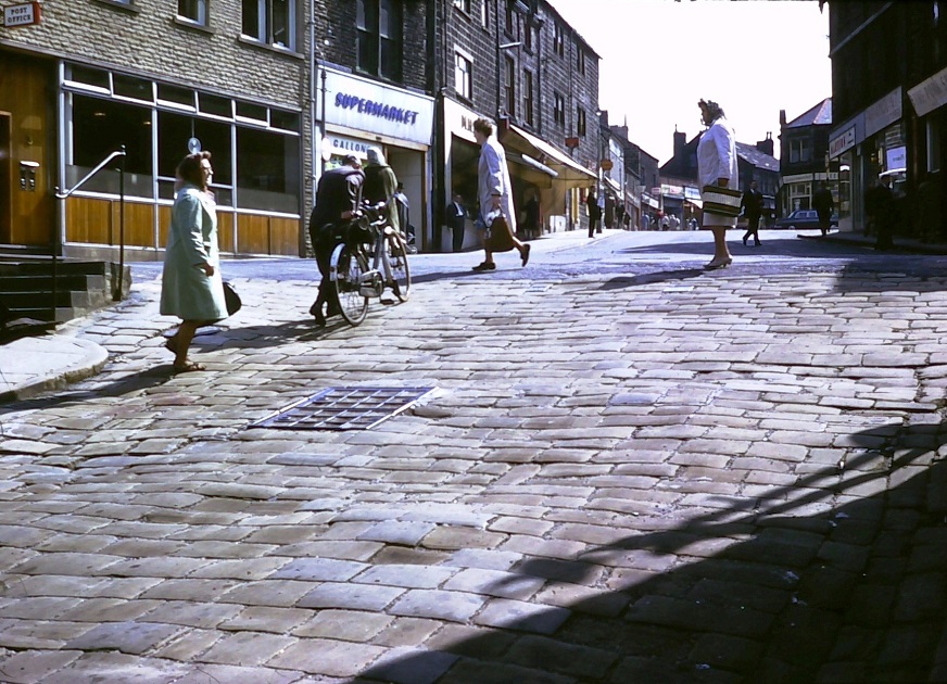
L121 – Steep, 1960s.
Steep – 1960s
A man with a bicycle is toiling up the cobbled incline which gives Town Street it’s local name “the Steep” which is in the foreground.
The view then continues looking up the High Street, to the left is the Post Office, now relocated next to Morrisons at the top of the High Street, the premises have since been used as various bars and restaurants. Next we can see Gallons supermarket then M H Rigg butcher.
Photographer Charles Lideard, donated by his daughter Christine Hogg.
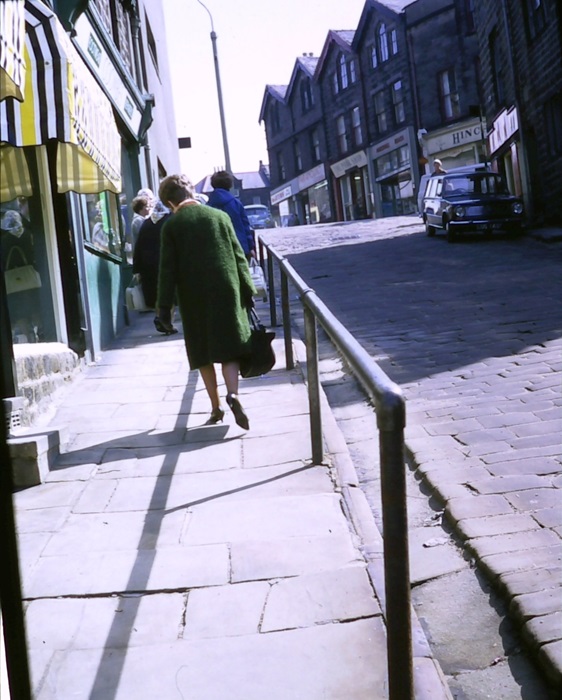
L164 – Steep, 1960s.
Steep – 1960s
Looking up the Steep towards the High Street, several people are toiling up the hill.
Photographer Charles Lideard donated by his daughter Christine Hogg.
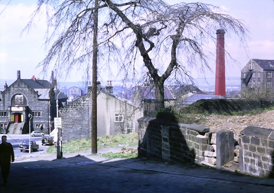
L173 – Steep, 1960s.
Steep – 1960s
This is towards the bottom of the Steep, on the left is the Temperance Hall, now used as a dance studio and beauty college.
On the right the vacant plot now has a block of apartments on it, the tree is still standing and the land behind the wall is a green space.
Part of Manor Mill can be seen on the upper left edge with it’s mill chimney.
Photographer Charles Lideard, donated by his daughter Christine Hogg.
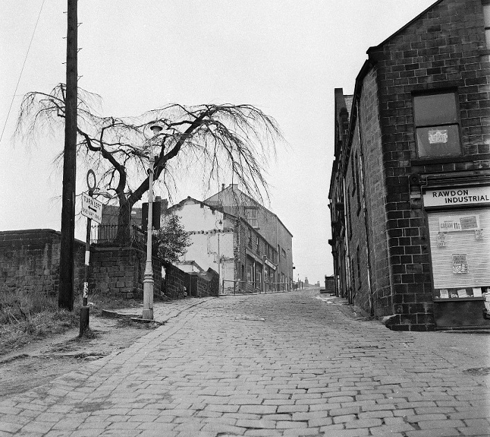
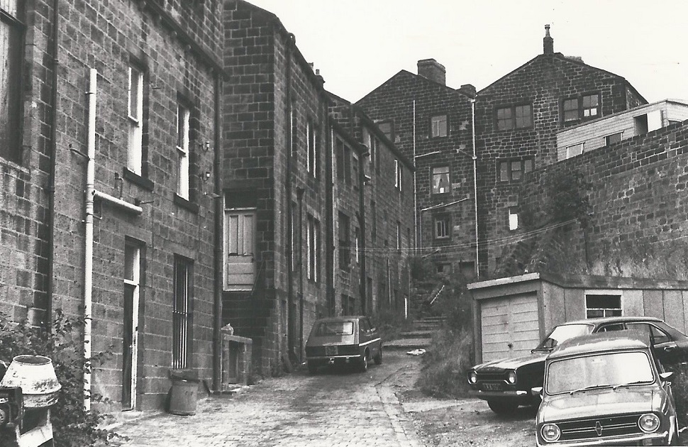
I305 – Steep, 1966.
Steep – 1966
The area to the upper left was Hudson’s Yard.
Photographer James Farrar, donated by his son David.
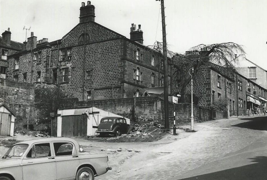
H148 – Steep, 1967.
Steep – 1967
Demolition of old property is taking place on the left, the site was used for apartments, other properties at the top of the Steep still remain. On the right is the corner with Sandy Way and what was a branch of the Rawdon Industrial Co-operative Society or the “Co-op” as these stores were usually referred to.
Photographer Bryan Waite, donated by his family.
A071 – Steep, 1978.
Steep – 1978
Looking up the precipitous road known as the Steep.
On the left at the bottom of the High Street is a newsagents shop, then the business of Cliffe’s. Next, at the junction with Ivegate is the Oxfam shop, it relocated to premises further up the High Street. The buildings at the top of the Steep were part of Dixon’s Mill. The spire of Yeadon Town Hall can be seen above the buildings.
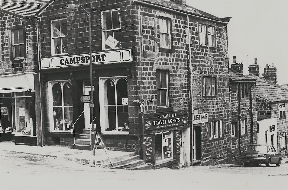
A072 – Steep, 1978.
Steep – 1978
To the left is Ivegate then the view looks down the Steep.
“Campsport” and the adjoining buildings were once part of Dixon’s mill, opened on 1st March 1806. At the top of the Steep is a travel agency run by H. J. Waye and Son, next a hairdressers, above the sign “Just Hair” is a date stone marked 1782. This is thought to refer to Dixon’s occupation of the property.
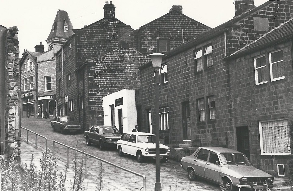
A061 – Steep, 1978.
Steep – 1978
Rear view of Town Street locally known as the Steep, the gradient of this cobbled road can be judged from this view!
In the middle rear view of buildings once part of Dixons Mill and Dixon House.
There is a date stone over a door at the beginning of the Steep which is inscribed 1782.

A062 – Steep, 1978.
Steep – 1978
Again a rear view, to the right a buttressed wall which surrounds a car park on Ivegate.
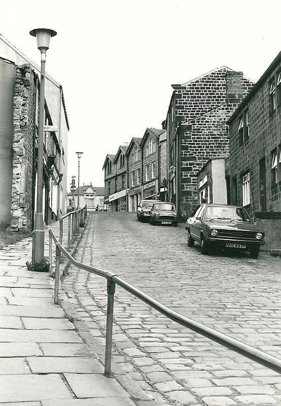
P192 – Steep, 1980.
Steep – 1980
Looking up to the junction with the High Street, on the left is Wray’s clothes shop.
In the centre is Yeadon Library which opened in the former Co-operative stores building in June 1968.
Donated by Graham Wood.
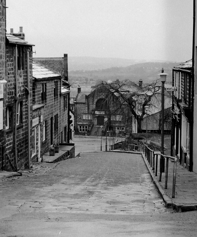
FBA059 – Steep, 1986.
Steep – 1986
Looking down the Steep to the Temperance Hall, on the right, at the top, is Wray’s clothing shop.
Donated by John Denison.
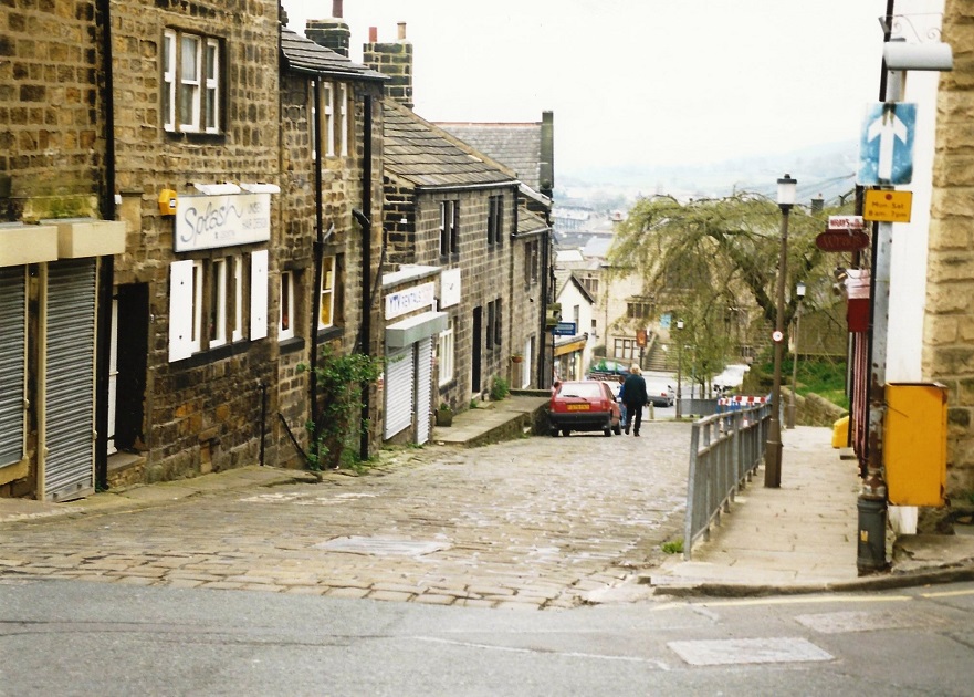
Y14 – Steep, 1999.
Steep – 1999
Looking down Town Street from the junction with the High Street.
On the left is a shuttered property which was incorporated into the Great Outdoors shop which is entered from around the corner on Ivegate.
Next a hairdressers which has a datestone above the door inscribed “1782 Dixon Mill”. The property was built by Samuel Dixon, son of James Dixon, the business began trading in 1806. The mill complex included property on Ivegate, Rivoli Pizza shop has a plaque on the wall which states it was formerly called Dixon House. At the bottom of the Steep is the Temperance Hall. On the right side is a handrail, a necessity in icy weather!
The shops here included Wray’s outfitters.
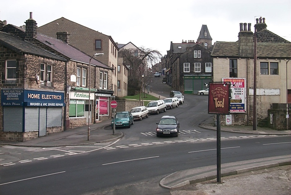
I102 – Steep, 2000.
Steep – 2000
Image shows Home Electrics on the left, facing down from the corner with Sandy Way is a Pet Shop, this was formerly a branch of the Rawdon Co-op.
A sign in the right foreground advertises the Tut & Shive hotel, this was the Robin Hood hotel before the name was changed.
Donated by Paul Weston.
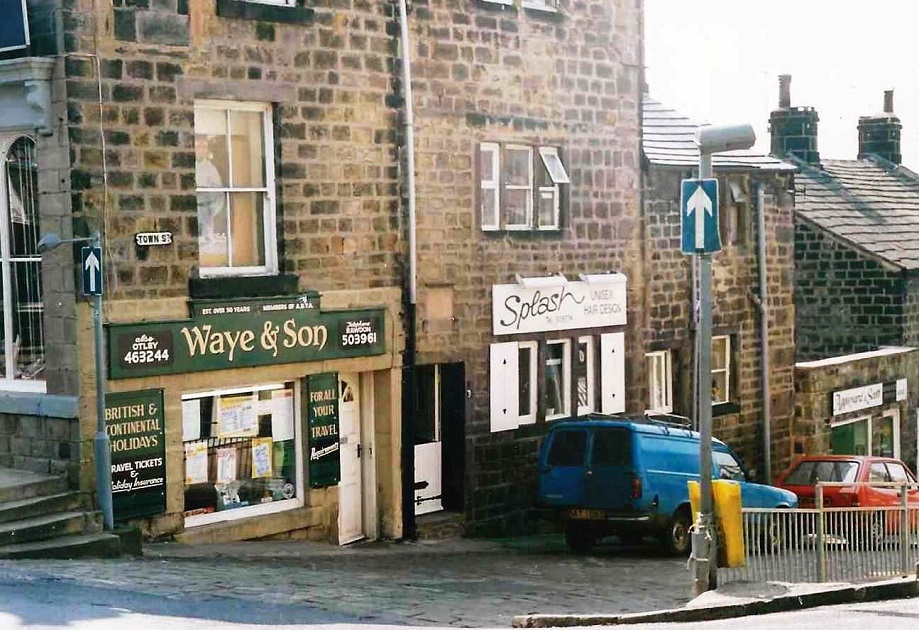
C199 – Steep, 2002.
Steep -2002
On the left edge is a section of window which belongs to the Great Outdoors store which faces onto Ivegate.
The window above Waye & Son Travel Agents also belongs to the Great Outdoors, Slash Hairdressers is next.
Donated by Sam Skinner.
Previous Comments:
Re A062
teleg
When I was young where the van is and the cars used to be a grey Pea shop where we used to go after the pictures at the Temperance hall for a plate of Grey peas before walking home. We sat on wooden forms at a stone table and the only warmth came from the pea boiler so we didn’t stay too long .
07 June 2013.
Re L121
valryan85a
This is how I remember the Steep riding down the cobbles on my bike bump bump and having to push it back up again! Walking up there after a night out watching a film at the “Temp” with a bag of chips or scraps! 1960’s.
23 November 2016.
Re L121 & L152
vjmol30
Does anyone remember the cobblers next door to Wray’s outfitters, higher up the steep.
Seen on the pictures the shop front painted green.
At some point it was known as Coombes, probably in the 1970’s.
11 October 2017.
Page 1 of 2 More >>
Consolidated by Elaine Ellwood. 20 June 2021.
Last updated: 23 December 2023 – Photo ID: X865. 26 October 2023 – Photo ID: K998 & L164. 11 August 2023 – Photo ID: F937. 08 January 2023 – All images updated.