| Title | Aerial Views |
| Date | c1900 |
| Location | Guiseley |
| Photo ID | AA23 |
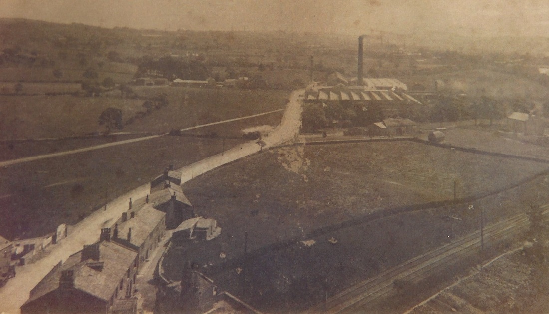
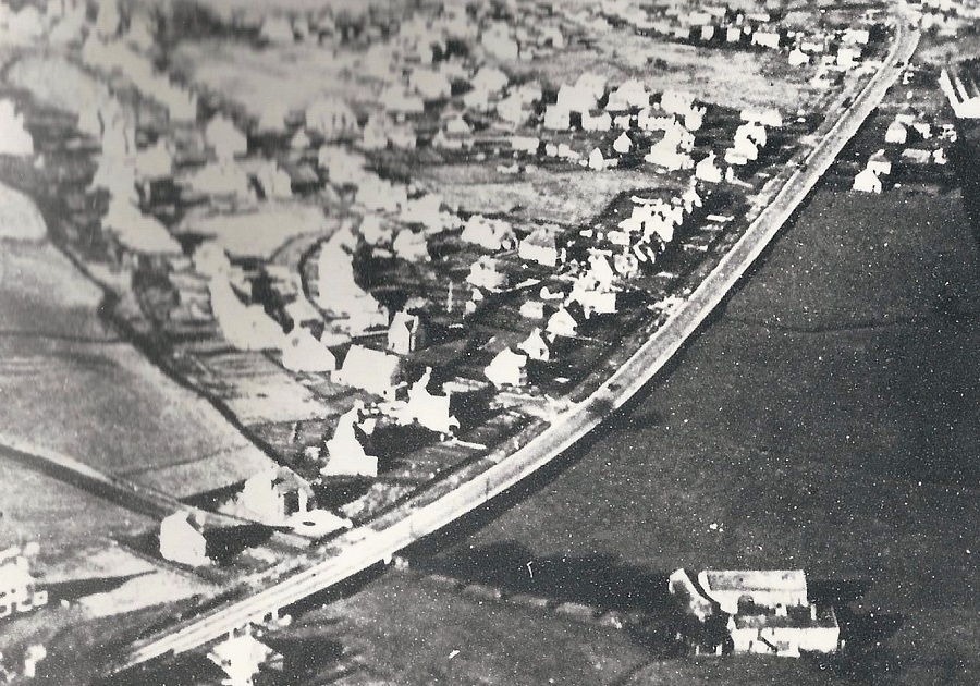
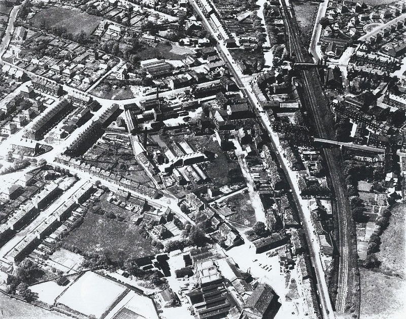
| Comment | Otley Road runs from the bottom left, the view is looking towards Yeadon and Rawdon. The dominant building is Nunroyd Mill, business of Jonathan Peate & Co, Ghyll Royd has not yet been built which dates this image Circa 1900. A section of the Leeds-Ilkley railway line can be seen in the bottom right corner, fields still exist where houses now stand (May 2013). |
AA25A – Aerial Views, c1900.
Aerial Views – c1900
View over Guiseley, Park Road runs from bottom right diagonally to the middle left.
AA28 – Aerial Views, c1900.
Aerial Views – c1900
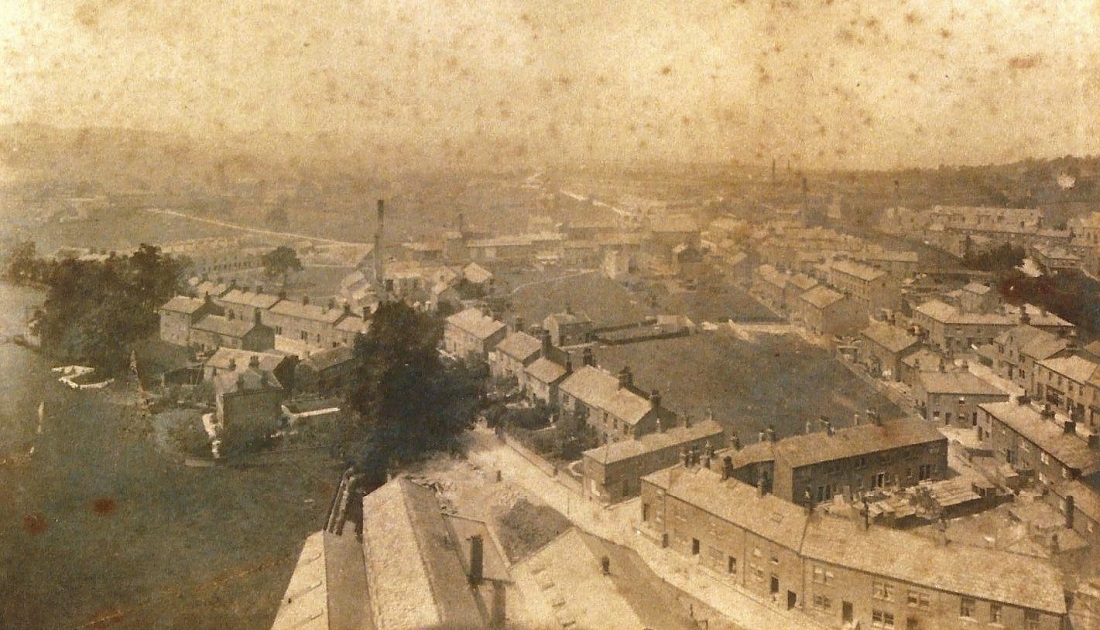
This photo was taken from the chimney of Greenbottom Mill.
It shows the Green with Springhead Mill in the mid section, the Leeds-Ilkley railway line is in the bottom left corner.
Guiseley Town Hall is in the bottom right corner, moving up from the Town Hall are Belle Vue Terrace, Green Terrace and Grove Terrace, then the National School (St. Oswald’s C of E School).
E519 – Aerial Views, 1927.
Aerial Views – 1927
View from the tower of St. Oswald’s Church, moving up from the bottom left corner are Well Lane, Cambridge Street then Oxford Street.
The tower of the Guiseley Methodist Chapel is seen on Oxford Road. To the right is Lands Lane, in front of the church in the bottom right corner is the Green.
C245 – Aerial Views, Post 1935.
Aerial Views – Post 1935
This is the Tranmere Park estate with Bradford Road running through diagonally from left to right.
This photo was one of a series published on a poster for the Yeadon and Guiseley Gas Company.
C247 – Aerial Views, Post 1935.
Aerial Views – Post 1935
This image appeared with others of the area on a poster presented by the Yeadon and Guiseley Gas Company.
In the upper left quarter is Oxford Road with the infant school and Wesleyan Methodist Chapel, the railway is seen as the diagonal line in the bottom left quarter. Town Street is in the top right quarter with the linear fields of Wills Gill to the right.
St. Oswald’s Church is to the right of Towngate with Busfield’s Albion Dyeworks behind it.
On the left of the Green is Springfield Works.
C272 – Aerial Views, 1937.
Aerial Views – 1937
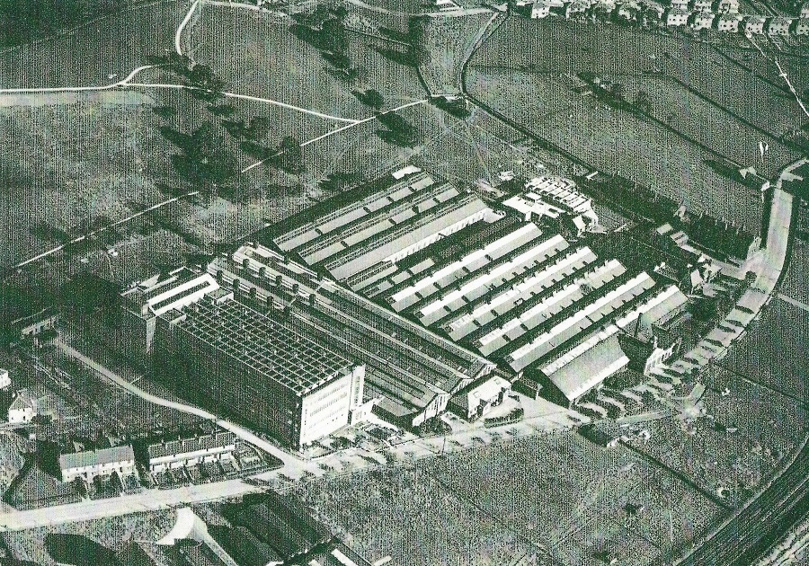
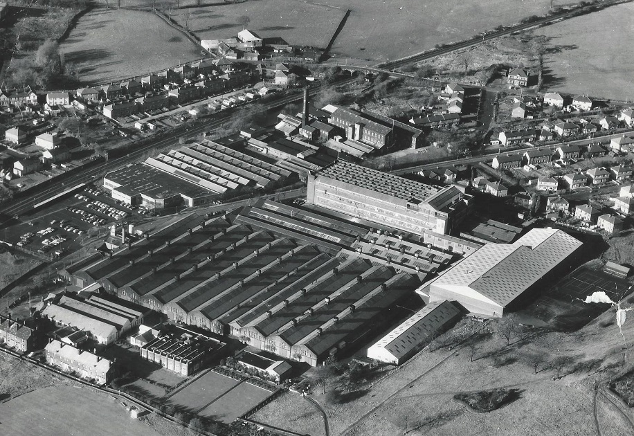
In the centre of this view is the Crompton Parkinson factory on Netherfield Road.
H269 – Aerial Views, Pre 1950.
Aerial Views – Pre 1950
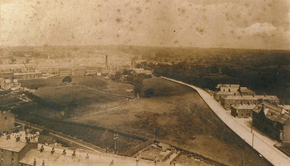
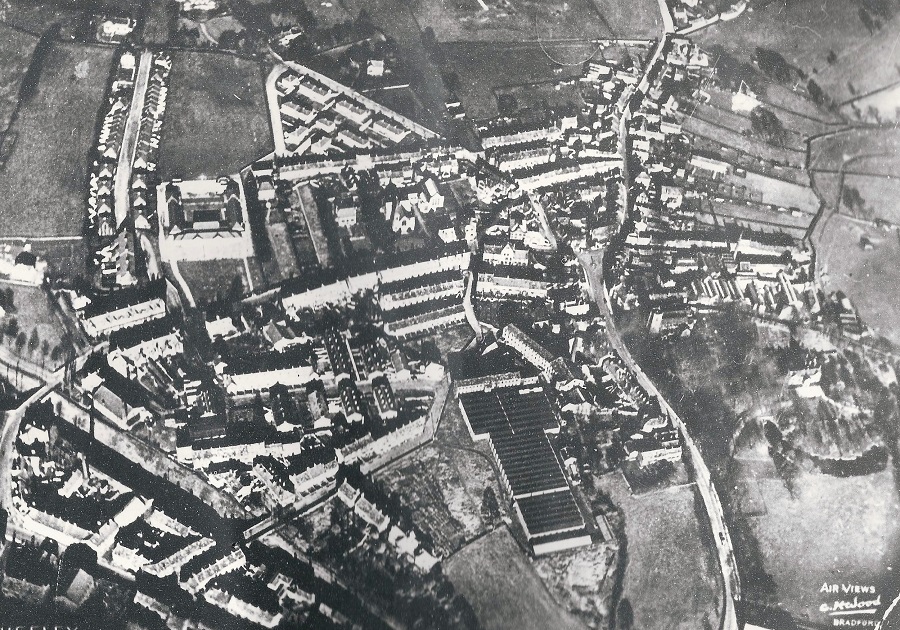
St. Oswald’s Church is at the top of the view, just right of centre.
Directly below is the Methodist Church on Oxford Road. The Albion Dyeworks is to the left of St. Oswald’s, Springhead Mill to the right of the Green. Orchard Street School is in the bottom left quarter.
Donated by Anne North.
C254 – Aerial Views, 1959.
Aerial Views – 1959
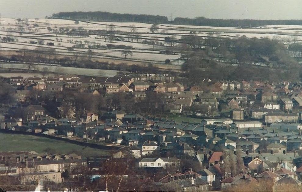
Just right of centre is Otley Road (A65) with the railway line to the right .
From Otley Road, on the left, the top junction is with Victoria Road, just below this is the Primitive Methodist Chapel then Cassfield Mills site where the present Morrisons supermarket stands.
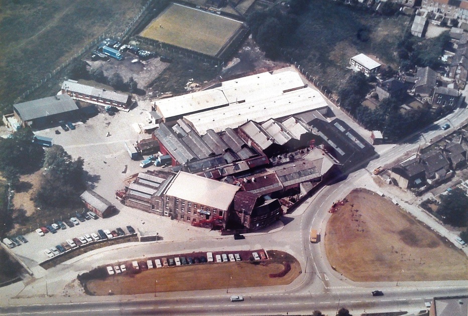
Still on the left, the lower junction on Otley Road is with Park Road and what was originally Greenbottom Mill which became Chloride Shires factory and is now Guiseley Retail Park. Top right the railway bridge spans Oxford Road, the lower bridge Springfield Road.
Z465 – Aerial Views, 1968.
Aerial Views – 1968
In this aerial view Crompton Parkinson’s dominates the centre of the image.
Located on Netherfield Road, opposite is Carter & Parker’s Wendy Wools mill, the railway line lies behind Wendy Wools.
In the upper centre is Ings Lane which runs across the railway line, the Ings Inn is the detached building in the upper right corner.
U477 – Aerial Views, 1983.
Aerial Views – 1983
This view of the Park Road area was photographed by Andrew Emsley, the pilot of the plane was Alec Webster, owner of Yeadon Flying Club.
In the top left corner is a glimpse of Otley Road, the area to the left of Otley Road was the Cassfield Mill complex, now the site of Morrison’s store.
Park Road runs from the top centre diagonally to the bottom right, to the left of the road the two apartment blocks are Holly Court and Vine Court.
Beneath them is Victoria Road. Opposite on the right is Silverdale Avenue, just on the edge of the top right corner is a sliver of Green Bottom bowling green, the area below was used as part of the site for the Bransdale estate.
FBA141 – Aerial Views, Undated.
Aerial Views – Undated
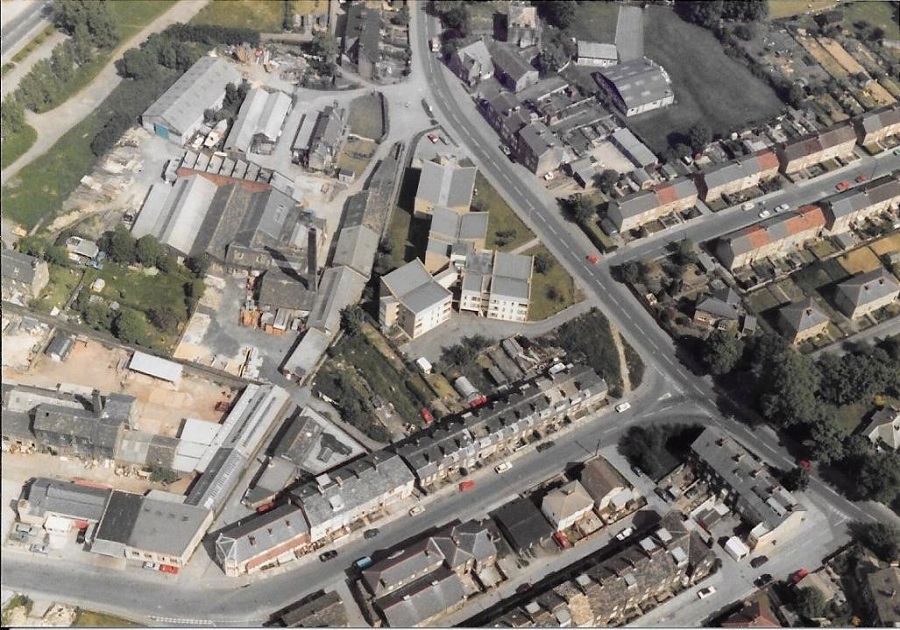
In the centre of the image is the Chloride Shires factory which was demolished in the early 1990s and Guiseley Retail Park built on the site.
In the foreground a gyratory system is being laid out to stream traffic, Park Road runs past Chloride Shires and off to mid-right.
Donated by Helen Heugh.
N315 – Aerial Views, Undated.
Aerial Views – Undated
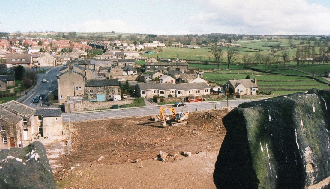
A view from Guiseley looking out towards Carlton, this photograph was possibly taken from St. Oswald’s Church tower.
L266 – Aerial Views, 1995.
Aerial Views – 1995
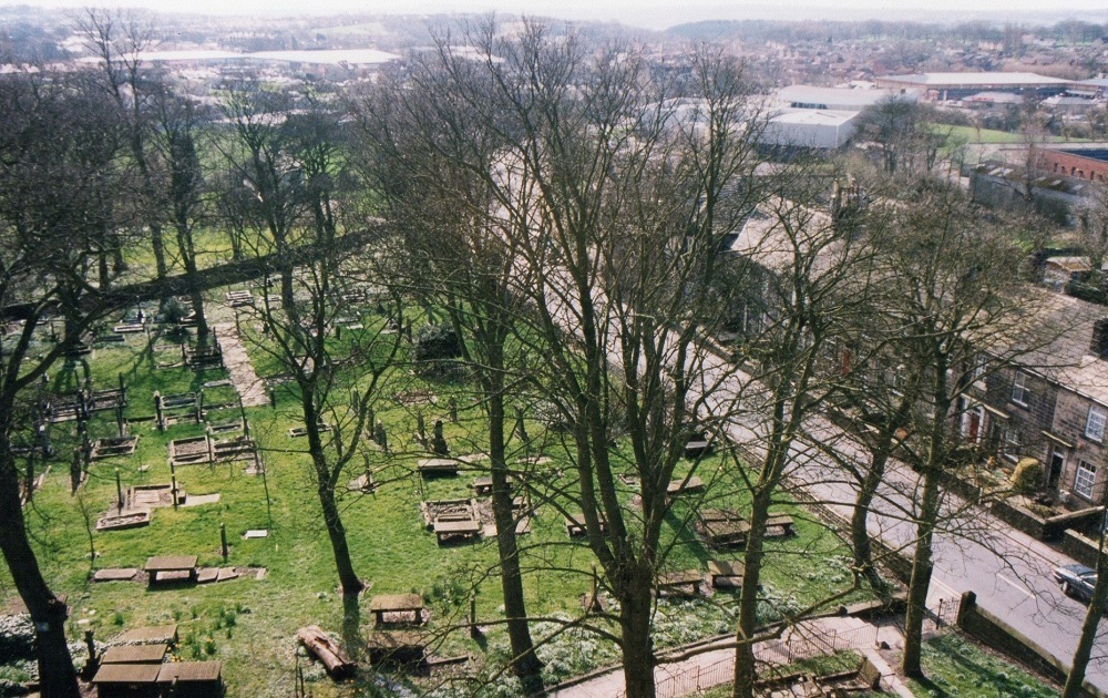
A view from the top of St. Oswald’s Church tower looking down on the left to the burial ground.
To the right are houses on St. Oswald’s Terrace, beyond them the roof of Aireborough Leisure Centre can be seen, towards the right edge is Guiseley Retail Park off Otley Road.
L277 – Aerial Views, 1995.
Aerial Views – 1995
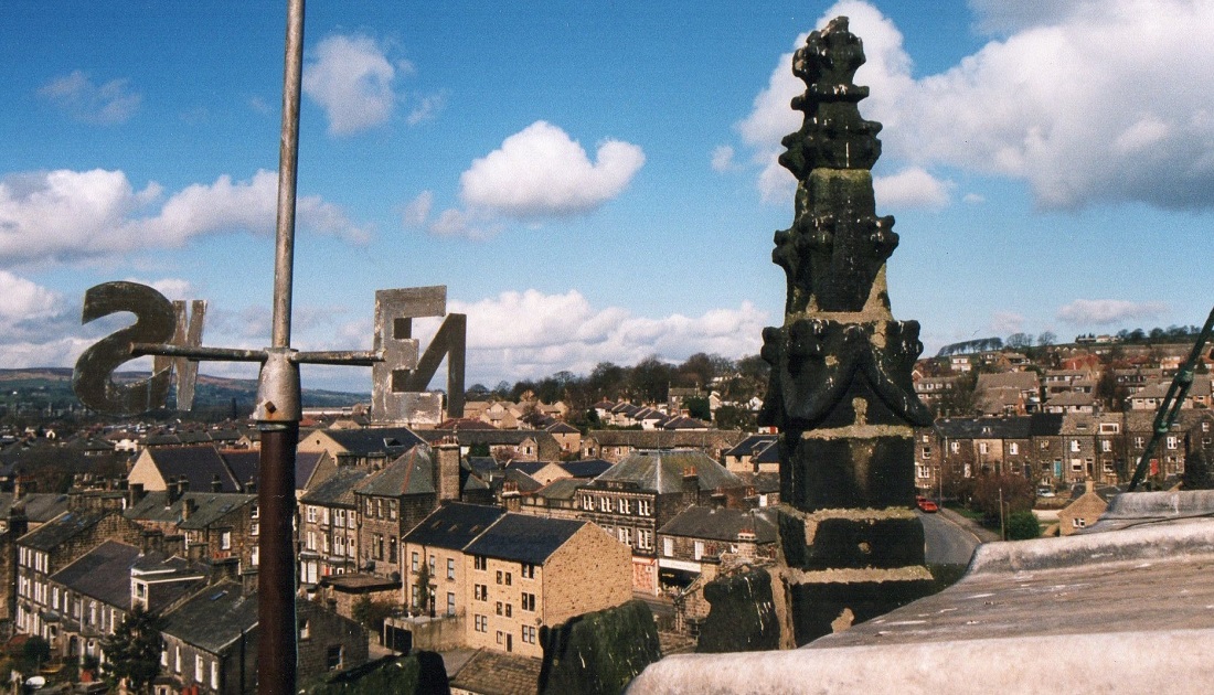
Seen from the top of the tower of St. Oswald’s Church, in front are a weather vane and a stone finial.
The view looks in the direction of Oxford Road.
L285 – Aerial Views, 1995.
Aerial Views – 1995
View from the tower of St. Oswald’s Church, in the foreground is the site where Busfield’s Albion Dyeworks had stood, now occupied by houses and a medical facility (July 2015).
To the left is Town Street, Queensway runs left to right through the view with a large property called Hillcroft at the junction with Town Street on the left. Moving right is Mellor Garth, a row of bungalows erected by Aireborough Flower Fund Homes, then a detached bungalow called Southlands.
On the right are the Medieval field strips known as Wills Gill.
L297 – Aerial Views, 1995.
Aerial Views – 1995
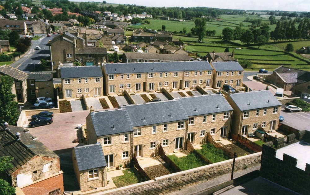
View from the tower of St. Oswald’s Church looking down on new houses addressed as Towngate Close built on the site of Albion Dyeworks.
To the left is Town Street, Queensway runs from left to right across the centre of the view but is mostly obscured by the houses except for a glimpse on the right.
The fields on the right are Wills Gill, a rare example of Medieval field strips.
L309 – Aerial Views, 1995.
Aerial Views – 1995
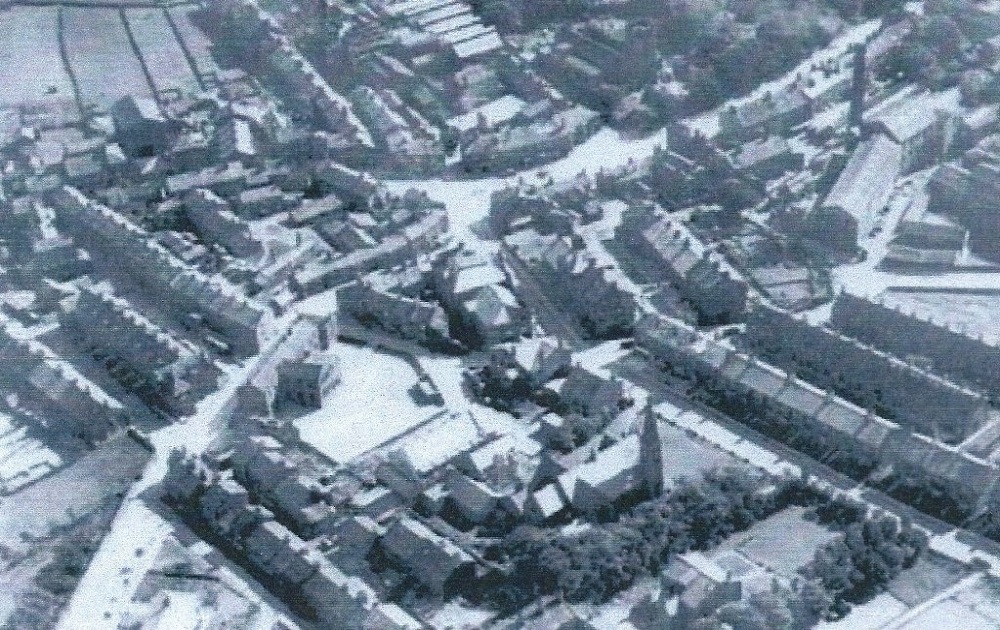
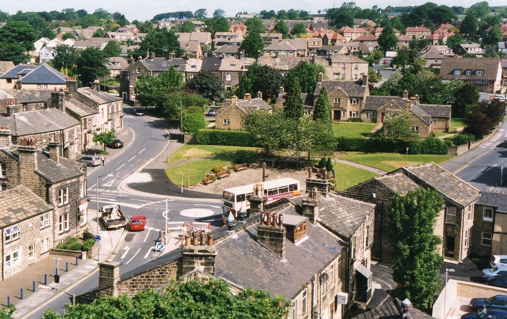
Looking down on Towngate from the tower of St. Oswald’s Church.
To the left is Lands Lane, then the Garden of Remembrance with Frank Parkinson homes immediately behind, Town Street is to the right.
Page 1 of 2 More >>
Consolidated by Jack Brayshaw. 07 February 2022.
Last updated: 30 March 2022 – Photo ID: Z465, FBA141 & N315.