
| Title | Aerial Views |
| Date | 1995 |
| Location | Guiseley |
| Photo ID | L314 |
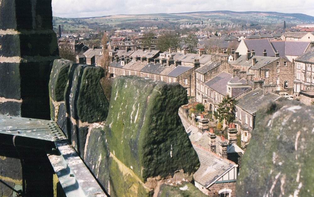
| Comment | Scene viewed from the tower of St. Oswald’s Church, on the left is Lands Lane then the Garden of Remembrance with Frank Parkinson Homes immediately behind, Town Street is to the right. The area of cleared land in the bottom right corner was part of the site on which the Albion Dyeworks had stood before demolition, houses addressed as Towngate were built there. |
L327 – Aerial Views, 1995.
Aerial Views- 1995
Seen from the tower of St. Oswald’s Church, the view looks to the Cambridge Street / Oxford Road area.
In the middle distance what was then High Royds Hospital can be seen.
L328 – Aerial Views, 1995.
Aerial Views- 1995
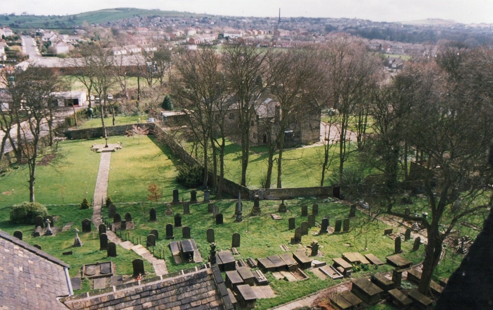
View from the tower of St. Oswald’s Church looking down on to the churchyard and the old Rectory.

I144 – Aerial Views, 2000.
Aerial Views- 2000
Running from left to right through the centre is Shaw Lane Gardens, Queensway is below running from the left edge diagonally to the right.
Donated by Anne North.
C275 – Aerial Views, Undated.
Aerial Views- Undated
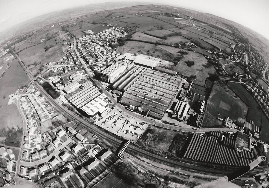
This photo has been taken with a fish-eye lens to give an impression of the earth’s curvature.
The view centre’s on Netherfield Road and the Leeds / Ilkley railway line.
The old goods yard for Guiseley Station has been demolished, in 2002 a new ticket office and waiting room were built.
Between the railway line and Netherfield Road is Abraham Moon’s Mill, this is the only mill to survive in the area (March 2014).
Crompton Parkinson works are on the right of Netherfield Road, to the right of the factory is a cricket pitch used by Crompton’s employees.
I443 – Aerial Views, Undated.
Aerial Views- Undated
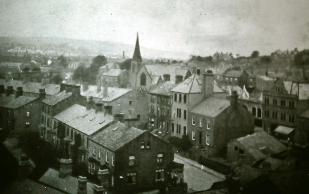
Photo probably taken from the tower of St. Oswald’s Church, to the left is Well Lane, moving up Cambridge Street is next then Oxford Road. The Methodist Chapel on Oxford Road is in clear view.
Z398 – Aerial Views, Undated.
Aerial Views- Undated
On the left is Oxford Road curving round to Towngate, the school and Wesleyan Chapel can be picked out.
The railway line is in dark shadow across the bottom left corner.
Moving right towards the centre, between Springfield Road and the Green, the large building is Springhead Mill.
The Green is on the right, merging into Towngate then Town Street continues up from it.
St. Oswald’s Church is on the right amongst the trees.
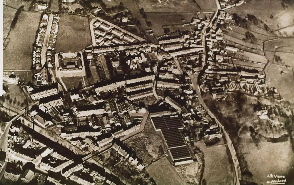
M680 – Aerial Views, Undated.
Aerial Views- Undated
Aerial view of the Netherfield Road area, in the bottom left corner is Crompton Parkinson’s factory. Netherfield Road runs from left to right at an angle from just above the factory to the top right corner. Guiseley Cemetery is on the left of the road, Swincar Nursery on the right.
The photograph was donated by Joanne Coultas.
Consolidated by Jack Brayshaw. 07 February 2022.
Last updated: 07 February 2022.