| Title | Aerial Views |
| Date | 1983 |
| Location | Yeadon |
| Photo ID | V358 |
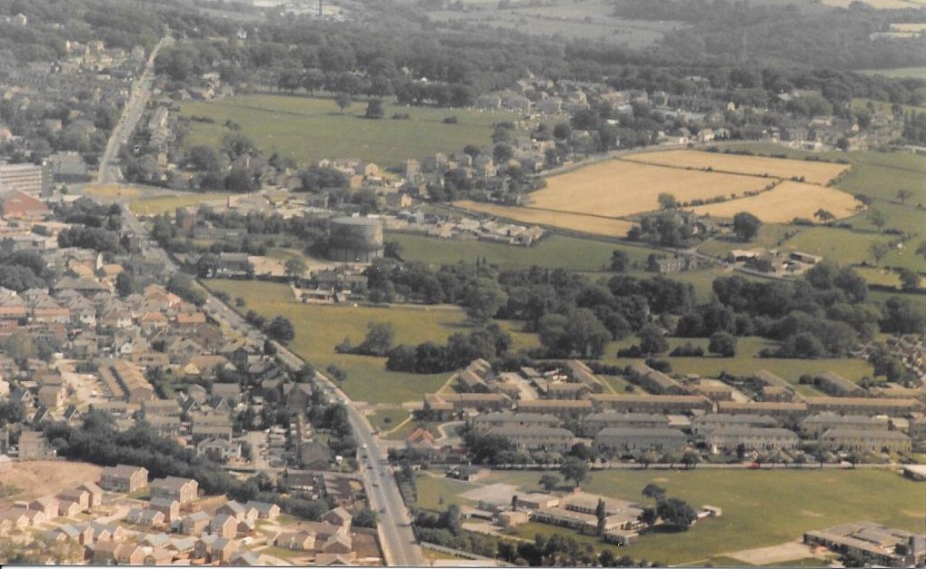
| Comment | June 19th 1983: The photographer was Andrew Emsley and the pilot of the plane Alec Webster, owner of Yeadon Flying Club. The road running top to bottom towards the left is New Road (A65), in the middle of the road is the roundabout locally called the JCT roundabout from its proximity to the JCT car sales and petrol station. A gasometer remains on the site of the Yeadon gasworks to the right of the road, in the bottom right corner is the Westfield estate. |
V359 – Aerial Views, 1983.
Aerial Views – 1983
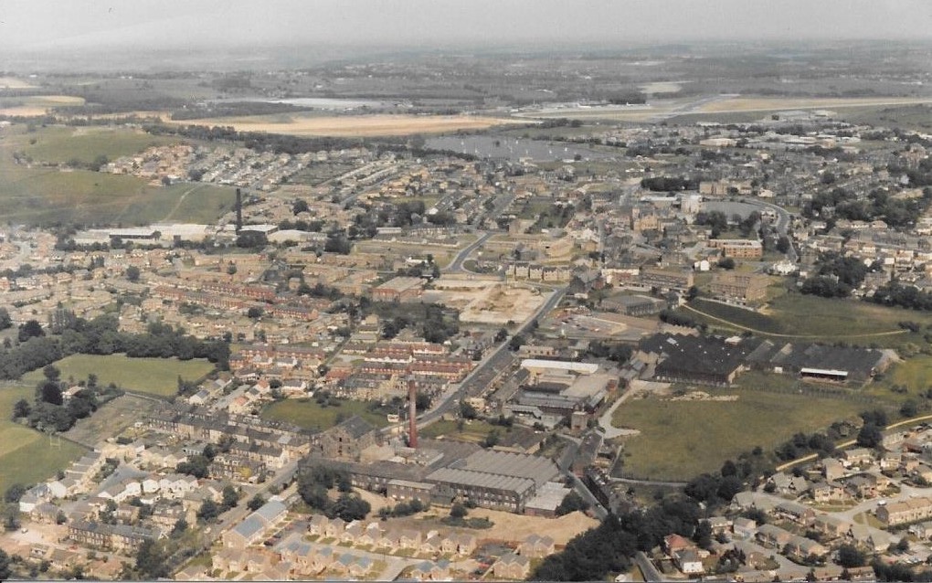
June 19th 1983: Towards the top of the view is Yeadon Tarn (Dam), the line of trees going off to the left are on Cemetery Road.
In the centre foreground is Leafield Mill on Kirk Lane, moving up is Westfield Mill, just a little higher to the left of Kirk Lane is the cleared site where Manor Mill had stood.
Moving left again is Banksfield Mill.
Photographer Andrew Emsley, pilot Alec Webster.
FB089 – Aerial Views, 1995.
Aerial Views – 1995
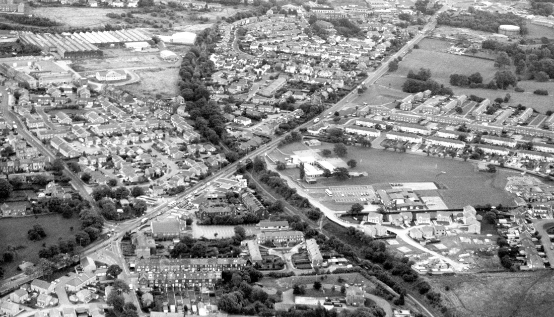
The A65 runs diagonally across the view from the top right corner to the bottom left corner.
Also running diagonally across the image is the route of the old Yeadon railway line, from just left of centre at the top to the bottom right corner.
Trees line both sides of the old line which disappears under the A65 then re-emerges.
Westfield Mill is in the top left corner, the large building with the “saw tooth” roof, below the mill and between Kirk Lane on the left and Whackhouse Lane on the right is the housing estate built on the site of Leafield Mill.
In the top right corner is a roundabout which is at the junction of the A65, Green Lane and Micklefield Lane, also JCT garage and car sales.
One gasometer can be seen remaining on the site of the Yeadon and Guiseley Gasworks, this area now has housing built on it.(March 2013)
To the left side of the A65 are the Barfield, Barcroft and St. John’s Streets, on the right is the Westfield estate.
In the bottom right corner are Westfield Junior School (nearest to the road ) and behind it is St. Peter and St. Paul, RC Primary School.
Previous Comments:
Re FB089
electricalphil2005
In the early days much of this photo would be termed as Nether Yeadon, particularly the Gill lane, Warm Lane and Westfield areas.
23 May 2013.
Consolidated by Jack Brayshaw. 11 August 2021.
Last updated: 27 November 2022 – All images reviewed.