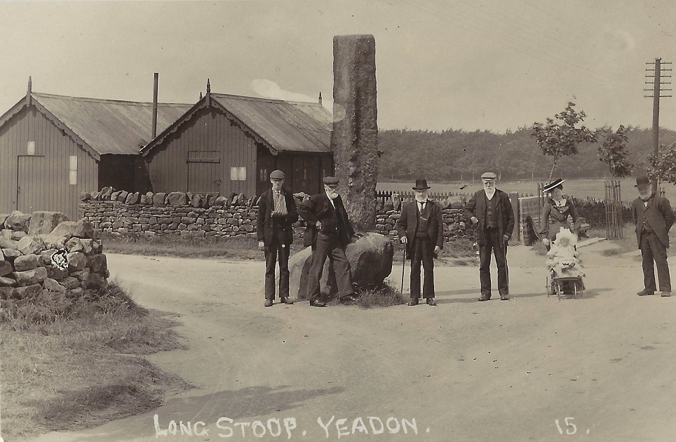
| Title | Long Stoop |
| Date | c1895 |
| Location | Yeadon |
| Photo ID | D036 |
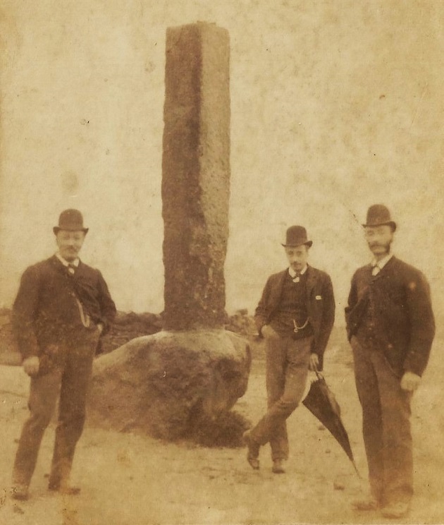
| Comment | The Long Stoop with 3 men wearing bowler hats. |
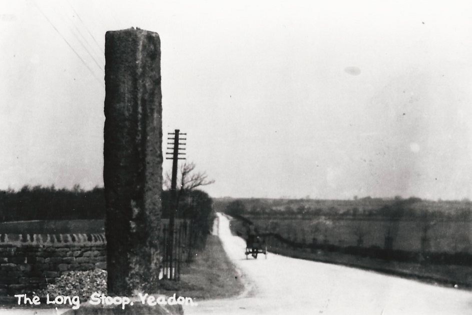
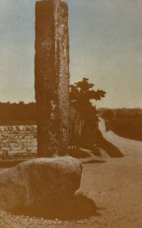
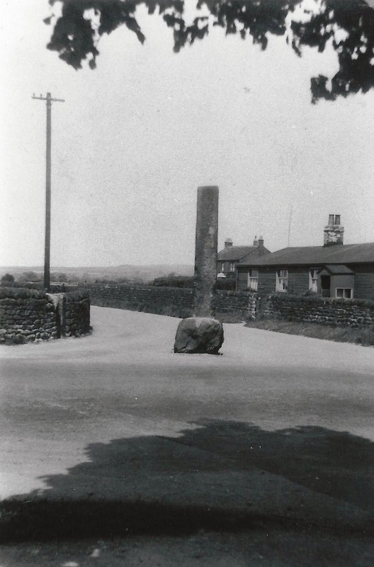
This tall, roughly-hewn stoop stone is actually a boundary stone or guide stone and is a tallish, rough-hewn gritstone pillar with a flat top, and is set into a base stone from the original old stoop whose base is all that remains of the original stoop from the early part of the 19th Century, which had, at that time, stood at Coney Lodge Farm about a ¼ of a mile to the northeast, but was apparently destroyed by lightning around 1836, after which a replacement stoop was erected. In 1983 it was moved once again a short distance to the side of the A658 roundabout when an extension to the airport’s runway was being built.
G090 – Long Stoop, c1900.
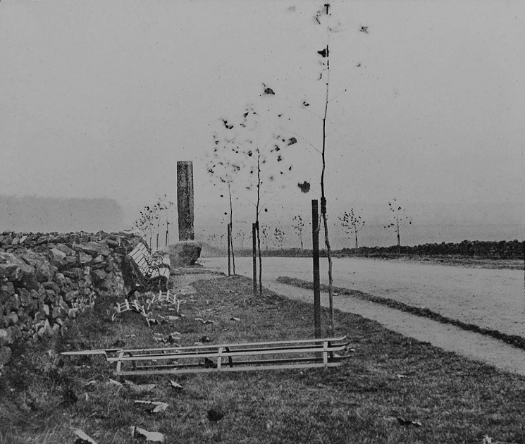
Long Stoop – c1900
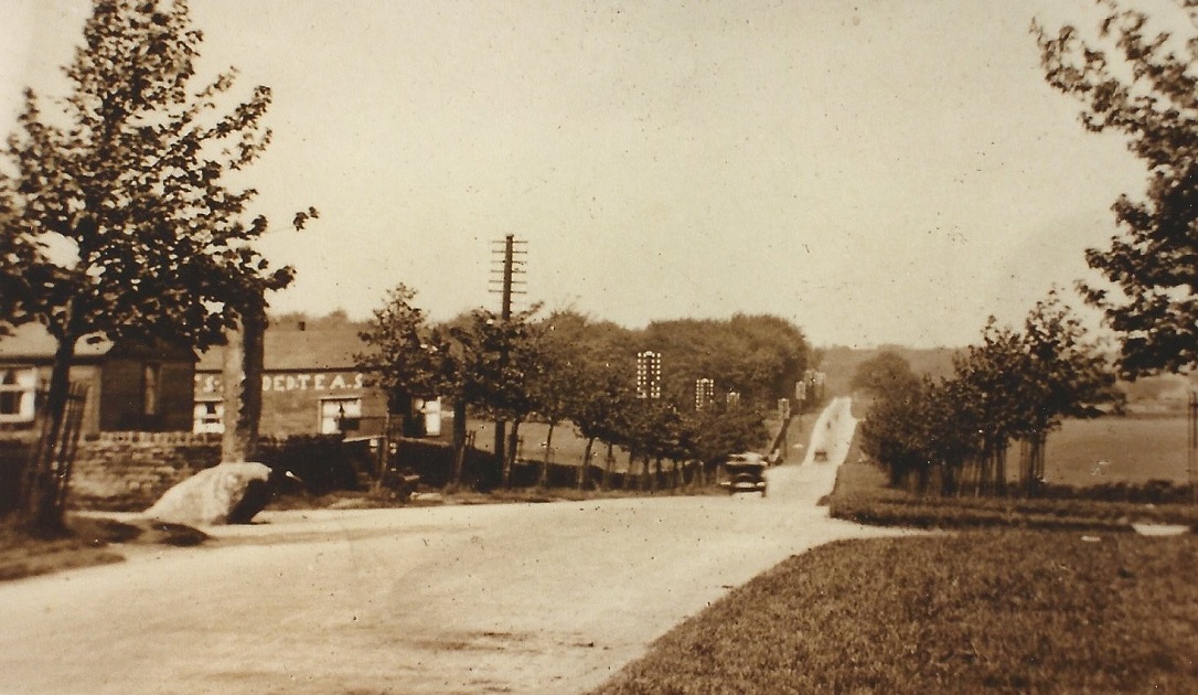
This is the junction of Warren House Lane to the left and Victoria Avenue (Harrogate Road) to the right. The young trees were many planted along the newly named Victoria Avenue to commemorate the Diamond Jubilee of Queen Victoria in 1898. Here we see that the protective frames have still to be fitted.
J006 – Long Stoop, c1900.
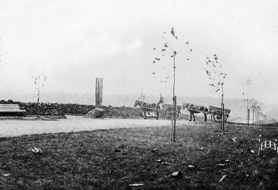
Long Stoop – c1900
The carts are just turning into Warren House Lane and showing the protective metal frames for the trees have still to be fitted.
A230 – Long Stoop, c1900.
Long Stoop – c1900
This is the junction of Warren House Lane to the left and Victoria Avenue (Harrogate Road) to the right. The young trees were 3 of many planted along the newly named Victoria Avenue to commemorate the Diamond Jubilee of Queen Victoria in 1898.
The two huts in the background were later replaced, the new ones were used as a farm labourers home and a tea shop run by John William Hudson.
R056 – Long Stoop, c1900.
Long Stoop – c1900
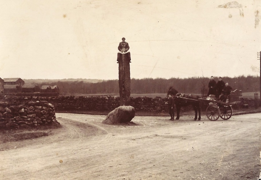
The cart is just turning into Warren House Lane.
A man is sat astride the Long Stoop, Warren House Farm is on the left.
A294 – Long Stoop, c1900.
Long Stoop – c1900
A farmer with his cows crossing over the road, note the seats at the left hand side of the image.
R088 – Long Stoop, c1900.
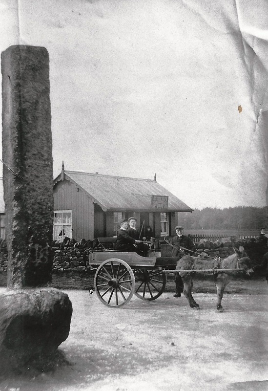
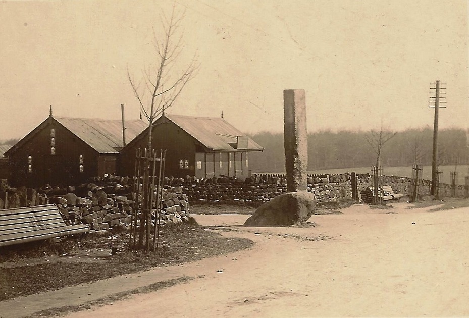
Long Stoop – c1900
Long Stoop is on the left, the Avenue Café is housed in the hut in the field. A man watches two boys on a donkey cart.
G076 – Long Stoop, c1900.
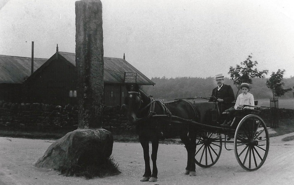
Long Stoop – c1900
Warren House Lane is on the left, Harrogate Road going off to the right. By the Long Stoop a man and a girl are sitting in a pony and trap.
To the left are two huts which would be replaced after the First World War. The hut at the left edge was used as a dwelling for a farm labourer. The other is a cafe, it has a sign “Avenue Cafe”, so called because this stretch of Harrogate Road had been named Victoria Avenue in honour of Queen Victoria’s Diamond Jubilee. The cafe was licensed to sell tobacco and cigarettes.
On the back of the card is the following message:
“July 15th Dear all, I have just come back from the cricket match Horsforth got 190 Yeadon 156, I hope you are enjoying yourself and having good weather everything seems to be going on alright at this end, I have just heard that the Council have settled for the Dam and Thornton’s ? the price somewhere about £2,500”
K684 – Long Stoop, c1900s.
Long Stoop – c1900s
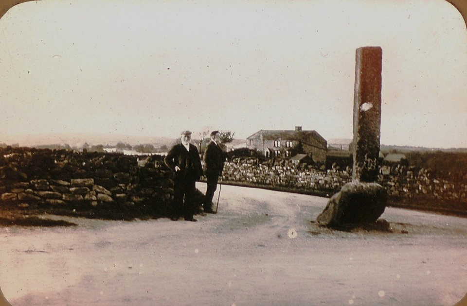
Seen from Harrogate Road, two old boys are perhaps cogitating on the origin of the ancient stone landmark at the junction with Warren House Lane. Warren House Farm is on the right,
The image was taken on a glass slide by E E Slater.
A404 – Long Stoop, c1900.
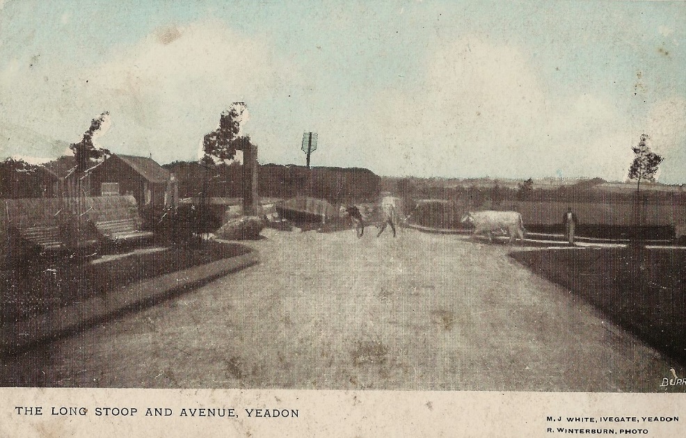
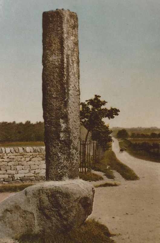
Long Stoop – c1900
Tinted postcard featuring the Long Stoop. Warren House Lane is to the left with Harrogate Road running off into the distance.
B274 – Long Stoop, c1903.
Long Stoop – c1903
A view of the Long Stoop.
B276 – Long Stoop, c1903.
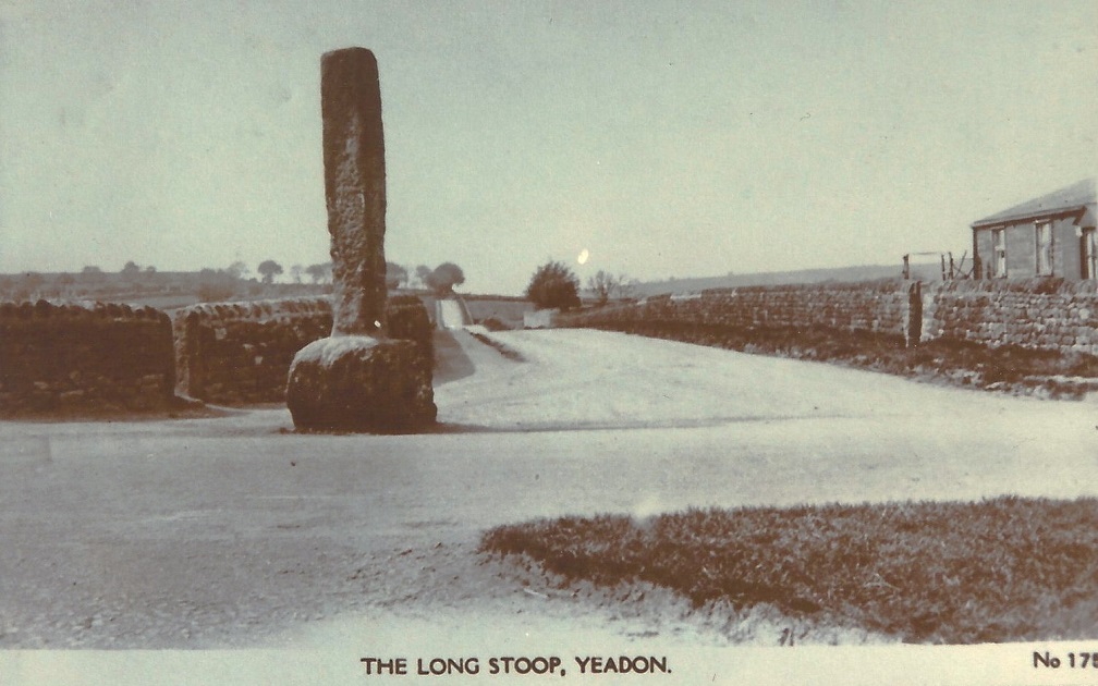
Long Stoop – c1903
Another view of the Long Stoop and crossroads.
M105 – Long Stoop, c1903.
Long Stoop – c1903
The Stoop stone is seen here in it’s original position at the end of Warren House Lane.
B150 – Long Stoop, 1918.
Long Stoop – 1918
On the left is Warren House Lane, the two huts were the second pair to have been placed here, this pair were Army surplus from the 1914-1918 War. One was used to house a farm worker, the other was a tea room run by John William Hudson. To the right is the area known as Crown Point.
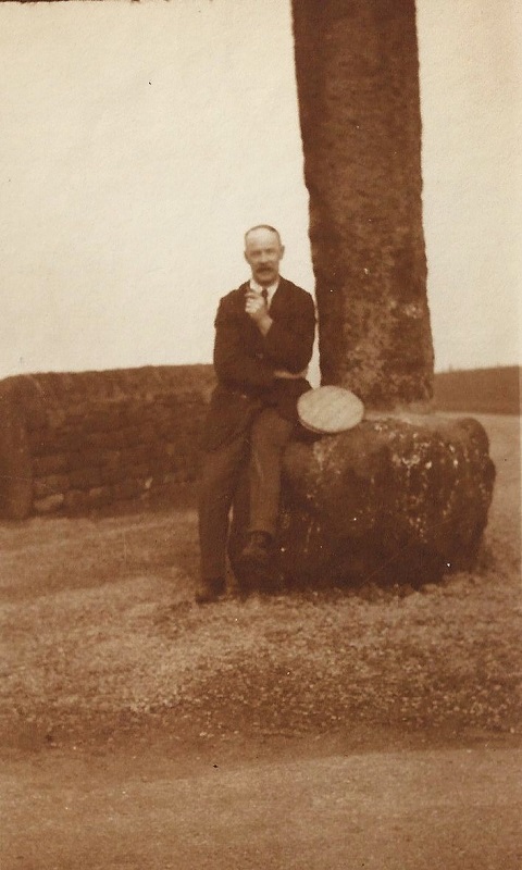
B419 – Long Stoop, c1920.
Long Stoop – c1920
A man poses seated at the foot of Long Stoop.
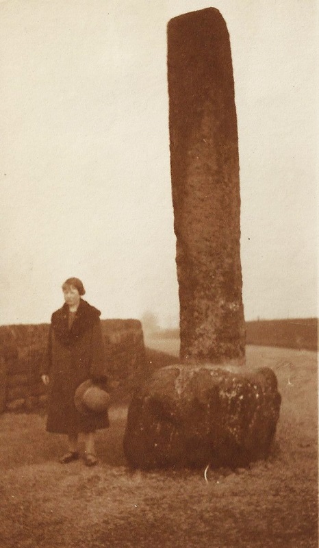
B439 – Long Stoop, c1920.
Long Stoop – c1920
A lady poses at the foot of Long Stoop, perhaps it is the wife or girlfriend of the man in the photo above?
B462 – Long Stoop, c1920.
Long Stoop – c1920
Again, probably the same couple took this photograph.
G069 – Long Stoop, 1924.
Long Stoop – 1924
A view of the crossroads and Long Stoop.
Page 1 of 3 More >>
Consolidated by Elaine Ellwood. 12 May 2021.
Last updated: 26 October 2023 – Photo ID: K684. 01 May 2023 – Photo ID: G090 & J006. 27 December 2022 – All images updated.